Category:Cumwhitton
Jump to navigation
Jump to search
English: Cumwhitton is a small village and civil parish in the City of Carlisle in Cumbria, England. At the 2001 census it had a population of 293. There is a church called St Mary's and a public house or inn called The Pheasant which offers a wide range of food and a good reputation for Real Ale.
village in the United Kingdom Feb2006.jpg) | |||||
| Upload media | |||||
| Instance of | |||||
|---|---|---|---|---|---|
| Location | Carlisle, Cumbria, North West England, England | ||||
| Population |
| ||||
 | |||||
Subcategories
This category has only the following subcategory.
M
- St Mary's Church, Cumwhitton (5 F)
Media in category "Cumwhitton"
The following 109 files are in this category, out of 109 total.
-

-
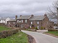
 Beech House Farm, Cumwhitton - geograph.org.uk - 2622973.jpg 640 × 480; 286 KB
-
 Benchmark by church door - geograph.org.uk - 2622979.jpg 477 × 640; 325 KB
-
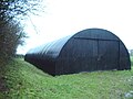 Black Nissen building - geograph.org.uk - 283839.jpg 640 × 480; 204 KB
-
 Bramley Mead, Hornsby - geograph.org.uk - 1480831.jpg 640 × 480; 99 KB
-
 Bridge at Carlatton Mill - geograph.org.uk - 4235218.jpg 640 × 480; 227 KB
-
 Cairn Beck at Carlatton Mill - geograph.org.uk - 4235212.jpg 640 × 480; 210 KB
-
 Cairn Beck at Hallfield - geograph.org.uk - 4235221.jpg 640 × 480; 214 KB
-
 Cairn Beck, downstream of Carlatton Mill - geograph.org.uk - 4609284.jpg 640 × 480; 492 KB
-
 Cairn Bridge - geograph.org.uk - 283812.jpg 640 × 480; 188 KB
-
 Cairndale Caravan Park - geograph.org.uk - 4235173.jpg 640 × 480; 178 KB
-
 Cairndale Caravan Park - geograph.org.uk - 488274.jpg 640 × 480; 147 KB
-
 Cairnhead - geograph.org.uk - 2708849.jpg 3,675 × 2,124; 1,004 KB
-
 Carlatton Demesne - geograph.org.uk - 283913.jpg 640 × 480; 64 KB
-
 Carlatton Mill - geograph.org.uk - 1961991.jpg 640 × 480; 67 KB
-
 Cattle at Moss Foot - geograph.org.uk - 4235172.jpg 640 × 480; 164 KB
-
 Country lane at Hallfield - geograph.org.uk - 4235162.jpg 640 × 480; 184 KB
-
 Countryside view towards Castle Hill - geograph.org.uk - 1961961.jpg 640 × 480; 63 KB
-
 Cumrew Cows - geograph.org.uk - 1778179.jpg 1,024 × 768; 169 KB
-
 Cumrew to South - geograph.org.uk - 1778203.jpg 1,024 × 768; 163 KB
-
 Cumwhitton Ford - geograph.org.uk - 4388037.jpg 3,872 × 2,592; 4.67 MB
-
 Cumwhitton village hall - geograph.org.uk - 2622965.jpg 640 × 429; 264 KB
-
 Deep Gill - geograph.org.uk - 2708784.jpg 3,345 × 1,911; 825 KB
-
 Far Harras - geograph.org.uk - 2708807.jpg 3,541 × 2,342; 1.36 MB
-
 Farm Building near Brocklewath - geograph.org.uk - 825278.jpg 640 × 480; 63 KB
-
 Farm buildings at Whinnyhill - geograph.org.uk - 1237778.jpg 640 × 480; 70 KB
-
 Farmland, Cumwhitton - geograph.org.uk - 4335470.jpg 640 × 480; 155 KB
-
 Farmland, Cumwhitton - geograph.org.uk - 4335580.jpg 640 × 480; 157 KB
-
 Farmland, Cumwhitton - geograph.org.uk - 4335591.jpg 640 × 480; 139 KB
-
 Field Entrance - geograph.org.uk - 488269.jpg 640 × 480; 161 KB
-
 Footbridge over Cumwhitton Beck - geograph.org.uk - 4235126.jpg 480 × 640; 149 KB
-
 Ford over Cumwhitton Beck - geograph.org.uk - 4235138.jpg 640 × 480; 162 KB
-
 Freshly ploughed field - geograph.org.uk - 1237827.jpg 640 × 480; 132 KB
-
 From Cumrew towards south-west - geograph.org.uk - 1778195.jpg 1,024 × 768; 149 KB
-
 Gate, tree and fields at Moss Foot - geograph.org.uk - 4235170.jpg 640 × 480; 218 KB
-
 Gateshaw Mill Farm - geograph.org.uk - 1237919.jpg 640 × 480; 74 KB
-
 Gateshawhill - geograph.org.uk - 2708851.jpg 3,405 × 1,999; 818 KB
-
 Hawcliff Scar - geograph.org.uk - 2231070.jpg 640 × 480; 120 KB
-
 Heading for Far Hornsby Gate - geograph.org.uk - 5778523.jpg 2,592 × 1,944; 1.13 MB
-
 Hedgerow and field off Randlaw Lane - geograph.org.uk - 4235093.jpg 640 × 480; 175 KB
-
 High Northsceugh - geograph.org.uk - 2708790.jpg 2,447 × 3,791; 1.67 MB
-
 Hornsby, the approach to the settlement - geograph.org.uk - 1480830.jpg 640 × 480; 122 KB
-

-
 King Harry - geograph.org.uk - 2708808.jpg 3,343 × 2,228; 1.15 MB
-
 King Harry Farm - geograph.org.uk - 4130900.jpg 640 × 480; 412 KB
-
 King Harry's Plantation - geograph.org.uk - 787881.jpg 640 × 480; 153 KB
-
 Livestock pens by the road to Cumwhitton - geograph.org.uk - 4235141.jpg 640 × 480; 129 KB
-
 Moorfarm Lodge - geograph.org.uk - 4131131.jpg 640 × 480; 410 KB
-
 Moorfarm Lodge - geograph.org.uk - 909269.jpg 600 × 450; 89 KB
-
 Newly mown field at Woodgill House Farm - geograph.org.uk - 4131105.jpg 640 × 480; 496 KB
-
 Northsceugh - geograph.org.uk - 2708787.jpg 3,888 × 1,991; 944 KB
-
 Nunfield Farm - geograph.org.uk - 1237781.jpg 640 × 480; 104 KB
-
 Pasture and woodland, Cumwhitton - geograph.org.uk - 4335465.jpg 640 × 427; 157 KB
-
 Pasture, Cumwhitton - geograph.org.uk - 787918.jpg 640 × 480; 112 KB
-
 Pasture, Cumwhitton - geograph.org.uk - 787957.jpg 640 × 480; 114 KB
-
 Pond at Cairn Head - geograph.org.uk - 4131111.jpg 640 × 480; 502 KB
-
 Poultry house, Cairnholme Farm - geograph.org.uk - 4235168.jpg 640 × 480; 132 KB
-
 Rabbit Warren on Footpath - geograph.org.uk - 488276.jpg 640 × 480; 131 KB
-
 Randlaw Lane - geograph.org.uk - 1961944.jpg 640 × 480; 95 KB
-
 River Eden - geograph.org.uk - 195906.jpg 640 × 478; 144 KB
-
 River Eden - geograph.org.uk - 195908.jpg 640 × 478; 179 KB
-
 River Eden - geograph.org.uk - 195910.jpg 640 × 478; 114 KB
-
 River Eden - geograph.org.uk - 195911.jpg 640 × 478; 147 KB
-
 Road junction at Hornsby Gate - geograph.org.uk - 5778531.jpg 2,592 × 1,944; 1.42 MB
-
 Scarrowhill Farm - geograph.org.uk - 1237801.jpg 640 × 480; 104 KB
-
 Sheep - geograph.org.uk - 283853.jpg 640 × 480; 112 KB
-
 Signpost at Hornsby Gate - geograph.org.uk - 1237831.jpg 640 × 480; 74 KB
-
 Stone Bridge - geograph.org.uk - 283910.jpg 640 × 480; 200 KB
-
 The Knott - geograph.org.uk - 2708802.jpg 3,776 × 2,453; 1.37 MB
-
 The long straight road - geograph.org.uk - 1237786.jpg 640 × 480; 52 KB
-
 The Pheasant Inn - geograph.org.uk - 1237782.jpg 640 × 480; 81 KB
-
 The Pheasant Inn, Cumwhitton - geograph.org.uk - 2622971.jpg 640 × 478; 340 KB
-
 The Pheasant Inn, Cumwhitton - January 2017 (1) - geograph.org.uk - 5264609.jpg 1,250 × 567; 734 KB
-
 The Pheasant Inn, Cumwhitton - January 2017 (2) - geograph.org.uk - 5264610.jpg 1,242 × 1,250; 2.1 MB
-
 The Pheasant Inn, Cumwhitton - January 2017 (3) - geograph.org.uk - 5264612.jpg 1,048 × 1,250; 1.63 MB
-
 The road to Castle Carrock - geograph.org.uk - 5778534.jpg 2,367 × 1,795; 1.16 MB
-
 Thwaites - geograph.org.uk - 1237823.jpg 640 × 480; 90 KB
-
 Townhead - geograph.org.uk - 2708795.jpg 3,849 × 2,533; 1.62 MB
-
 Townhead - geograph.org.uk - 2708798.jpg 3,888 × 2,592; 1.52 MB
-
 Track and Farm Buildings, Brocklewath - geograph.org.uk - 825281.jpg 640 × 480; 56 KB
-
 Track in woodland near Cumrew - geograph.org.uk - 780150.jpg 640 × 480; 169 KB
-
 Track, Cumwhitton - geograph.org.uk - 4335416.jpg 640 × 480; 163 KB
-
 Village green and ford, Cumwhitton - geograph.org.uk - 2622963.jpg 640 × 481; 329 KB
-
 Whiteheads Hill Farm - geograph.org.uk - 4235166.jpg 640 × 480; 162 KB
-
 Woodgill House - geograph.org.uk - 2708814.jpg 3,674 × 2,539; 2.1 MB
-
 Woodgill House Farm - geograph.org.uk - 1237987.jpg 640 × 480; 83 KB
-
 Bridleway from Stonebridge Lees - geograph.org.uk - 488264.jpg 640 × 480; 155 KB
-

-
 Brocklewath - geograph.org.uk - 195914.jpg 640 × 478; 147 KB
-
 Cottages, Cotehill - geograph.org.uk - 196372.jpg 640 × 478; 150 KB
-
 Cross roads at Hornsby Gate - geograph.org.uk - 283906.jpg 640 × 480; 230 KB
-
 Cumwhitton Beck - geograph.org.uk - 283841.jpg 640 × 480; 119 KB
-
 Eden Brows Woodland - geograph.org.uk - 117866.jpg 640 × 480; 116 KB
-
 Field and Fells - geograph.org.uk - 488277.jpg 640 × 427; 132 KB
-
 Footpath to Carlatton Demesne - geograph.org.uk - 488272.jpg 640 × 480; 145 KB
-
 Footpath to Cumwhitton - geograph.org.uk - 283835.jpg 640 × 480; 132 KB
-
 Gate - geograph.org.uk - 283831.jpg 640 × 480; 227 KB
-
 Gateway to a field of turnips - geograph.org.uk - 283857.jpg 640 × 480; 201 KB
-
 Hornsby sunset - geograph.org.uk - 379737.jpg 640 × 480; 182 KB
-
 Lowood - geograph.org.uk - 261749.jpg 640 × 480; 113 KB
-
 Nunfield Cottage - geograph.org.uk - 283863.jpg 640 × 480; 230 KB
-
 Old barn near Scarrowhill - geograph.org.uk - 283873.jpg 640 × 480; 124 KB
-
 Quarry - geograph.org.uk - 283851.jpg 640 × 480; 218 KB
-
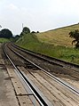 Railway near Armathwaite - geograph.org.uk - 195904.jpg 478 × 640; 131 KB
-
 Randlaw Lane - geograph.org.uk - 283847.jpg 640 × 480; 128 KB
-
 Road past Maxwell Cottage and Moss Foot - geograph.org.uk - 488281.jpg 640 × 388; 109 KB
-
 Road, Far Hornsby Gate - geograph.org.uk - 379735.jpg 640 × 478; 130 KB
-
 The Road to Low Wood - geograph.org.uk - 283751.jpg 640 × 480; 213 KB
-
 The Road to Moorthwaite - geograph.org.uk - 283866.jpg 640 × 480; 228 KB


_-_geograph.org.uk_-_5264609.jpg)
_-_geograph.org.uk_-_5264610.jpg)
_-_geograph.org.uk_-_5264612.jpg)


