Category:Culrain
Jump to navigation
Jump to search
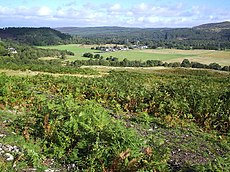
Nederlands: Culrain (Schots-Gaelisch: Cul Raoin) is een dorp ten westen van Ardgay in de Schotse lieutenancy Sutherland in het raadsgebied Highland.
human settlement in Highland, Scotland, UK | |||||
| Upload media | |||||
| Instance of | |||||
|---|---|---|---|---|---|
| Location |
| ||||
 | |||||
Subcategories
This category has the following 2 subcategories, out of 2 total.
C
- Carbisdale Castle (43 F)
- Culrain railway station (10 F)
Media in category "Culrain"
The following 61 files are in this category, out of 61 total.
-
A Croft - geograph.org.uk - 57686.jpg 640 × 480; 147 KB
-
A few logs - geograph.org.uk - 57580.jpg 640 × 480; 148 KB
-
A Forest Road - geograph.org.uk - 57652.jpg 640 × 480; 138 KB
-
A New Forestry Road - geograph.org.uk - 57569.jpg 640 × 480; 97 KB
-
Carbisdale Castle Lairg - geograph.org.uk - 453300.jpg 1,375 × 2,095; 963 KB
-
Flower - geograph.org.uk - 443203.jpg 497 × 640; 119 KB
-
Fungi - geograph.org.uk - 444744.jpg 640 × 492; 194 KB
-
Invercarron Games - geograph.org.uk - 241312.jpg 640 × 480; 362 KB
-
Looking back towards the Sand Quarry - geograph.org.uk - 130350.jpg 640 × 480; 35 KB
-
Looking over towards Culrain . - geograph.org.uk - 130347.jpg 640 × 480; 28 KB
-
Railway Bridge - geograph.org.uk - 55835.jpg 640 × 480; 143 KB
-
River Carron - geograph.org.uk - 43340.jpg 640 × 480; 119 KB
-
Shin Power Station Surge Shaft - geograph.org.uk - 322422.jpg 640 × 480; 139 KB
-
The Invercarron Games - geograph.org.uk - 241307.jpg 640 × 557; 420 KB
-
The Invercarron Games - geograph.org.uk - 241315.jpg 640 × 480; 363 KB
-
The River Carron - geograph.org.uk - 443188.jpg 640 × 477; 166 KB
-
The River Carron - geograph.org.uk - 443194.jpg 480 × 640; 179 KB
-
The River Carron - geograph.org.uk - 444736.jpg 640 × 480; 199 KB
-
The River Carron - geograph.org.uk - 444738.jpg 640 × 480; 165 KB
-
The River Carron - geograph.org.uk - 444749.jpg 640 × 480; 181 KB
-
The River Carron - geograph.org.uk - 444753.jpg 640 × 480; 205 KB
-
The River Carron - geograph.org.uk - 444770.jpg 640 × 461; 162 KB
-
The River Carron - geograph.org.uk - 444772.jpg 640 × 480; 182 KB
-
The River Carron - geograph.org.uk - 444794.jpg 640 × 480; 185 KB
-
Village of Culrain.jpg 640 × 480; 160 KB
-
Wild Flower - geograph.org.uk - 444743.jpg 603 × 480; 137 KB
-
You looking at me^ - geograph.org.uk - 444816.jpg 640 × 480; 118 KB
-
A view of the Kyle from the Maikle Woods - geograph.org.uk - 122839.jpg 640 × 480; 109 KB
-
Balblair House - geograph.org.uk - 60840.jpg 640 × 480; 128 KB
-
Balblair Wood Scene - geograph.org.uk - 551606.jpg 640 × 427; 200 KB
-
Carbisdale loch - geograph.org.uk - 57607.jpg 640 × 480; 120 KB
-
Carbisdale Wood - geograph.org.uk - 57646.jpg 640 × 480; 109 KB
-
Cawdearg and the River Carron - geograph.org.uk - 443175.jpg 640 × 480; 210 KB
-
Cawdearg and the River Carron - geograph.org.uk - 443179.jpg 640 × 480; 192 KB
-
Country Road - geograph.org.uk - 55916.jpg 640 × 480; 129 KB
-
Croft Land - geograph.org.uk - 444779.jpg 640 × 480; 186 KB
-
Culrain Village - geograph.org.uk - 55917.jpg 640 × 480; 106 KB
-
Farmland and Woods at Gruinards - geograph.org.uk - 663498.jpg 640 × 426; 160 KB
-
Field Clearance by Culrain - geograph.org.uk - 702003.jpg 640 × 427; 77 KB
-
Forestry Road - geograph.org.uk - 57658.jpg 640 × 480; 157 KB
-
Forestry View - geograph.org.uk - 57506.jpg 640 × 480; 115 KB
-
Gean Cottages - geograph.org.uk - 642373.jpg 640 × 480; 45 KB
-
Hilton Wood - geograph.org.uk - 57559.jpg 640 × 480; 131 KB
-
Invershin Hotel - geograph.org.uk - 60851.jpg 640 × 480; 124 KB
-
Looking towards the River Carron - geograph.org.uk - 444785.jpg 480 × 640; 163 KB
-
Old Ruin at Maikle Wood - geograph.org.uk - 122833.jpg 640 × 480; 98 KB
-
Road and Trees near wester Dounie - geograph.org.uk - 50695.jpg 640 × 480; 127 KB
-
Sand Quarry - geograph.org.uk - 43458.jpg 640 × 480; 110 KB
-
Sand Quarry - geograph.org.uk - 43461.jpg 640 × 480; 93 KB
-
Stone work - geograph.org.uk - 444791.jpg 640 × 480; 195 KB
-
Strathcarron - geograph.org.uk - 443079.jpg 640 × 480; 124 KB
-
The Bridge over the Allt a' Ghlinne - geograph.org.uk - 50702.jpg 640 × 480; 171 KB
-
The Ford - geograph.org.uk - 43343.jpg 640 × 480; 120 KB
-
The Kyle of Sutherland - geograph.org.uk - 52623.jpg 640 × 480; 137 KB
-
The Wee Loch with no name - geograph.org.uk - 57622.jpg 640 × 480; 91 KB
-
The Wee Loch with no name - geograph.org.uk - 57629.jpg 640 × 480; 112 KB
-
The Wee Loch with no name - geograph.org.uk - 57634.jpg 640 × 480; 159 KB
-
Viewfield Wood Forestry Road - geograph.org.uk - 57518.jpg 640 × 480; 109 KB
-
Viewfield Wood Forestry Road Fire brake - geograph.org.uk - 57528.jpg 640 × 480; 115 KB


