Category:Culmore
Jump to navigation
Jump to search
village in United Kingdom | |||||
| Upload media | |||||
| Instance of | |||||
|---|---|---|---|---|---|
| Location | Northern Ireland | ||||
 | |||||
English: Culmore is a large village in County Londonderry, Northern Ireland, close to Derry. In the 2001 Census it had a population of 2,960 people. It is situated directly across the River Foyle from the village of Strathfoyle.
Bahasa Indonesia: Culmore ( bahasa Irlandia: Chuil Móir) adalah sebuah desa besar yang terletak di Londonderry, Irlandia Utara, dekat dengan Derry. Pada saat sensus Britania Raya tahun 2001, populasi desa ini sebesar 2.960 jiwa. Desa ini terletak diseberang sungai Foyle dari desa Strathfoyle.
Nederlands: Culmore ( Iers: An Chúil Mhór) is een plaats in het Noord-Ierse County Londonderry. Culmore telt 2937 inwoners. Van de bevolking is 8,2% protestant en 90,2% katholiek.

Media in category "Culmore"
The following 30 files are in this category, out of 30 total.
-
 A small part of the Foyle Bridge - geograph.org.uk - 578426.jpg 636 × 322; 50 KB
-
 Cottages on Culmore Road - geograph.org.uk - 5683223.jpg 640 × 427; 361 KB
-
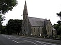 Culmore Church of Ireland - geograph.org.uk - 953278.jpg 640 × 479; 51 KB
-
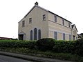 Culmore Masonic Hall - geograph.org.uk - 953321.jpg 640 × 479; 41 KB
-
 Culmore point - geograph.org.uk - 953319.jpg 640 × 479; 52 KB
-
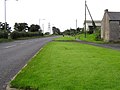 Culmore Road - geograph.org.uk - 953287.jpg 640 × 479; 50 KB
-
 Culmore Townland - geograph.org.uk - 953285.jpg 640 × 479; 69 KB
-
 Culmore-Coolkeeragh Co. Londonderry - geograph.org.uk - 335218.jpg 426 × 640; 93 KB
-
 Lisahally Docks, Derry - Londonderry - geograph.org.uk - 414762.jpg 640 × 479; 77 KB
-
 Lough Foyle, Culmore Point - geograph.org.uk - 5561698.jpg 640 × 480; 287 KB
-
 Near Culmore - geograph.org.uk - 5511594.jpg 2,000 × 1,333; 2.17 MB
-
 Near Culmore - geograph.org.uk - 953322.jpg 640 × 479; 52 KB
-
 Near Culmore - geograph.org.uk - 953324.jpg 640 × 479; 61 KB
-
 On the Culmore road - geograph.org.uk - 5511611.jpg 2,000 × 1,333; 1.84 MB
-
 Road at Culmore - geograph.org.uk - 953283.jpg 640 × 479; 52 KB
-
 South of Muff - geograph.org.uk - 5511541.jpg 2,000 × 1,333; 1.86 MB
-
 Stratfoyle - geograph.org.uk - 414757.jpg 640 × 479; 68 KB
-
 Strathfoyle Library - geograph.org.uk - 361289.jpg 640 × 480; 138 KB
-
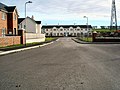
 Strathfoyle Village Centre - geograph.org.uk - 361300.jpg 640 × 480; 138 KB
-
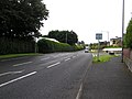
 The A2 to Derry - geograph.org.uk - 5683218.jpg 640 × 427; 425 KB
-
 Cottage at Coolkeeragh - geograph.org.uk - 379471.jpg 640 × 480; 156 KB
-
 Gorticross Townland - geograph.org.uk - 283195.jpg 640 × 479; 52 KB
-
 Gorticross Townland - geograph.org.uk - 283198.jpg 640 × 479; 50 KB
-
 Lane to Knockanroe - geograph.org.uk - 366346.jpg 640 × 480; 146 KB
-
 New housing in Strathfoyle - geograph.org.uk - 611993.jpg 640 × 480; 76 KB
-
 Newly built housing at Strathfoyle - geograph.org.uk - 612014.jpg 640 × 480; 88 KB
-
 Otterbank Road - geograph.org.uk - 355266.jpg 640 × 480; 122 KB
-
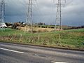 Pylons near Strathfoyle - geograph.org.uk - 360965.jpg 640 × 480; 145 KB
-
 Strathfoyle - geograph.org.uk - 414763.jpg 640 × 293; 32 KB
-
 The Auld School Centre - geograph.org.uk - 283173.jpg 640 × 479; 49 KB


