Category:Culloden, Highland
Jump to navigation
Jump to search
Culloden (Gaelic Cùil Lodair) is a village to the east of the city of Inverness in Scotland.
The Battle of Culloden took place in 1746, on the nearby Culloden Moor.
village in Highland, Scotland, UK  | |||||
| Upload media | |||||
| Instance of | |||||
|---|---|---|---|---|---|
| Location |
| ||||
| Population |
| ||||
 | |||||
Subcategories
This category has the following 8 subcategories, out of 8 total.
B
- Balnuaran of Clava (137 F)
- Bouldering at Tom Riach (8 F)
C
- Culloden House Stables (7 F)
- Culloden Viaduct (54 F)
S
- St Mary's Well, Culloden (5 F)
Media in category "Culloden, Highland"
The following 43 files are in this category, out of 43 total.
-
 Allanfearn Sunset - geograph.org.uk - 5702943.jpg 640 × 400; 74 KB
-
 Allanfearn Sunset - geograph.org.uk - 6121924.jpg 1,024 × 442; 135 KB
-
 Barn Church - entrance - geograph.org.uk - 1747447.jpg 1,024 × 768; 952 KB
-
 Caravan Site, Culloden - geograph.org.uk - 35236.jpg 640 × 480; 101 KB
-
 Culloden Academy - geograph.org.uk - 1747473.jpg 1,023 × 678; 633 KB
-
 Culloden Assembly Gospel Hall - geograph.org.uk - 1746348.jpg 640 × 456; 149 KB
-
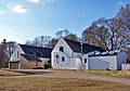 Culloden Barn Church of Scotland - geograph.org.uk - 1747443.jpg 1,022 × 717; 691 KB
-
 Culloden Barn Church of Scotland - geograph.org.uk - 1747455.jpg 1,023 × 698; 765 KB
-
 Culloden Centre - geograph.org.uk - 345469.jpg 640 × 480; 260 KB
-
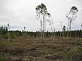
 Culloden Forest - geograph.org.uk - 1475513.jpg 640 × 480; 142 KB
-
 Culloden Forest - geograph.org.uk - 215993.jpg 640 × 480; 242 KB
-
 Culloden Forest - geograph.org.uk - 219701.jpg 640 × 480; 49 KB
-
 Culloden Forest - geograph.org.uk - 370207.jpg 640 × 480; 135 KB
-
 Culloden House ice house - geograph.org.uk - 1747500.jpg 1,007 × 668; 514 KB
-
 Culloden library - geograph.org.uk - 1746398.jpg 1,024 × 707; 675 KB
-
 Culloden medical practice - geograph.org.uk - 1746374.jpg 1,023 × 690; 507 KB
-
 Culloden Moor Caravan Club Site, Newlands, Culloden Moor (geograph 3798370).jpg 2,088 × 1,400; 403 KB
-
 Culloden Moor Inn - geograph.org.uk - 1747715.jpg 1,024 × 768; 693 KB
-
 Culloden shops - geograph.org.uk - 1746365.jpg 1,024 × 768; 623 KB
-
 Directions to Culloden. - geograph.org.uk - 250756.jpg 640 × 480; 82 KB
-

-
 Forest road - geograph.org.uk - 370111.jpg 640 × 480; 133 KB
-
 Freight Train cruising through Culloden Woods bound for Inverness (geograph 6026465).jpg 2,400 × 1,350; 3.22 MB
-
 Highland, UK - panoramio (106).jpg 3,412 × 2,273; 15.05 MB
-
 Highland, UK - panoramio (107).jpg 3,687 × 2,468; 14.14 MB
-
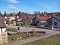 Housing in Culloden - geograph.org.uk - 1747511.jpg 1,024 × 768; 716 KB
-
 Moray Park Gardens Culloden - geograph.org.uk - 95833.jpg 640 × 480; 75 KB
-
 Ordnance Survey One-Inch Sheet 28 Inverness, Published 1958.jpg 8,236 × 9,883; 9.83 MB
-
 Police Station, Culloden - geograph.org.uk - 1746389.jpg 1,024 × 768; 597 KB
-
 Red Marker at the battlefield of the Culloden battle.jpg 3,456 × 2,304; 3.34 MB
-
 Road junction, Culloden - geograph.org.uk - 1747482.jpg 1,024 × 768; 700 KB
-
 Scottish soldier - geograph.org.uk - 253964.jpg 480 × 640; 132 KB
-
 SCY Centre, Culloden - geograph.org.uk - 1746410.jpg 1,024 × 768; 1 MB
-
 Shops in Culloden - geograph.org.uk - 1746385.jpg 1,024 × 768; 685 KB
-
 Shoreline at Scretan - geograph.org.uk - 6112750.jpg 1,024 × 819; 327 KB
-
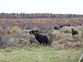 Soay Sheep, Culloden Moor - geograph.org.uk - 59546.jpg 640 × 480; 90 KB
-
 St Columba's, Culloden - geograph.org.uk - 1475534.jpg 640 × 480; 90 KB
-
 St Mary in the Fields - geograph.org.uk - 1746353.jpg 1,024 × 768; 824 KB
-
 The Blacksmiths bar and restaurant - geograph.org.uk - 1746358.jpg 1,024 × 768; 567 KB
-
 The Cairnlaw Burn - geograph.org.uk - 6120296.jpg 640 × 480; 78 KB
-
 The Cairnlaw Burn - geograph.org.uk - 6121751.jpg 1,024 × 768; 266 KB
-
 The Gruffalo - geograph.org.uk - 2871598.jpg 2,000 × 2,000; 1.78 MB
-
 The Loch Flemmington junction. - geograph.org.uk - 203317.jpg 640 × 427; 76 KB


.jpg)


.jpg)
.jpg)
.jpg)


