Category:Crossings of Rock Creek in Maryland
Jump to navigation
Jump to search
Subcategories
This category has the following 2 subcategories, out of 2 total.
K
- Kensington Railway (5 F)
N
- Needwood Dam (8 F)
Media in category "Crossings of Rock Creek in Maryland"
The following 54 files are in this category, out of 54 total.
-

-

-
 Avery Road Bridge 2021a.jpg 6,240 × 4,160; 14.16 MB
-
 Avery Road Bridge 2021b.jpg 6,240 × 4,160; 12.15 MB
-
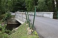
 Baltimore Road Bridge Rock Creek 2021a.jpg 6,240 × 4,160; 13.18 MB
-
 Baltimore Road Bridge Rock Creek 2021b.jpg 6,240 × 4,160; 14.75 MB
-
 Boundary Bridge 2021.jpg 6,240 × 4,160; 13.01 MB
-
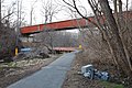
 CSX Rock Creek Bridge MD 2009.jpg 4,000 × 3,000; 8.9 MB
-
 East-West Highway Rock Creek Bridge 2021.jpg 6,240 × 4,160; 11.91 MB
-
 Footbridge to Linthicum Street 2021.jpg 6,240 × 4,160; 16.82 MB
-
 Garrett Park Road Bridge 2020.jpg 6,240 × 4,160; 15.26 MB
-
 Intercounty Connector Rock Creek crossing 2021a.jpg 6,240 × 4,160; 12.2 MB
-
 Intercounty Connector Rock Creek crossing 2021b.jpg 6,240 × 4,160; 10.07 MB
-
 Intercounty Connector Rock Creek crossing 2021c.jpg 6,240 × 4,160; 9.5 MB
-
 Kensington (Maryland) Banner.jpg 3,990 × 570; 1.75 MB
-
 Knowles Avenue Bridge 2020.jpg 6,240 × 4,160; 15.86 MB
-
 Lake Needwood Dam 2021a.jpg 6,240 × 4,160; 10.69 MB
-
 Lake Needwood Dam 2021b.jpg 6,240 × 4,160; 13.67 MB
-
 Lake Needwood Dam 2021c.jpg 6,240 × 4,160; 9.71 MB
-
 Lake Needwood Dam 2021d.jpg 6,240 × 4,160; 14.95 MB
-
 Laytonsville Golf Course 1st culvert 2021a.jpg 6,240 × 4,160; 19.89 MB
-
 Laytonsville Golf Course 1st culvert 2021b.jpg 6,240 × 4,160; 15.91 MB
-
 Laytonsville Golf Course 2nd culvert 2021a.jpg 6,240 × 4,160; 15.33 MB
-
 Laytonsville Golf Course 2nd culvert 2021b.jpg 6,240 × 4,160; 12.01 MB
-
 Laytonsville Golf Course 3rd culvert 2021.jpg 6,240 × 4,160; 17.43 MB
-
 Laytonsville Golf Course dam 2021a.jpg 6,240 × 4,160; 12.57 MB
-
 Laytonsville Golf Course dam 2021b.jpg 6,240 × 4,160; 11.09 MB
-
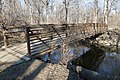
 Meadowbrook Park footbridge 2021.jpg 6,240 × 4,160; 15.08 MB
-
 Metropolitan Subdivision Rock Creek crossing 2020a.jpg 6,240 × 4,160; 13.67 MB
-
 Metropolitan Subdivision Rock Creek crossing 2020b.jpg 6,240 × 4,160; 14.53 MB
-
 Muncaster Mill Road Bridge 2021.jpg 6,240 × 4,160; 13.86 MB
-
 Needwood Road Bridge 2021a.jpg 6,240 × 4,160; 10.43 MB
-
 Needwood Road Bridge 2021b.jpg 6,240 × 4,160; 9.42 MB
-
 Norbeck Road Bridge 2021a.jpg 6,240 × 4,160; 10.64 MB
-
 Norbeck Road Bridge 2021b.jpg 6,240 × 4,160; 12.55 MB
-
 Parklawn Cemetery Bridge 2020.jpg 6,240 × 4,160; 14.44 MB
-
 Purple Line Rock Creek crossing construction 2021a.jpg 6,240 × 4,160; 14.68 MB
-
 Purple Line Rock Creek crossing construction 2021b.jpg 6,240 × 4,160; 9.14 MB
-
Rock Creek Parkway and Beach Drive time-lapse.webm 1 min 56 s, 1,920 × 1,072; 112.64 MB
-
 Rock Creek source at Dorsey Road 2021a.jpg 6,240 × 4,160; 19.01 MB
-
 Rock Creek source at Dorsey Road 2021b.jpg 6,240 × 4,160; 11.49 MB
-
 Rock Creek Trail 1st crossing 2021a.jpg 6,240 × 4,160; 16.04 MB
-
 Rock Creek Trail 1st crossing 2021b.jpg 6,240 × 4,160; 16.17 MB
-
 Rock Creek Trail 2nd crossing 2021.jpg 6,240 × 4,160; 15.18 MB
-
 Rock Creek Trail 3rd crossing 2021.jpg 6,240 × 4,160; 12.76 MB
-
 Rock Creek Trail 4th crossing 2021.jpg 6,240 × 4,160; 14.48 MB
-
 Rock Creek Trail 8th crossing 2021a.jpg 6,240 × 4,160; 16.03 MB
-
 Rock Creek Trail 8th crossing 2021b.jpg 6,240 × 4,160; 16.59 MB
-
 Rock Creek Trail 8th crossing 2021c.jpg 6,240 × 4,160; 15.47 MB
-
 Rock Creek Trail 9th crossing 2021.jpg 6,240 × 4,160; 13.19 MB
-
 Southlawn Lane Bridge 2021.jpg 6,240 × 4,160; 14.65 MB
-
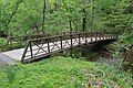
 Twinbrook Connector Trail Bridge 2020.jpg 6,240 × 4,160; 15.94 MB
-
 Upper Rock Creek Trail 1st crossing 2021.jpg 6,240 × 4,160; 15.28 MB
-
 Veirs Mill Road Bridge 2020.jpg 6,240 × 4,160; 14.97 MB
_at_Beach_Drive_in_Chevy_Chase,_Montgomery_County,_Maryland.jpg)
_from_the_overpass_for_Interstate_495_(Capital_Beltway)_on_the_edge_of_Chevy_Chase_and_Bethesda_in_Montgomery_County,_Maryland.jpg)


_Banner.jpg)