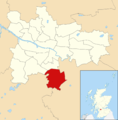
Category:Croftfoot
Jump to navigation
Jump to search
residential district of Glasgow, Scotland | |||||
| Upload media | |||||
| Instance of | |||||
|---|---|---|---|---|---|
| Location | Glasgow City, Scotland | ||||
 | |||||
Subcategories
This category has the following 2 subcategories, out of 2 total.
C
- Croftfoot railway station (19 F)
Media in category "Croftfoot"
The following 39 files are in this category, out of 39 total.
-
Bin day, Croftpark Avenue (geograph 5451513).jpg 1,600 × 1,036; 326 KB
-
Castlemilk and Croftfoot - geograph.org.uk - 1232627.jpg 640 × 480; 132 KB
-
Castlemilk Road - geograph.org.uk - 5409987.jpg 640 × 480; 160 KB
-
Croftend Avenue (geograph 5410025).jpg 640 × 431; 115 KB
-
Croftend Avenue (geograph 5410027).jpg 640 × 480; 147 KB
-
Croftend Avenue (geograph 5410057).jpg 640 × 480; 208 KB
-
Croftfoot 2022 (2).jpg 4,032 × 2,268; 3.68 MB
-
Croftfoot 2022.jpg 4,032 × 2,268; 4.18 MB
-
Croftfoot Drive and Croftfoot Road (geograph 5780788).jpg 1,600 × 1,200; 369 KB
-
Croftfoot Road at Castlemilk Road (geograph 5409974).jpg 640 × 480; 222 KB
-
Crofthill Road (geograph 2483227).jpg 640 × 480; 309 KB
-
Croftside Avenue (geograph 2635834).jpg 640 × 480; 86 KB
-
Crossroads in Croftfoot (geograph 3241587).jpg 640 × 480; 69 KB
-
Former Spittal Sports Ground (geograph 5410035).jpg 640 × 480; 152 KB
-
Former Spittal Sports Ground (geograph 5410060).jpg 640 × 480; 191 KB
-
Former Spittal Sports Ground - geograph.org.uk - 5410033.jpg 640 × 480; 139 KB
-
Glasgow City - Croftfoot School, Croftpark Avenue, Glasgow - 20150424133057.jpg 3,264 × 2,448; 3.59 MB
-
Glasgow wards 2017 no01 Linn.png 2,000 × 2,040; 504 KB
-
Houses on Croftfoot Road (geograph 5826185).jpg 1,600 × 999; 300 KB
-
Houses, Croftpark Avenue (geograph 5451509).jpg 1,600 × 965; 279 KB
-
Lane leading to Croftfoot railway station (geograph 5410031).jpg 640 × 480; 176 KB
-
Lane leading to Croftfoot railway station (geograph 5410045).jpg 640 × 480; 222 KB
-
Linn ward.PNG 418 × 342; 11 KB
-
Lloyds TSB, Croftfoot Roundabout - geograph.org.uk - 1300252.jpg 640 × 480; 110 KB
-
Map of Lanarkshire Sheet 010, Ordnance Survey, 1863-1865.jpg 10,680 × 7,158; 7.6 MB
-
Map of Lanarkshire Sheet 010, Ordnance Survey, 1863-1865.tiff 10,680 × 7,158; 218.72 MB
-
Midcroft Avenue, Croftfoot, Glasgow 2022 (2).jpg 4,032 × 3,024; 4.73 MB
-
Midcroft Avenue, Croftfoot, Glasgow 2022 (3).jpg 4,032 × 2,268; 3.78 MB
-
Midcroft Avenue, Croftfoot, Glasgow 2022.jpg 4,032 × 3,024; 6.79 MB
-
Path, Croftfoot (geograph 2635832).jpg 640 × 480; 131 KB
-
Roundabout on Carmunnock Road (B766) (geograph 3241570).jpg 640 × 480; 58 KB
-
Shops on Castlemilk Road (geograph 5410000).jpg 640 × 378; 96 KB
-
Shops On Castlemilk Road - geograph.org.uk - 761332.jpg 640 × 480; 68 KB
-
The Croft - geograph.org.uk - 761334.jpg 640 × 480; 62 KB
-
Thornicroft Drive, Croftfoot - geograph.org.uk - 2637423.jpg 640 × 480; 97 KB
-
Towards Kingspark - geograph.org.uk - 723800.jpg 640 × 480; 83 KB
-
Underpass, Kings Park (geograph 2483224).jpg 640 × 480; 327 KB
-
View from Kings Park (geograph 2635837).jpg 640 × 480; 100 KB


