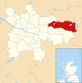
Category:Craigend, Glasgow
Jump to navigation
Jump to search
district in Glasgow City, Scotland, UK | |||||
| Upload media | |||||
| Instance of | |||||
|---|---|---|---|---|---|
| Location | Glasgow City, Scotland | ||||
 | |||||
Subcategories
This category has only the following subcategory.
Media in category "Craigend, Glasgow"
The following 13 files are in this category, out of 13 total.
-
Collessie Drive (geograph 5816574).jpg 1,024 × 768; 285 KB
-
Craigend Water Towers from Riggside Road - geograph.org.uk - 1262034.jpg 640 × 480; 103 KB
-
Elmcroft Nursery School - geograph.org.uk - 123458.jpg 640 × 480; 174 KB
-
Glasgow wards 2017 no21 North East.png 2,000 × 2,040; 503 KB
-
Glenraith Road - geograph.org.uk - 1262065.jpg 640 × 480; 119 KB
-
Glenraith Square - geograph.org.uk - 1262059.jpg 640 × 480; 130 KB
-
Kilchoan Road - geograph.org.uk - 2467648.jpg 640 × 480; 242 KB
-
Lane to Glenraith Square - geograph.org.uk - 1262057.jpg 640 × 480; 121 KB
-
Mossvale Road - geograph.org.uk - 1262053.jpg 640 × 480; 105 KB
-
Mossvale Road, Craigend (geograph 2466843).jpg 640 × 480; 260 KB
-
Primary school on Mossvale Road - geograph.org.uk - 1262047.jpg 640 × 480; 130 KB
-
Sunnyside Primary School (geograph 2675678).jpg 640 × 480; 59 KB
-
Water towers, Garthamlock (geograph 4455374).jpg 3,504 × 2,336; 5.15 MB


