Category:Cracoe
Jump to navigation
Jump to search
village in United Kingdom | |||||
| Upload media | |||||
| Instance of | |||||
|---|---|---|---|---|---|
| Location | Craven, North Yorkshire, Yorkshire and the Humber, England | ||||
| Population |
| ||||
 | |||||
Subcategories
This category has the following 4 subcategories, out of 4 total.
Media in category "Cracoe"
The following 200 files are in this category, out of 236 total.
(previous page) (next page)-
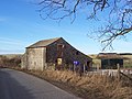
 A barn on Thorpe Lane - geograph.org.uk - 2967793.jpg 800 × 600; 164 KB
-
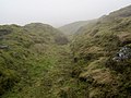
 A gulley to scramble down - geograph.org.uk - 1822681.jpg 2,112 × 2,816; 2.57 MB
-
 A line of grouse butts on Barden Moor - geograph.org.uk - 2129174.jpg 1,600 × 1,198; 555 KB
-
 Access Track from Chapel Lane - geograph.org.uk - 2254683.jpg 4,320 × 3,240; 3.36 MB
-
 Approaching The Obelisk - geograph.org.uk - 5153635.jpg 1,920 × 1,280; 538 KB
-
 B6265 between Cracoe and Rylstone. - geograph.org.uk - 92912.jpg 640 × 480; 60 KB
-
 B6265 in Cracoe - geograph.org.uk - 5417784.jpg 640 × 481; 70 KB
-
 B6265 near Swiden Quarry - geograph.org.uk - 5417791.jpg 640 × 481; 49 KB
-
 B6265 Tarns Lane - geograph.org.uk - 5417796.jpg 640 × 481; 44 KB
-
 B6265 towards Grassington - geograph.org.uk - 2464982.jpg 1,600 × 1,200; 524 KB
-
 B6265 towards Grassington - geograph.org.uk - 2465090.jpg 1,600 × 1,200; 621 KB
-
 B6265 west of Cracoe - geograph.org.uk - 3350874.jpg 640 × 408; 114 KB
-
 B6265 west of Threapland House Farm - geograph.org.uk - 5417787.jpg 640 × 481; 68 KB
-
 Back Lane - geograph.org.uk - 5077240.jpg 4,000 × 3,000; 4.28 MB
-
 Back Lane in Cracoe - geograph.org.uk - 1354686.jpg 640 × 480; 126 KB
-
 Back Lane into Cracoe - geograph.org.uk - 1559192.jpg 640 × 480; 129 KB
-
 Back Lane, Cracoe - geograph.org.uk - 1354864.jpg 640 × 480; 96 KB
-
 Barden Moor - geograph.org.uk - 3401424.jpg 3,648 × 2,736; 4.08 MB
-
 Barn near Cracoe - geograph.org.uk - 5572485.jpg 480 × 640; 192 KB
-
 Barn near Cracoe - geograph.org.uk - 5572486.jpg 640 × 480; 225 KB
-
 Benchmark on a gatepost northeast of Cracoe - geograph.org.uk - 3637994.jpg 1,600 × 1,200; 843 KB
-
 Boggy ground east of Skelterton Hill - geograph.org.uk - 2238845.jpg 640 × 480; 76 KB
-
 Bottom Flats Laithe looking towards the Cracoe Obelisk - geograph.org.uk - 1858330.jpg 4,592 × 3,056; 5.15 MB
-
 Bottom Flatts Laithe - geograph.org.uk - 2053732.jpg 640 × 480; 77 KB
-
 Boundary Post on Rylstone Fell - geograph.org.uk - 2129130.jpg 1,600 × 1,198; 498 KB
-
 Boundary Wall on Cracoe Fell - geograph.org.uk - 2282793.jpg 4,320 × 3,240; 3.14 MB
-
 Bridge SKS2-29 crossing Swinden Lane - geograph.org.uk - 424837.jpg 640 × 480; 75 KB
-
 Bridleway south of Cracoe - geograph.org.uk - 1354669.jpg 640 × 480; 151 KB
-
 Camp on Peter's Crag - geograph.org.uk - 5153640.jpg 1,920 × 1,280; 541 KB
-
 Camp, Cracoe Fell - geograph.org.uk - 5153641.jpg 1,920 × 1,280; 538 KB
-
 Carden Hill in the foreground, Threapland Fell beyond - geograph.org.uk - 2112944.jpg 4,592 × 3,056; 4.68 MB
-
 Catch-all Farm - geograph.org.uk - 2657040.jpg 1,500 × 1,000; 212 KB
-
 Chapel Lane - Bridleway and track - geograph.org.uk - 1011386.jpg 640 × 480; 159 KB
-
 Chapel Lane - geograph.org.uk - 2254679.jpg 4,320 × 3,240; 3.24 MB
-
 Chapel Lane between Cracoe and Rylstone - geograph.org.uk - 2129720.jpg 1,600 × 1,198; 670 KB
-
 Checking me out for a 12 bore - geograph.org.uk - 1822476.jpg 1,600 × 1,065; 361 KB
-
 Coonlands Barn - geograph.org.uk - 119992.jpg 640 × 480; 107 KB
-
 Cottages, Cracoe - geograph.org.uk - 2053731.jpg 640 × 480; 108 KB
-
 Cracoe at dusk - geograph.org.uk - 3298562.jpg 3,872 × 2,592; 3.28 MB
-
 Cracoe cafe - geograph.org.uk - 931510.jpg 640 × 480; 153 KB
-
 Cracoe Fell - geograph.org.uk - 3363044.jpg 2,592 × 1,944; 1.23 MB
-
 Cracoe Fell - geograph.org.uk - 5498059.jpg 1,024 × 576; 310 KB
-
 Cracoe Fell Lane merging into Mist - geograph.org.uk - 2282757.jpg 4,320 × 3,240; 3.25 MB
-
 Cracoe House.jpg 4,000 × 3,000; 4.92 MB
-
 Cracoe obelisk from the southwest - geograph.org.uk - 3422369.jpg 2,048 × 1,536; 409 KB
-
 Cracoe's Café, Cracoe - geograph.org.uk - 4080706.jpg 1,600 × 1,064; 567 KB
-
 Cracoe, Looking north along the B6265 - geograph.org.uk - 5338189.jpg 3,456 × 2,304; 3.6 MB
-
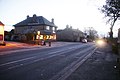
 Cracoe, The 'Devonshire Arms' - geograph.org.uk - 3340673.jpg 4,320 × 3,240; 5.34 MB
-
 Cracoe, The 'Devonshire Arms' - geograph.org.uk - 5338182.jpg 3,456 × 2,304; 3.07 MB
-
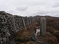 Cracoe-Rylstone boundary stone - geograph.org.uk - 3422379.jpg 2,048 × 1,536; 657 KB
-
 Crags and the view NNW from Cracoe War Memorial - geograph.org.uk - 5079621.jpg 4,000 × 3,000; 3.3 MB
-
 Crinoidal Limestone - geograph.org.uk - 5572489.jpg 640 × 480; 255 KB
-
 Devonshire Arms, Cracoe - geograph.org.uk - 931511.jpg 640 × 480; 154 KB
-
 Eastern End of Cracoe Lane Fell - geograph.org.uk - 2282780.jpg 4,320 × 3,240; 3.22 MB
-
 Elbolton, Burnsall and Thorpe - geograph.org.uk - 4331759.jpg 3,648 × 2,736; 3.92 MB
-
 Eller Beck, Linton Moor - geograph.org.uk - 398708.jpg 640 × 480; 106 KB
-
 Farmland near Cracoe - geograph.org.uk - 2464968.jpg 1,600 × 1,200; 470 KB
-
 Farmland south of Thorpe Lane - geograph.org.uk - 2465629.jpg 1,600 × 1,200; 411 KB
-
 Farmland to the west of Cracoe - geograph.org.uk - 6173965.jpg 1,024 × 683; 440 KB
-
 Farmland, Threapland - geograph.org.uk - 2465080.jpg 640 × 480; 116 KB
-
 Fell Lane - geograph.org.uk - 5079637.jpg 4,000 × 3,000; 5.22 MB
-
 Fell Lane approaching Cracoe - geograph.org.uk - 2282712.jpg 4,320 × 3,240; 3.66 MB
-
 Fell Lane entering Cracoe - geograph.org.uk - 4364502.jpg 3,776 × 2,520; 4.15 MB
-
 Fell Lane near Cracoe - geograph.org.uk - 3914681.jpg 3,776 × 2,520; 4.07 MB
-
 Fell Lane, Cracoe - geograph.org.uk - 3637999.jpg 1,600 × 1,200; 704 KB
-
 Fell Lane, near Cracoe - geograph.org.uk - 4364505.jpg 3,776 × 2,520; 4.29 MB
-
 Fellside, Cracoe Fell - geograph.org.uk - 2238854.jpg 640 × 480; 88 KB
-
 Field - wood boundary near Cracoe - geograph.org.uk - 1916329.jpg 640 × 480; 113 KB
-
 Field gate, west side of B6265 - geograph.org.uk - 3533777.jpg 1,024 × 768; 151 KB
-
 Field west of Cracoe - geograph.org.uk - 6173955.jpg 1,024 × 683; 564 KB
-
 Fields west of Cracoe - geograph.org.uk - 6173957.jpg 1,024 × 683; 464 KB
-

-
 Fly past by the RGF - geograph.org.uk - 1822608.jpg 4,592 × 3,056; 5.14 MB
-
 Footpath between Cracoe and Linton - geograph.org.uk - 2229486.jpg 4,320 × 3,240; 3.35 MB
-
 Gate and ladder stile give access to the crags - geograph.org.uk - 3421794.jpg 2,048 × 1,536; 588 KB
-
 Gateway, Thorpe Lane - geograph.org.uk - 2053729.jpg 640 × 480; 85 KB
-
 Grey Mare Yethergill - geograph.org.uk - 1822702.jpg 4,592 × 3,056; 5.36 MB
-
 Gritstone formations, Cracoe Fell - geograph.org.uk - 5498048.jpg 1,024 × 683; 346 KB
-
 Gritstone on Cracoe Fell - geograph.org.uk - 2283138.jpg 4,320 × 3,240; 2.43 MB
-
 Hall Demesne - geograph.org.uk - 2053524.jpg 640 × 480; 87 KB
-
 Heading along Cracoe Fell - geograph.org.uk - 2053686.jpg 640 × 480; 70 KB
-
 House near Threapland - geograph.org.uk - 3346449.jpg 1,024 × 768; 178 KB
-

-
 Invisible stream, Cracoe - geograph.org.uk - 1351735.jpg 640 × 480; 145 KB
-
 Junction in Cracoe - geograph.org.uk - 6173970.jpg 1,024 × 683; 454 KB
-

-
 Lane in Cracoe - geograph.org.uk - 2238834.jpg 640 × 480; 107 KB
-
 Lane near Cracoe - geograph.org.uk - 2238829.jpg 640 × 480; 96 KB
-

-
 Minor road towards Cracoe - geograph.org.uk - 2464972.jpg 1,600 × 1,200; 751 KB
-
 Moorland on Cracoe Fell - geograph.org.uk - 1916418.jpg 640 × 480; 89 KB
-
 Moorland, Cracoe Fell - geograph.org.uk - 2238853.jpg 640 × 480; 94 KB
-
 New Laithe on Swinden Lane, Cracoe - geograph.org.uk - 3637864.jpg 1,600 × 1,200; 575 KB
-
 North end of Chapel Lane, Cracoe - geograph.org.uk - 3638002.jpg 1,600 × 1,200; 958 KB
-

-

-

-

-

-
 Old guide post, Cracoe - geograph.org.uk - 1351656.jpg 480 × 640; 142 KB
-
 Old road direction signs, Cracoe - geograph.org.uk - 1351620.jpg 640 × 480; 138 KB
-
 On Chapel Lane - geograph.org.uk - 6212203.jpg 5,184 × 3,456; 6.62 MB
-
 On Cracoe Fell - geograph.org.uk - 5498041.jpg 1,024 × 683; 358 KB
-
 Ordnance Survey Sheet SD 96 Conistone, Published1957.jpg 5,545 × 5,642; 3.77 MB
-
 Part of the long wall on Cracoe Fell - geograph.org.uk - 3914692.jpg 3,776 × 2,520; 4.12 MB
-
 Pastures below Cracoe Fell - geograph.org.uk - 2254687.jpg 4,320 × 3,240; 3.11 MB
-

-
 Peter the grouse is clearly not too impressed - geograph.org.uk - 1822574.jpg 4,592 × 3,056; 7.21 MB
-
 Pilot engine and hopper wagons at Swinden Quarry - geograph.org.uk - 2657034.jpg 1,500 × 1,000; 202 KB
-
 Potter Gap - geograph.org.uk - 2283132.jpg 4,320 × 3,240; 2.87 MB
-
-
 Railway Bridge crossing Swinden Lane, Cracoe - geograph.org.uk - 6211816.jpg 5,184 × 3,456; 6.62 MB
-
 Railway bridge over Swinden Lane, Cracoe - geograph.org.uk - 3637987.jpg 1,600 × 1,200; 783 KB
-
 Railway near Cracoe - geograph.org.uk - 6173941.jpg 1,024 × 683; 470 KB
-
 Ratts Laithe - geograph.org.uk - 3637852.jpg 1,600 × 1,200; 462 KB
-
 Remains of Bottom Flats Laithe - geograph.org.uk - 3638006.jpg 1,600 × 1,200; 489 KB
-
 Road junction at Catch-all Farm - geograph.org.uk - 3083158.jpg 640 × 388; 84 KB
-
 Road junction at Cracoe - geograph.org.uk - 3083446.jpg 640 × 364; 58 KB
-
 Rolling Gate Crags - geograph.org.uk - 2238849.jpg 640 × 480; 79 KB
-
 Rolling Gate Crags - geograph.org.uk - 4364514.jpg 3,776 × 2,520; 4.21 MB
-
 Rolling Gate Nook - geograph.org.uk - 3421780.jpg 2,048 × 1,536; 602 KB
-
 Ruins of Bottom Flats Laithe - geograph.org.uk - 6212200.jpg 5,184 × 3,456; 7.68 MB
-
 School and village hall, Cracoe - geograph.org.uk - 1351750.jpg 640 × 473; 104 KB
-
 Sheep fold, Cracoe - geograph.org.uk - 3396416.jpg 1,181 × 785; 537 KB
-
 Sheep in Cracoe - geograph.org.uk - 6173971.jpg 1,024 × 683; 465 KB
-
 Sheep pasture, west of Tarns Lane - geograph.org.uk - 3533786.jpg 1,024 × 768; 123 KB
-
 Sheep Pen beside lane to Bordley - geograph.org.uk - 286002.jpg 640 × 480; 107 KB
-
 Sheep pens near Cracoe - geograph.org.uk - 1916412.jpg 2,592 × 1,944; 1.6 MB
-
 Sheep Pens, Fell Lane - geograph.org.uk - 5079634.jpg 4,000 × 3,000; 5.07 MB
-
 Signpost on B6265 in Cracoe - geograph.org.uk - 1911336.jpg 1,944 × 2,592; 1.48 MB
-
 Skelterton Hill - geograph.org.uk - 2238840.jpg 640 × 480; 60 KB
-
 Skelterton Hill - geograph.org.uk - 3396421.jpg 1,181 × 762; 515 KB
-
 Solar powered water system - geograph.org.uk - 4949106.jpg 1,600 × 1,200; 473 KB
-
 Southern Yorkshire Dales - geograph.org.uk - 5572474.jpg 640 × 480; 152 KB
-
 Southern Yorkshire Dales - geograph.org.uk - 5572492.jpg 640 × 480; 187 KB
-
 Stone Barn on Cracoe Fell Lane - geograph.org.uk - 2282750.jpg 4,320 × 3,240; 2.89 MB
-
 Stone Gate Posts near Ratts Laithe - geograph.org.uk - 6211486.jpg 5,184 × 3,456; 7 MB
-
 Stone train - geograph.org.uk - 225380.jpg 640 × 442; 54 KB
-
 Strip of woodland, Cracoe - geograph.org.uk - 1351765.jpg 640 × 480; 148 KB
-
 Summit, Cracoe Fell - geograph.org.uk - 5498053.jpg 1,024 × 683; 295 KB
-
 Swinden Lane - geograph.org.uk - 6173968.jpg 683 × 1,024; 735 KB
-
 Swinden Limestone Quarry close to Cracoe - geograph.org.uk - 5572477.jpg 640 × 480; 151 KB
-

-
 Swinden Quarry - geograph.org.uk - 5684410.jpg 3,264 × 2,448; 968 KB
-
 Swinden Quarry and dry stone wall - geograph.org.uk - 4948089.jpg 1,600 × 1,200; 333 KB
-
 Swinden Quarry from Cracoe War Memorial - geograph.org.uk - 5079628.jpg 4,000 × 3,000; 3.4 MB
-
 Swinden, Yorkshire, Quarry with stone hoppers - geograph.org.uk - 3437439.jpg 3,420 × 2,478; 5.25 MB
-
 Tarns Lane - geograph.org.uk - 3533782.jpg 1,024 × 768; 138 KB
-
 The B6265 at Cracoe - geograph.org.uk - 3298558.jpg 3,872 × 2,592; 3.79 MB
-
 The B6265 through Cracoe - geograph.org.uk - 1354720.jpg 640 × 453; 100 KB
-
 The Corncrake Guest House - geograph.org.uk - 931512.jpg 640 × 480; 211 KB
-
 The Cracoe Obelisk from Thorpe Lane - geograph.org.uk - 2112970.jpg 4,592 × 3,056; 5.78 MB
-
 The Devonshire Arms - Cracoe - geograph.org.uk - 5132654.jpg 2,204 × 1,654; 531 KB
-
 The Devonshire Arms at Cracoe - geograph.org.uk - 2129713.jpg 1,600 × 1,198; 375 KB
-
 The Devonshire Arms, Cracoe - geograph.org.uk - 2464977.jpg 1,600 × 827; 268 KB
-
 The Devonshire Arms, Cracoe - geograph.org.uk - 2967711.jpg 800 × 600; 107 KB
-
 The Devonshire Arms, Cracoe - geograph.org.uk - 3298555.jpg 3,872 × 2,592; 3.06 MB
-
 The Devonshire Arms, Cracoe - geograph.org.uk - 4080696.jpg 1,600 × 1,064; 500 KB
-
 The Devonshire Arms, Cracoe - geograph.org.uk - 4080697.jpg 1,064 × 1,600; 377 KB
-
 The Obelisk, Cracoe Fell - geograph.org.uk - 3914717.jpg 3,776 × 2,520; 3.9 MB
-
 The top of Peter's Crag - geograph.org.uk - 1822441.jpg 4,592 × 3,056; 4.36 MB
-
 The track around Thorpe Fell Top - geograph.org.uk - 2129188.jpg 1,600 × 1,198; 548 KB
-
 The track towards Watt Crag - geograph.org.uk - 1822385.jpg 4,592 × 3,056; 5.1 MB
-
 The village hall at Cracoe - geograph.org.uk - 2967721.jpg 800 × 600; 141 KB
-
 The wall above Cracoe Fell - geograph.org.uk - 2129164.jpg 1,600 × 1,198; 401 KB
-
 The WitchWay Bus at Cracoe - geograph.org.uk - 4080711.jpg 1,600 × 1,064; 689 KB
-
 Thorpe Lane - geograph.org.uk - 2465086.jpg 1,600 × 1,200; 690 KB
-
 Thorpe Lane - geograph.org.uk - 3346609.jpg 1,024 × 656; 112 KB
-
 Thorpe Lane heading east - geograph.org.uk - 2465632.jpg 1,600 × 1,200; 649 KB
-
 Thorpe Lane near Threapland - geograph.org.uk - 2129697.jpg 1,600 × 1,198; 398 KB
-
 Thorpe Lane, Cracoe - geograph.org.uk - 2967736.jpg 800 × 600; 211 KB
-
 Threapland Farmhouse.jpg 3,000 × 4,000; 5 MB
-
 Towards Fleets from Swinden Lane - geograph.org.uk - 3637858.jpg 1,600 × 1,200; 593 KB
-
 Town End House on the B6265, Cracoe - geograph.org.uk - 424847.jpg 640 × 480; 79 KB
-
 Track near Threapland - geograph.org.uk - 2229507.jpg 4,169 × 3,239; 3.3 MB
-
 Track on Thorpe Fell - geograph.org.uk - 2283155.jpg 4,320 × 3,240; 2.35 MB
-
 Track to the open fell - geograph.org.uk - 2238837.jpg 640 × 480; 113 KB
-
 Triangulation Pillar on edge of Swinden Quarry - geograph.org.uk - 2021568.jpg 1,024 × 664; 150 KB
-
 Vehicle Height Barrier near Swinden Quarry - geograph.org.uk - 2229476.jpg 4,320 × 3,240; 4.2 MB
-

-

-

-

-
-
 View to Ebolton Hill - geograph.org.uk - 5572490.jpg 640 × 480; 188 KB
-
 View to Skelterton Hill - geograph.org.uk - 5572483.jpg 640 × 480; 210 KB
-
 View to Skelterton Hill - geograph.org.uk - 5572488.jpg 640 × 480; 200 KB
-
 View west from Cracoe Fell - geograph.org.uk - 4364508.jpg 3,776 × 2,520; 3.9 MB
-
 Waterless pond and waterfall, Cracoe.jpg 640 × 480; 92 KB
-
 Wet Dry Stone Wall on Cracoe Fell - geograph.org.uk - 2283147.jpg 4,320 × 3,240; 2.57 MB
-
 Winterburn Reservoir - geograph.org.uk - 285102.jpg 640 × 480; 86 KB
-
 Yellow Bike, Devonshire Arms, Cracoe - geograph.org.uk - 4080701.jpg 1,600 × 1,064; 807 KB
-
 A track across Boss Moor - geograph.org.uk - 824760.jpg 640 × 480; 197 KB
-
 A track across Lane Head - geograph.org.uk - 824764.jpg 640 × 480; 189 KB
-
 Bell pit - geograph.org.uk - 338820.jpg 640 × 480; 137 KB
-
 Boundary marks carved on boulder - geograph.org.uk - 392660.jpg 640 × 480; 139 KB
-
 Bridge over Hetton Common Beck - geograph.org.uk - 286003.jpg 640 × 480; 112 KB
-

-
 Bridge with wall on top - geograph.org.uk - 1480309.jpg 640 × 480; 120 KB
-


_-_geograph.org.uk_-_419465.jpg)


