Category:Coupar Angus
Jump to navigation
Jump to search
town in Perth and Kinross, Scotland, UK  | |||||
| Upload media | |||||
| Instance of |
| ||||
|---|---|---|---|---|---|
| Location |
| ||||
| Population |
| ||||
 | |||||
English: The name Coupar Angus serves to differentiate the town from Cupar, Fife. The town was transferred from the county of Angus to Perthshire in 1891, but retained its traditional name.
Gàidhlig: 'S e baile-beag ann am Peairt agus Ceann Rois a th' ann an Cùbar Aonghais (Beurla: Coupar Angus). 'S e seo na co-chomharran aige: 56° 33′ 0″ Tuath agus 3° 16′ 0″ Iar.
Norsk bokmål: Coupar Angus ( Skotsk gælisk: Cùbar Aonghais) er en by (town) i regionen Perth and Kinross i Skottland. Angus ble lagt til navnet for å skille den fra Cupar i Fife. Da byen ble overført fra grevskapet Angus til Perthshire i 1891 behodlt den sitt tradisjonelle navn.
Subcategories
This category has the following 2 subcategories, out of 2 total.
C
- Coupar Angus Abbey (7 F)
- Coupar Angus Town Hall (3 F)
Media in category "Coupar Angus"
The following 57 files are in this category, out of 57 total.
-
 9 15am 16th December (188410037).jpeg 2,048 × 1,362; 932 KB
-
 Boat House on Laird's Loch - geograph.org.uk - 41069.jpg 640 × 427; 355 KB
-
 Boys Football at Kettins - geograph.org.uk - 79918.jpg 640 × 480; 129 KB
-
 Bridge of Couttie (geograph 7144789).jpg 5,184 × 3,888; 5.69 MB
-
-

-
-
 Clock Tower in Coupar Angus.jpg 640 × 480; 146 KB
-
-
 New housing, Coupar Angus - geograph.org.uk - 828105.jpg 640 × 480; 110 KB
-
 Ordnance Survey One-Inch Sheet 49 Blairgowrie, Published 1958 2.jpg 8,610 × 10,668; 19.76 MB
-
 Ordnance Survey One-Inch Sheet 49 Blairgowrie, Published 1958.jpg 8,241 × 9,880; 11.46 MB
-
 Ransom (Allium ursinum ) - geograph.org.uk - 828142.jpg 480 × 640; 82 KB
-
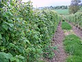 Raspberry Canes, Coupar Angus - geograph.org.uk - 828775.jpg 640 × 480; 132 KB
-
 River Isla - geograph.org.uk - 1496419.jpg 640 × 480; 44 KB
-
 Road junction, Coupar Angus - geograph.org.uk - 1554626.jpg 640 × 481; 149 KB
-
 St. Mary's Catholic Church, Coupar Angus (88).jpg 640 × 480; 45 KB
-
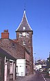
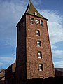 The Steeple - geograph.org.uk - 401945.jpg 480 × 640; 85 KB
-
 The Workers - geograph.org.uk - 409449.jpg 640 × 480; 84 KB
-
 Bee Hives and Fruit Frames - geograph.org.uk - 409439.jpg 640 × 480; 122 KB
-
 Bee Hives at Princeland Farm - geograph.org.uk - 316670.jpg 640 × 410; 122 KB
-
 Bendochy Church - geograph.org.uk - 278659.jpg 640 × 480; 143 KB
-
 Caddam Farmland and Polytunnel Frames - geograph.org.uk - 352721.jpg 640 × 480; 102 KB
-
 Candlehouse Lane - geograph.org.uk - 401905.jpg 640 × 480; 102 KB
-
 Coupar Angus - geograph.org.uk - 9267.jpg 391 × 640; 155 KB
-
 Couttie Law - geograph.org.uk - 278662.jpg 640 × 480; 70 KB
-
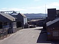
 East of Scotland Farmers Limited - geograph.org.uk - 403707.jpg 640 × 480; 70 KB
-
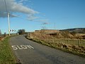
 Entering Coupar Angus from Perth - geograph.org.uk - 426247.jpg 640 × 480; 111 KB
-
 Field Path - geograph.org.uk - 408436.jpg 640 × 480; 150 KB
-
 Gateway to Isla Park House A94 - geograph.org.uk - 352748.jpg 640 × 432; 120 KB
-
 Houses on Forfar Road - geograph.org.uk - 316656.jpg 640 × 407; 91 KB
-
 Kettins Church - geograph.org.uk - 177140.jpg 640 × 480; 84 KB
-
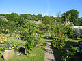
 Kettins Community Garden - geograph.org.uk - 177139.jpg 640 × 480; 114 KB
-
 Kettins Primary School - geograph.org.uk - 177138.jpg 640 × 480; 86 KB
-
 Lapwing (Vanellus vanellus) - geograph.org.uk - 522658.jpg 640 × 427; 96 KB
-
 Lonely phonebox - geograph.org.uk - 278823.jpg 640 × 480; 51 KB
-
 Model Cottages - geograph.org.uk - 651051.jpg 640 × 426; 85 KB
-
 My Garden - geograph.org.uk - 79893.jpg 640 × 480; 161 KB
-
 Old Railway Bridge over the River Isla - geograph.org.uk - 8989.jpg 640 × 480; 77 KB
-
 Raspberry Canes - geograph.org.uk - 407490.jpg 640 × 480; 134 KB
-
 Raspberry Canes and Covering Frames - geograph.org.uk - 316667.jpg 640 × 408; 108 KB
-
 Roadside Blossom - geograph.org.uk - 408396.jpg 640 × 480; 133 KB
-
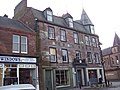 Royal Hotel - geograph.org.uk - 401884.jpg 640 × 480; 97 KB
-
 School Park, Kettins - geograph.org.uk - 177141.jpg 640 × 480; 58 KB
-
 Soft Fruit Farms near Coupar Angus - geograph.org.uk - 409429.jpg 640 × 480; 131 KB
-
 Spring arrives near Campmuir - geograph.org.uk - 352373.jpg 640 × 480; 68 KB
-
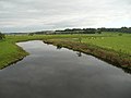
 The River Isla near Coupar Angus - geograph.org.uk - 7356.jpg 640 × 480; 163 KB
-
 The River Isla north of Coupar Angus - geograph.org.uk - 57848.jpg 640 × 480; 97 KB
-
 The River Isla north of Coupar Angus - geograph.org.uk - 651004.jpg 640 × 426; 59 KB
-
 The River Isla north of Coupar Angus - geograph.org.uk - 651008.jpg 640 × 426; 43 KB
-
 The River Isla north of Coupar Angus - geograph.org.uk - 651012.jpg 640 × 426; 41 KB
-
 The smaller loch at Monk Myre - geograph.org.uk - 650948.jpg 640 × 426; 83 KB
-
 Thorn Alley - geograph.org.uk - 401864.jpg 640 × 480; 102 KB
-
 Towards the River Isla - geograph.org.uk - 352741.jpg 640 × 480; 123 KB
-
 Track near Princeland - geograph.org.uk - 409423.jpg 640 × 480; 139 KB
-
 Track near Princeland Farm - geograph.org.uk - 408386.jpg 640 × 480; 152 KB
-
 Tree - geograph.org.uk - 79895.jpg 480 × 640; 201 KB
.jpeg)


.jpg)


_-_geograph.org.uk_-_828142.jpg)


.jpg)


_-_geograph.org.uk_-_522658.jpg)


