
Category:County signs in Georgia (U.S. state)
States of the United States: Alabama · Alaska · Arizona · Arkansas · California · Colorado · Delaware · Florida · Georgia · Idaho · Illinois · Indiana · Iowa · Kansas · Kentucky · Louisiana · Maine · Maryland · Massachusetts · Michigan · Minnesota · Mississippi · Missouri · Montana · Nebraska · Nevada · New Jersey · New Mexico · New York · North Carolina · Ohio · Oklahoma · Oregon · Pennsylvania · South Carolina · South Dakota · Tennessee · Texas · Utah · Vermont · Virginia · Washington · West Virginia · Wisconsin · Wyoming
Media in category "County signs in Georgia (U.S. state)"
The following 200 files are in this category, out of 289 total.
(previous page) (next page)-
 Appling County, Big Satilla Creek bridge, GA15 121NB.jpg 5,184 × 3,456; 7.07 MB
-
 Arabi, Crisp County limit US41NB.jpg 5,184 × 3,456; 8.25 MB
-
 Arch over Dougherty Mitchell County line on Dixie Highway.JPG 4,608 × 3,456; 5.93 MB
-
 Atkinson County border, GA135NB.JPG 4,320 × 3,240; 4.51 MB
-
 Bacon County border, GA32EB.JPG 5,152 × 3,864; 7.94 MB
-
 Bacon County Sign (32785395261).jpg 1,600 × 2,400; 1.46 MB
-
 Baker County border, GA216.jpg 5,184 × 3,456; 9.42 MB
-
 Baker County boundary FLSR2WB.JPG 5,152 × 3,864; 7.96 MB
-
 Baker County boundary, GA91SB.JPG 5,152 × 3,864; 7.88 MB
-
 Ben Hill County border, GA90EB.JPG 4,608 × 3,456; 4.19 MB
-
 Berrien County border, GA135NB.JPG 4,320 × 3,240; 4.55 MB
-
 Berrien County border, GA135SB.JPG 4,320 × 3,240; 4.53 MB
-
 Bibb County line, GA11 at Echeconnee Creek.JPG 5,184 × 3,456; 7.83 MB
-
 Brantley County line, US82WB.JPG 4,608 × 3,456; 5.27 MB
-
 Brooks County limit, GA133SB.JPG 5,152 × 3,864; 7.93 MB
-
 Brooks County Line marker, GA SR 122 WB.JPG 4,320 × 3,240; 4.49 MB
-
 Brooks County Line, GA SR 122 EB.JPG 4,320 × 3,240; 4.51 MB
-
 Brooks County line, GA31SB.jpg 5,184 × 3,456; 6.49 MB
-
 Brooks County line, SR133 NW.JPG 4,320 × 3,240; 4.44 MB
-
 Brooks County, Georgia state signs US 221 NB.JPG 4,320 × 3,240; 4.42 MB
-
 Butts County line, Chappell Mill Rd EB.JPG 4,608 × 3,456; 5.64 MB
-
 Calhoun County border, Arlington.jpg 5,184 × 3,456; 9.01 MB
-
 Calhoun County, Bluffton Rd EB.JPG 4,320 × 3,240; 4.51 MB
-
 Calhoun County, GA62 WB.JPG 4,320 × 3,240; 4.59 MB
-
 Camden County border, GA 40EB.JPG 4,608 × 3,456; 5.79 MB
-
 Charlton County border, GA 40WB.JPG 4,608 × 3,456; 5.53 MB
-
 Charlton County border, US1 SB.JPG 4,608 × 3,456; 5.96 MB
-
 Charlton County boundary GASR94EB.JPG 5,152 × 3,864; 7.87 MB
-
 Charlton County boundary GASR94WB.JPG 5,152 × 3,864; 7.94 MB
-
 Chauncey City limit, GA165SB.JPG 4,608 × 3,456; 5.4 MB
-
 Clay Couty limit, Bluffton Rd WB.JPG 4,320 × 3,240; 4.48 MB
-
 Clayton County border, Lower Woolsey Rd.JPG 4,608 × 3,456; 5.97 MB
-
 Clayton County border, Wildwood Rd.JPG 4,608 × 3,456; 6.36 MB
-
 Clinch County border, GA122EB.jpg 5,184 × 3,456; 9.77 MB
-
 Clinch County border, GA122WB.jpg 5,184 × 3,456; 6.29 MB
-
 Clinch County border, GA94 EB.JPG 4,320 × 3,240; 4.51 MB
-
 Clinch County boundary GASR94NB.JPG 5,152 × 3,864; 7.84 MB
-
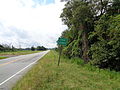
 Coffee County border, GA32WB.jpg 5,152 × 3,864; 8 MB
-
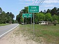
 Coffee County border, GA64EB.JPG 5,152 × 3,864; 7.95 MB
-
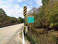
 Coffee County border, Ocmulgee River bridge, US319SB.JPG 4,608 × 3,456; 4.74 MB
-
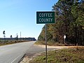
 Coffee County Sign (32868735336).jpg 1,600 × 2,400; 3.81 MB
-
 Coffee County US221SB.JPG 5,152 × 3,864; 7.85 MB
-
 Colquitt County border, Branch Rd NB.jpg 5,184 × 3,456; 6.88 MB
-
 Colquitt County border, GA202NB.jpg 5,184 × 3,456; 8.18 MB
-
 Colquitt County limit, Kinard Bridge Rd.JPG 5,152 × 3,864; 7.92 MB
-
 Colquitt County Line, GA 133 NB.JPG 5,152 × 3,864; 7.94 MB
-
 Columbia County boundary FLSR2SB.JPG 5,152 × 3,864; 7.9 MB
-
 Cook Co marker, US41SB.JPG 4,608 × 3,456; 6.35 MB
-
 Cook County border, GA37EB.jpg 5,184 × 3,456; 4.66 MB
-
 Cook County border, Hempstead Church Rd EB.jpg 5,184 × 3,456; 7.02 MB
-
 Cook County limit, US41NB.JPG 4,608 × 3,456; 6.07 MB
-
 Crawford County limit, US341nb.JPG 4,320 × 3,240; 4.51 MB
-
 Crawford County limit, US80 EB.jpg 5,184 × 3,456; 5.06 MB
-
 Crawford County limit, US80eb.JPG 4,320 × 3,240; 4.42 MB
-
 Crisp County border GA257SB.JPG 5,152 × 3,864; 7.83 MB
-
 Crisp County border, GA300NB.jpg 5,184 × 3,456; 7.69 MB
-
 Crisp County border, GA7SB.JPG 5,152 × 3,864; 7.86 MB
-
 Crisp County border, Georgia Veterans State Park.jpg 5,184 × 3,456; 4.02 MB
-
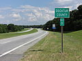
 Decatur County border, GA253EB.jpg 5,184 × 3,456; 7.03 MB
-
 Decatur County line, US84EB.JPG 4,608 × 3,456; 5.07 MB
-
 Dodge County border, US280eb.JPG 4,608 × 3,456; 4.73 MB
-
 Dodge County limit, GA165NB.JPG 4,608 × 3,456; 5.43 MB
-
 Dodge County limit, GA165SB.JPG 4,608 × 3,456; 4.24 MB
-
 Dodge County, US341WB.JPG 4,608 × 3,456; 5.71 MB
-
 Dodge County, US441SB.jpg 5,184 × 3,456; 5.63 MB
-
 Dooly County border GA257NB.JPG 5,152 × 3,864; 7.92 MB
-
 Dooly County border, GA27EB.JPG 4,608 × 3,456; 4.49 MB
-
 Dooly County border, GA7NB.JPG 5,152 × 3,864; 7.88 MB
-
 Dougherty County Albany City Limits, Palmyra Rd SB.jpg 5,184 × 3,456; 5.56 MB
-
 Dougherty County boundary, GA91NB.JPG 5,152 × 3,864; 7.87 MB
-
 Dougherty County Line, GA 133 NB.JPG 4,320 × 3,240; 4.45 MB
-
 Early County border in Arlington.jpg 5,184 × 3,456; 6.79 MB
-
 Early County border, GA216.jpg 5,184 × 3,456; 8.4 MB
-
 Early County limit, Killebrew Rd.jpg 5,184 × 3,456; 9.99 MB
-
 Early County limit, US84 WB.jpg 5,184 × 3,456; 4.93 MB
-
 Echols County border GA135NB.JPG 5,152 × 3,864; 7.9 MB
-
 Echols County Border sign on GA SR 94.JPG 3,072 × 2,304; 3.04 MB
-
 Echols County border US129NB.JPG 5,152 × 3,864; 7.97 MB
-
 FL2 EB, Baker County at GA94 Charlton County border.jpg 5,184 × 3,456; 4.52 MB
-
 Fl2 WB, Nassau County at Charlton County, Georgia.jpg 5,184 × 3,456; 4.52 MB
-
 Florida State line, FL53 SB.JPG 5,152 × 3,864; 7.9 MB
-
 Florida State Line, Gadsden County, US27SB.JPG 4,320 × 3,240; 4.43 MB
-
 Florida State Road 2 eastern terminus, Jackson County.jpg 5,184 × 3,456; 6.76 MB
-
 Fort Valley city limit GA 247 Connector WB.jpg 5,184 × 3,456; 4.57 MB
-
 GA state route 140 Peachtree Corners.jpg 2,454 × 1,472; 2.94 MB
-
 GA-FL state line Brooks-Madison north01.jpg 2,448 × 3,264; 2.02 MB
-
 GA135 NB Atkinson County limit.jpg 5,184 × 3,456; 4.78 MB
-
 GA135 SB Alapaha River Berrien County.jpg 5,184 × 3,456; 5.19 MB
-
 GA16wb, Spalding County limit.jpg 5,184 × 3,456; 6.68 MB
-
 GA18 GA219 I-85 I-185 Signs (32093502173).jpg 2,400 × 1,600; 2.58 MB
-
 GA3 GA300 end, Jefferson county line, Florida state line.jpg 5,184 × 3,456; 8.19 MB
-
 GA90 NB Irwin County.jpg 5,184 × 3,456; 6.29 MB
-
 GA90 SB at GA158 Coffee County border.jpg 5,184 × 3,456; 4.42 MB
-
 GA90 SB Atkinson County 2024.jpg 5,184 × 3,456; 5.44 MB
-
 GA90 SB Atkinson County.jpg 5,184 × 3,456; 5.45 MB
-
 GA94 EB, Clinch County, Suwannoochee Creek.jpg 5,184 × 3,456; 4.11 MB
-
 GA94WB, Charlton County, Entering Baker County Florida.jpg 5,184 × 3,456; 4.86 MB
-
 GA94WB, Echols County.jpg 5,184 × 3,456; 4.52 MB
-
 GA94WB, Entering Columbia County Florida.jpg 5,184 × 3,456; 4.83 MB
-
 Georgia GA384 SB Habersham County.jpg 5,184 × 3,456; 5.21 MB
-
 Georgia I475sb Bibb County line.jpg 5,184 × 3,456; 5.39 MB
-
 Georgia I675nb DeKalb County limit.jpg 5,184 × 3,456; 4.36 MB
-
 Georgia I75nb Butts County.jpg 5,184 × 3,456; 4.75 MB
-
 Georgia I75nb Crawford County limit.jpg 5,184 × 3,456; 4.42 MB
-
 Georgia I75nb Crawford County.jpg 5,184 × 3,456; 4.3 MB
-
 Georgia I75nb Crisp County line.JPG 4,320 × 3,240; 4.43 MB
-
 Georgia I75nb Dooly County.jpg 5,184 × 3,456; 4.54 MB
-
 Georgia I75nb Henry County.jpg 5,184 × 3,456; 4.34 MB
-
 Georgia I75nb Houston County line.JPG 4,608 × 3,456; 4.29 MB
-
 Georgia I75nb Houston County.jpg 5,184 × 3,456; 4.44 MB
-
 Georgia I75nb Lamar County 2024.jpg 5,184 × 3,456; 4.31 MB
-
 Georgia I75nb Lamar County limit.jpg 5,184 × 3,456; 4.07 MB
-
 Georgia I75nb Lowndes County border 2024.jpg 5,184 × 3,456; 4.02 MB
-
 Georgia I75nb Lowndes County line.JPG 4,320 × 3,240; 4.42 MB
-
 Georgia I75nb Macon-Bibb County limit.jpg 5,184 × 3,456; 4.14 MB
-
 Georgia I75nb Macon-Bibb County.jpg 5,184 × 3,456; 3.97 MB
-
 Georgia I75nb MM89.6 dashcam.jpg 3,840 × 2,160; 1.14 MB
-
 Georgia I75nb Peach County.jpg 5,184 × 3,456; 4.15 MB
-
 Georgia I75nb Spalding County.jpg 5,184 × 3,456; 5.34 MB
-
 Georgia I75nb Tift County border.JPG 4,320 × 3,240; 4.42 MB
-
 Georgia I75nb Turner County line.JPG 4,320 × 3,240; 4.47 MB
-
 Georgia I75nb Turner County.jpg 5,184 × 3,456; 4.25 MB
-
 Georgia I75sb Butts County border.jpg 5,184 × 3,456; 3.83 MB
-
 Georgia I75sb Cook County limit.jpg 5,184 × 3,456; 4.44 MB
-
 Georgia I75sb County Line Rd Overpass, Dooly County line.jpg 5,184 × 3,456; 3.67 MB
-
 Georgia I75sb Crawford County limit.jpg 5,184 × 3,456; 4.56 MB
-
 Georgia I75sb Dooly County.jpg 5,184 × 3,456; 4.46 MB
-
 Georgia I75sb Exit 228 Henry County limit.jpg 5,184 × 3,456; 4.1 MB
-
 Georgia I75sb Exit 238B.jpg 5,184 × 3,456; 4.46 MB
-
 Georgia I75sb High Falls Rd overpass, Monroe County border.jpg 5,184 × 3,456; 4.12 MB
-
 Georgia I75sb Lamar County border.jpg 5,184 × 3,456; 5.62 MB
-
 Georgia I75sb Lamar County limit.jpg 5,184 × 3,456; 6.41 MB
-
 Georgia I75sb Peach County limit.jpg 5,184 × 3,456; 4.86 MB
-
 Georgia I75sb Spalding County border.jpg 5,184 × 3,456; 4.02 MB
-
 Georgia I75sb Tift County dashcam.jpg 3,840 × 2,160; 1.16 MB
-
 Georgia I75sb Tift County limit.jpg 5,184 × 3,456; 4.19 MB
-
 Georgia I75sb Turner County line.JPG 5,184 × 3,456; 4.36 MB
-
 Georgia I95nb Chatham County border.jpg 5,184 × 3,456; 4.85 MB
-
 Georgia I95nb Jerico River, Bryan County.jpg 5,184 × 3,456; 5.45 MB
-
 Georgia I95nb Liberty County border.jpg 5,184 × 3,456; 4.98 MB
-
 Georgia I95nb McIntosh County Darien City border.jpg 5,184 × 3,456; 4.52 MB
-
 Georgia I95sb Bryan County border.jpg 5,184 × 3,456; 4.39 MB
-
 Georgia I95sb Glynn County Altamaha River.jpg 5,184 × 3,456; 4.47 MB
-
 Georgia I95sb Liberty County.jpg 5,184 × 3,456; 4.19 MB
-
 Georgia I95sb McIntosh County.jpg 5,184 × 3,456; 3.86 MB
-
 Georgia I985sb MM 7.5 Gwinnett County limit.jpg 5,184 × 3,456; 4.19 MB
-
 Georgia State Line, Decatur County, US27NB.JPG 4,320 × 3,240; 4.41 MB
-
 Georgia State Line, GA 31 NB.JPG 4,320 × 3,240; 4.53 MB
-
 Georgia State line, GA333 NB.JPG 5,152 × 3,864; 7.84 MB
-
 Georgia State Line, US82 EB.JPG 4,320 × 3,240; 4.5 MB
-
 Georgia State Route 285, Decatur County border.jpg 5,184 × 3,456; 6.21 MB
-
 Georgia State Route 285, Seminole County border.jpg 5,184 × 3,456; 7.97 MB
-
 Georgia State Route 31 bridge Brooks County NB 01.JPG 4,608 × 3,456; 3.65 MB
-
 Georgia State Route 31 bridge Brooks County SB 07.JPG 4,608 × 3,456; 3.62 MB
-
 Georgia State Route 91 southern terminus, Seminole County.jpg 5,184 × 3,456; 6.2 MB
-
 Georgia US23sb Hall County limit.jpg 5,184 × 3,456; 3.99 MB
-
 GeorgiaStateLine-HaralsonCounty-US78 (32908218865).jpg 2,400 × 1,600; 2.08 MB
-
 Glynn County line, US82EB.JPG 4,608 × 3,456; 4.81 MB
-
 Grady County border GA111sb.JPG 4,320 × 3,240; 4.46 MB
-
 Grady County boundary, Metcalf-Beachton Rd WB.jpg 5,184 × 3,456; 8.51 MB
-
 Grady County line, Georgia State border, GA111NB.jpg 5,184 × 3,456; 7.77 MB
-
 Grady County line, US84EB.JPG 4,608 × 3,456; 5.85 MB
-
 HartCountyStateLine.jpg 1,894 × 1,433; 729 KB
-
 Henry County border, US19.JPG 4,608 × 3,456; 5.36 MB
-
 Houston County border US341EB.JPG 5,152 × 3,864; 7.71 MB
-
 Houston County border US341NB.JPG 5,152 × 3,864; 7.88 MB
-
 Houston County limit, GA7sb.JPG 4,320 × 3,240; 4.4 MB
-
 Irwin County border GA125NB.jpg 5,184 × 3,456; 11.25 MB
-
 Irwin County border, US129NB.jpg 5,184 × 3,456; 5.47 MB
-
 Jeff Davis County border and bridge over Altamaha River, US221SB.JPG 5,152 × 3,864; 8.02 MB
-
 Jeff Davis County limit US341SB.jpg 5,184 × 3,456; 6.01 MB
-
 Jeff Davis County US221NB.JPG 5,152 × 3,864; 7.85 MB
-
 Lamar County line, High Falls Rd WB.JPG 4,608 × 3,456; 5.68 MB
-
 Lanier County border, GA122 EB.jpg 5,184 × 3,456; 6.57 MB
-
 Lanier County border, GA122WB.jpg 5,184 × 3,456; 8.41 MB
-
 Lanier County border, GA125nb.JPG 4,320 × 3,240; 4.43 MB
-
 Lanier County border, GA135SB.JPG 4,320 × 3,240; 4.5 MB
-
 Lanier County border, US129eb.jpg 5,184 × 3,456; 8.12 MB
-
 Lanier County border, US221NB.JPG 4,320 × 3,240; 4.43 MB
-
 Lanier County border, US84 EB.JPG 4,608 × 3,456; 4.04 MB
-
 Lanier County border, US84 WB.JPG 4,320 × 3,240; 4.51 MB
-
 Laurens County limit, GA165NB.JPG 4,608 × 3,456; 5.17 MB
-
 Laurens County limit, GA165SB.JPG 4,608 × 3,456; 5.5 MB
-
 Laurens County, US441NB.jpg 5,184 × 3,456; 7.27 MB
-
 Lee County border US19SB.jpg 5,184 × 3,456; 8.18 MB
-
 Lee County US82 WB.jpg 5,184 × 3,456; 4.32 MB
-
 Lee County, Palmyra Rd NB.jpg 5,184 × 3,456; 4.97 MB
-
 Liberty County border, Elam Rd.jpg 5,184 × 3,456; 7.78 MB
-
 Liberty County Walthourville City limit US84 EB.jpg 5,184 × 3,456; 4.67 MB
-
 Long County Altamaha River US84 EB.jpg 5,184 × 3,456; 4.8 MB
-
 Long County border US84EB.jpg 5,184 × 3,456; 6.93 MB
-
 Long County border US84WB.jpg 5,184 × 3,456; 4.78 MB
-
 Lowndes Co marker, US41NB.JPG 4,608 × 3,456; 6.64 MB
-
 Lowndes County Border sign on GA SR 94.JPG 3,072 × 2,304; 2.93 MB
-
 Lowndes County border, from Boyette Rd in Lanier County.jpg 5,184 × 3,456; 7.98 MB
-
 Lowndes County border, GA122 WB.jpg 5,184 × 3,456; 8.05 MB
-
 Lowndes County border, Strickland Rd.jpg 5,184 × 3,456; 6.77 MB
-
 Lowndes County limit, Union Rd SB.JPG 4,608 × 3,456; 5.83 MB
-
 Lowndes County limit, US41SB.JPG 4,608 × 3,456; 5.6 MB
-
 Lowndes County line, GA31NB.jpg 5,184 × 3,456; 8.34 MB


.jpg)


.jpg)


.jpg)


.jpg)


&filefrom=Lowndes+County+line%2C+US84EB.JPG#mw-category-media)