Category:County Road, Walton
Jump to navigation
Jump to search

County Road is the continuation of Kirkdale Road from Spellow lane to Breeze Hill, where it becomes Rice Lane. It forms part of the A59.
Subcategories
This category has the following 10 subcategories, out of 10 total.
Media in category "County Road, Walton"
The following 19 files are in this category, out of 19 total.
-
 Benchmark at 16 County Road, Walton.jpg 4,603 × 3,452; 12.63 MB
-
 County Road (A59) - geograph.org.uk - 6136805.jpg 4,674 × 3,030; 3.44 MB
-
 County Road approaching Spellow Lane.jpg 5,153 × 3,413; 23.4 MB
-
 County Road at Ludlow Street.jpg 4,737 × 3,312; 9.5 MB
-
 County Road at Wilbury Street.jpg 5,133 × 3,361; 24.84 MB
-
 County Road in Walton - geograph.org.uk - 6445273.jpg 2,700 × 2,025; 449 KB
-
 County Road post office, Walton.jpg 4,517 × 3,387; 10 MB
-
 County Road, Walton - 2014-03-16.JPG 4,320 × 3,240; 2.84 MB
-
 County Road, Walton, Liverpool (1).jpg 4,320 × 3,240; 3.3 MB
-
 Former Ethel Austin shop on County Road, Liverpool L4.JPG 4,320 × 3,240; 2.86 MB
-
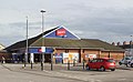 Jack's, Walton.jpg 4,719 × 2,910; 8.54 MB
-
 Post box on County Road, Walton, Liverpool.jpg 3,102 × 5,133; 10.03 MB
-
 Post box at County Road Post Office, Walton.jpg 3,198 × 4,449; 9.17 MB
-
 Oxton Street - geograph.org.uk - 1537110.jpg 640 × 480; 72 KB
-
 Players, Walton.jpg 4,575 × 3,052; 6.46 MB
-
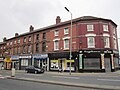 Shops on County Road, Walton (1).JPG 4,320 × 3,240; 3.22 MB
-
 The County pub, Walton, Liverpool.jpg 4,320 × 3,240; 3.16 MB
-
 View along Neston Street to Goodison.jpg 3,195 × 4,197; 7.51 MB
-
 Walton sign, Barlow Lane.jpg 3,411 × 4,554; 10.61 MB

_-_geograph.org.uk_-_6136805.jpg)


.jpg)


.JPG)


