Category:Countryside in Northern Ireland
Jump to navigation
Jump to search
Subcategories
This category has the following 7 subcategories, out of 7 total.
C
- Countryside in County Antrim (292 F)
- Countryside in County Armagh (220 F)
- Countryside in County Down (61 F)
- Countryside in County Fermanagh (474 F)
L
N
T
Media in category "Countryside in Northern Ireland"
The following 200 files are in this category, out of 336 total.
(previous page) (next page)-
 Ballyleckan near Bushmills - geograph.org.uk - 858924.jpg 640 × 480; 110 KB
-
 Barley Hill - geograph.org.uk - 407609.jpg 640 × 479; 71 KB
-
 Bayhead Road - geograph.org.uk - 1373650.jpg 640 × 479; 44 KB
-
 Bratwell Townland - geograph.org.uk - 802072.jpg 640 × 479; 65 KB
-
 Brone Road - geograph.org.uk - 838904.jpg 640 × 479; 43 KB
-
 Brone Townland - geograph.org.uk - 838908.jpg 640 × 479; 76 KB
-
 Browns Hill - geograph.org.uk - 840148.jpg 640 × 479; 70 KB
-
 Caheny Townland - geograph.org.uk - 838879.jpg 640 × 479; 53 KB
-
 Camus Townland - geograph.org.uk - 830480.jpg 640 × 479; 62 KB
-
 Camus Townland - geograph.org.uk - 830482.jpg 640 × 479; 54 KB
-
 Camus Townland - geograph.org.uk - 830485.jpg 640 × 479; 82 KB
-
 Carnoughter Townland - geograph.org.uk - 391273.jpg 640 × 479; 69 KB
-
 Carnroe Townland - geograph.org.uk - 838683.jpg 640 × 479; 56 KB
-
 Carrickphaddyhone Townland - geograph.org.uk - 631660.jpg 640 × 479; 70 KB
-
 Chambered grave at Moneydig - geograph.org.uk - 838803.jpg 640 × 479; 68 KB
-
 Church Hall at Ballylaggan - geograph.org.uk - 830507.jpg 640 × 479; 51 KB
-
 Clintagh Lane - geograph.org.uk - 802312.jpg 640 × 479; 97 KB
-
 Clintagh Townland - geograph.org.uk - 802304.jpg 640 × 479; 94 KB
-
 Clintagh Townland - geograph.org.uk - 802305.jpg 640 × 479; 85 KB
-
 Countryside near Kilrea - geograph.org.uk - 840099.jpg 640 × 479; 71 KB
-
 Cows at Mullan - geograph.org.uk - 840074.jpg 640 × 479; 63 KB
-
 Cromore Road - geograph.org.uk - 846364.jpg 640 × 360; 44 KB
-
 Cullycapple Townland - geograph.org.uk - 830550.jpg 640 × 479; 74 KB
-
 Cullycapple Townland - geograph.org.uk - 830556.jpg 640 × 479; 68 KB
-
 Culnaman Townland - geograph.org.uk - 838685.jpg 640 × 479; 61 KB
-
 Derrylattinee Townland - geograph.org.uk - 241869.jpg 640 × 479; 60 KB
-
 Dromore Townland - geograph.org.uk - 830487.jpg 640 × 479; 69 KB
-
 Dromore Townland - geograph.org.uk - 830531.jpg 640 × 479; 78 KB
-
 Dromore Townland - geograph.org.uk - 830533.jpg 640 × 479; 51 KB
-
 Drumane Townland - geograph.org.uk - 840129.jpg 640 × 479; 49 KB
-
 Drumane Townland - geograph.org.uk - 840143.jpg 640 × 479; 98 KB
-
 Drumcroon Road - geograph.org.uk - 830423.jpg 640 × 479; 56 KB
-
 Drumcroon Townland - geograph.org.uk - 802267.jpg 640 × 479; 74 KB
-
 Drumcroon Townland - geograph.org.uk - 802285.jpg 640 × 479; 74 KB
-
 Drumeil Road, Landagivey - geograph.org.uk - 838672.jpg 640 × 479; 44 KB
-
 Drumnagarner Road - geograph.org.uk - 840135.jpg 640 × 479; 57 KB
-
 Drumsaragh Hill - geograph.org.uk - 840067.jpg 640 × 479; 54 KB
-
 Drumsteeple Townland - geograph.org.uk - 830512.jpg 640 × 479; 48 KB
-
 Drumsteeple Townland - geograph.org.uk - 830523.jpg 640 × 479; 62 KB
-
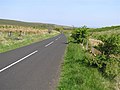
 Dunhill Road (A37) - geograph.org.uk - 801171.jpg 640 × 479; 65 KB
-
 Dunhill Road (A37) - geograph.org.uk - 801173.jpg 640 × 479; 48 KB
-
 Edenbane Road - geograph.org.uk - 838984.jpg 640 × 479; 57 KB
-
 Farm at Bovagh Wood - geograph.org.uk - 838948.jpg 640 × 479; 53 KB
-
 Farm at Moneydig - geograph.org.uk - 838961.jpg 640 × 479; 73 KB
-
 Farm at Upper Gortnacrane - geograph.org.uk - 840138.jpg 640 × 479; 60 KB
-
 Farm near Killyliss Hill - geograph.org.uk - 830431.jpg 640 × 479; 54 KB
-
 Fermoyle Hill - geograph.org.uk - 801452.jpg 640 × 479; 89 KB
-
 Fields, near Gransha - geograph.org.uk - 633628.jpg 640 × 480; 108 KB
-
 Formoyle Townland - geograph.org.uk - 801422.jpg 640 × 479; 49 KB
-
 Formoyle Townland - geograph.org.uk - 801459.jpg 640 × 479; 87 KB
-
 Formullen Townland - geograph.org.uk - 802076.jpg 640 × 479; 95 KB
-
 Formullen Townland - geograph.org.uk - 802077.jpg 640 × 479; 59 KB
-
 Gill Townland - geograph.org.uk - 830495.jpg 640 × 479; 97 KB
-
 Glencurry Bridge - geograph.org.uk - 112083.jpg 640 × 479; 109 KB
-
 Glenkeen Orange Hall - geograph.org.uk - 838653.jpg 640 × 479; 49 KB
-
 Gortin Road, Culnaman - geograph.org.uk - 838690.jpg 640 × 479; 62 KB
-
 Grange Park Wood - geograph.org.uk - 801557.jpg 640 × 479; 83 KB
-
 Grange Park Wood - geograph.org.uk - 802033.jpg 640 × 479; 78 KB
-
 Heading towards Magherabouy - geograph.org.uk - 847856.jpg 640 × 360; 51 KB
-
 Hill Head - geograph.org.uk - 840140.jpg 640 × 479; 96 KB
-
 Hill Head - geograph.org.uk - 840144.jpg 640 × 479; 64 KB
-
 Hill Head - geograph.org.uk - 840146.jpg 640 × 479; 61 KB
-
 Inishallen Townland - geograph.org.uk - 838911.jpg 640 × 479; 62 KB
-
 Inishallen Townland - geograph.org.uk - 838916.jpg 640 × 479; 50 KB
-
 Inshallen Townland - geograph.org.uk - 830418.jpg 640 × 479; 63 KB
-
 Killeague Townland - geograph.org.uk - 802294.jpg 640 × 479; 92 KB
-
 Killeague Townland - geograph.org.uk - 802309.jpg 640 × 479; 65 KB
-
 Killeague Townland - geograph.org.uk - 830537.jpg 640 × 479; 61 KB
-
 Killybrack Townland, Omagh - geograph.org.uk - 72739.jpg 640 × 479; 120 KB
-
 Killykergan Townland - geograph.org.uk - 830421.jpg 640 × 479; 64 KB
-
 Killykergan Townland - geograph.org.uk - 830655.jpg 640 × 479; 63 KB
-
 Killyliss Hill - geograph.org.uk - 830427.jpg 640 × 479; 75 KB
-
 Kiltinny - geograph.org.uk - 529433.jpg 640 × 479; 75 KB
-
 Knockmull Townland - geograph.org.uk - 801390.jpg 640 × 479; 80 KB
-
 Knockmull Townland - geograph.org.uk - 801392.jpg 640 × 479; 87 KB
-
 Knocknadruddian Townland - geograph.org.uk - 802210.jpg 640 × 479; 77 KB
-
 Knocknogher Townland - geograph.org.uk - 802064.jpg 640 × 479; 74 KB
-
 Knocknogher Townland - geograph.org.uk - 802066.jpg 640 × 479; 59 KB
-
 Knocknogher Townland - geograph.org.uk - 802069.jpg 640 × 479; 59 KB
-
 Landagivey Townland - geograph.org.uk - 838666.jpg 640 × 479; 53 KB
-
 Landagivey Townland - geograph.org.uk - 838675.jpg 640 × 479; 68 KB
-
 Lane near Formoyle Hill - geograph.org.uk - 813706.jpg 640 × 479; 62 KB
-
 Ligfordrum Townland - geograph.org.uk - 197189.jpg 640 × 479; 47 KB
-
 Lower Ballintaggart - geograph.org.uk - 830497.jpg 640 × 479; 75 KB
-
 Lower Cam Townland - geograph.org.uk - 767175.jpg 640 × 479; 62 KB
-
 Lower Drumcrow - geograph.org.uk - 830447.jpg 640 × 479; 47 KB
-
 Lower Dullaghry - geograph.org.uk - 838974.jpg 640 × 479; 62 KB
-
 Lower Glenleary - geograph.org.uk - 830478.jpg 640 × 479; 50 KB
-
 Lower Kiltinny - geograph.org.uk - 802214.jpg 640 × 479; 47 KB
-
 Lower Kiltinny - geograph.org.uk - 802216.jpg 640 × 479; 66 KB
-
 Lugmore - geograph.org.uk - 471919.jpg 640 × 479; 67 KB
-
 Macleary Townland - geograph.org.uk - 802224.jpg 640 × 479; 65 KB
-
 Maddybenny Riding Centre - geograph.org.uk - 1167969.jpg 640 × 480; 63 KB
-
 Magheramore Road - geograph.org.uk - 742063.jpg 640 × 479; 40 KB
-
 Magheramore Townland - geograph.org.uk - 741965.jpg 640 × 479; 54 KB
-
 Magheramore Townland - geograph.org.uk - 742068.jpg 640 × 479; 85 KB
-
 Magheramore Townland - geograph.org.uk - 742074.jpg 640 × 479; 64 KB
-
 Magheramore Townland - geograph.org.uk - 742076.jpg 640 × 479; 53 KB
-
 Managher Townland - geograph.org.uk - 830526.jpg 640 × 479; 77 KB
-
 Mathers Cross - geograph.org.uk - 847843.jpg 640 × 360; 67 KB
-
 Mayboy Townland - geograph.org.uk - 830437.jpg 640 × 479; 65 KB
-
 Mayboy Townland - geograph.org.uk - 830441.jpg 640 × 479; 65 KB
-
 Mayboy Townland - geograph.org.uk - 830444.jpg 640 × 479; 86 KB
-
 Mettican road - geograph.org.uk - 830434.jpg 640 × 479; 51 KB
-
 Middle Brockagh - geograph.org.uk - 741785.jpg 640 × 479; 65 KB
-
 Middle Brockagh - geograph.org.uk - 741804.jpg 640 × 479; 69 KB
-
 Middle Brockagh Townland - geograph.org.uk - 741786.jpg 640 × 479; 60 KB
-
 Middle Glenleary - geograph.org.uk - 830477.jpg 640 × 479; 60 KB
-
 Middle Quarter - geograph.org.uk - 767378.jpg 640 × 479; 48 KB
-
 Milltown Townland - geograph.org.uk - 830518.jpg 640 × 479; 71 KB
-
 Moneybrannon Road - geograph.org.uk - 830555.jpg 640 × 479; 68 KB
-
 Moneybrannon Townland - geograph.org.uk - 830546.jpg 640 × 479; 76 KB
-
 Moneydig Road - geograph.org.uk - 840068.jpg 640 × 479; 57 KB
-
 Moneydig townland - geograph.org.uk - 838805.jpg 640 × 479; 73 KB
-
 Moneydig townland - geograph.org.uk - 838869.jpg 640 × 479; 48 KB
-
 Moneydig Townland - geograph.org.uk - 838965.jpg 640 × 479; 60 KB
-
 Moneydig Townland - geograph.org.uk - 840070.jpg 640 × 479; 82 KB
-
 Moneygran Road - geograph.org.uk - 840086.jpg 640 × 479; 73 KB
-
 Mountsandel Fort - geograph.org.uk - 528928.jpg 640 × 285; 27 KB
-
 Mourne country near Bryansford - geograph.org.uk - 823444.jpg 640 × 417; 93 KB
-
 Movanagher Road - geograph.org.uk - 840085.jpg 640 × 479; 76 KB
-
 Moyletra Kill Townland - geograph.org.uk - 741153.jpg 640 × 479; 61 KB
-
 Mullaghcapple Townland - geograph.org.uk - 830559.jpg 640 × 479; 54 KB
-
 Mullaghinch Townland - geograph.org.uk - 830561.jpg 640 × 479; 65 KB
-
 Mullaghinch Townland - geograph.org.uk - 830567.jpg 640 × 479; 74 KB
-
 Mullaghinch Townland - geograph.org.uk - 830568.jpg 640 × 479; 82 KB
-
 Mullaghmeana - geograph.org.uk - 78823.jpg 640 × 479; 107 KB
-
 Mullan Hill - geograph.org.uk - 802133.jpg 640 × 479; 77 KB
-
 Mullan Townland - geograph.org.uk - 840075.jpg 640 × 479; 54 KB
-
 Mullan Townland - geograph.org.uk - 840077.jpg 640 × 479; 74 KB
-
 Near Ballystrone Hill - geograph.org.uk - 802094.jpg 640 × 479; 89 KB
-
 Near Ballystrone Hill - geograph.org.uk - 802112.jpg 640 × 479; 44 KB
-
 Near Black Hill - geograph.org.uk - 802323.jpg 640 × 479; 87 KB
-
 Near Boleran - geograph.org.uk - 767385.jpg 640 × 479; 53 KB
-
 Near Brockagh - geograph.org.uk - 741911.jpg 640 × 479; 55 KB
-
 Near Crossgare - geograph.org.uk - 830476.jpg 640 × 479; 68 KB
-
 Near Grange Park Wood - geograph.org.uk - 801569.jpg 640 × 479; 92 KB
-
 Near Grange Park Wood - geograph.org.uk - 802031.jpg 640 × 479; 69 KB
-
 Near Killyliss Hill - geograph.org.uk - 830426.jpg 640 × 479; 59 KB
-
 Near Killyliss Hill - geograph.org.uk - 830430.jpg 640 × 479; 63 KB
-
 Near Kilrea - geograph.org.uk - 840124.jpg 640 × 479; 75 KB
-
 Near Kiltest - geograph.org.uk - 767213.jpg 640 × 479; 84 KB
-
 Near Macosquin - geograph.org.uk - 802171.jpg 640 × 479; 71 KB
-
 Near Mayboy - geograph.org.uk - 830439.jpg 640 × 479; 74 KB
-
 Near Meencraig - geograph.org.uk - 767225.jpg 640 × 479; 52 KB
-
 Near Meencraig - geograph.org.uk - 767227.jpg 640 × 479; 62 KB
-
 Near Rindsend - geograph.org.uk - 767234.jpg 640 × 479; 87 KB
-
 Near Sanneys Hill - geograph.org.uk - 741161.jpg 640 × 479; 59 KB
-
 Near The Wood - geograph.org.uk - 838895.jpg 640 × 479; 62 KB
-
 Old airfield, Landagivey - geograph.org.uk - 838669.jpg 640 × 479; 66 KB
-
 Outside Cam Forest - geograph.org.uk - 1298313.jpg 640 × 426; 83 KB
-

-
 Pipers Hill - geograph.org.uk - 802172.jpg 640 × 479; 73 KB
-
 Pomeroy Townland - geograph.org.uk - 767420.jpg 640 × 479; 63 KB
-
 Pomeroy Townland - geograph.org.uk - 767425.jpg 640 × 479; 72 KB
-
 Quilly Head - geograph.org.uk - 802141.jpg 640 × 479; 65 KB
-
 Quilly Road - geograph.org.uk - 802138.jpg 640 × 479; 61 KB
-
 Railway near Portstewart - geograph.org.uk - 1085536.jpg 640 × 421; 91 KB
-
 Rangrash More - geograph.org.uk - 802115.jpg 640 × 479; 63 KB
-
 Rath at Carbalintober - geograph.org.uk - 741371.jpg 640 × 479; 96 KB
-
 Ravellea Townland - geograph.org.uk - 168124.jpg 640 × 479; 89 KB
-
 Raw Townland - geograph.org.uk - 912351.jpg 640 × 479; 53 KB
-
 Ringrash More - geograph.org.uk - 802117.jpg 640 × 479; 51 KB
-
 Ringsend Townland - geograph.org.uk - 767236.jpg 640 × 479; 70 KB
-
 Ringsend Townland - geograph.org.uk - 767240.jpg 640 × 479; 72 KB
-
 Ringsend Townland - geograph.org.uk - 767241.jpg 640 × 479; 80 KB
-
 Road at Ballwildrick - geograph.org.uk - 802081.jpg 640 × 479; 84 KB
-
 Road at Ballyhacket Glenahorry - geograph.org.uk - 802036.jpg 640 × 479; 59 KB
-
 Road at Ballynacanon - geograph.org.uk - 802238.jpg 640 × 479; 53 KB
-
 Road at Caheny - geograph.org.uk - 838871.jpg 640 × 479; 48 KB
-
 Road at Caheny - geograph.org.uk - 838874.jpg 640 × 479; 56 KB
-
 Road at Cam Forest - geograph.org.uk - 767061.jpg 640 × 479; 53 KB
-
 Road at Cam Forest - geograph.org.uk - 767246.jpg 640 × 479; 101 KB
-
 Road at Carbarintober - geograph.org.uk - 741337.jpg 640 × 479; 56 KB
-
 Road at Coose Quarter - geograph.org.uk - 767311.jpg 640 × 479; 78 KB
-
 Road at Craiggore - geograph.org.uk - 767050.jpg 640 × 479; 46 KB
-
 Road at Craignamolt - geograph.org.uk - 767076.jpg 640 × 479; 49 KB
-
 Road at Craignashinny - geograph.org.uk - 767170.jpg 640 × 479; 40 KB
-
 Road at Croghan - geograph.org.uk - 767079.jpg 640 × 479; 50 KB
-
 Road at Grange Park Wood - geograph.org.uk - 801561.jpg 640 × 479; 60 KB
-
 Road at Grange Park Wood - geograph.org.uk - 801564.jpg 640 × 479; 71 KB
-
 Road at Killeague - geograph.org.uk - 802314.jpg 640 × 479; 63 KB
-
 Road at Kiltest - geograph.org.uk - 767068.jpg 640 × 479; 47 KB
-
 Road at Lower Cam - geograph.org.uk - 767177.jpg 640 × 479; 81 KB
-
 Road at Lower Kiltinny - geograph.org.uk - 802219.jpg 640 × 479; 57 KB
-
 Road at Middle Quarter - geograph.org.uk - 767380.jpg 640 × 479; 52 KB
-
 Road at Pomeroy - geograph.org.uk - 767423.jpg 640 × 479; 62 KB
-
 Road at Rusky - geograph.org.uk - 830520.jpg 640 × 479; 82 KB
-
 Road at Temain Hill - geograph.org.uk - 767048.jpg 640 × 479; 59 KB
-
 Road leaving Grange Park Wood - geograph.org.uk - 802029.jpg 640 × 479; 54 KB
-
 Road near Gortnamoylagh - geograph.org.uk - 767428.jpg 640 × 479; 58 KB
-
 Road near Kiltest - geograph.org.uk - 767072.jpg 640 × 479; 39 KB
-

-
 Rusky Townland - geograph.org.uk - 1259857.jpg 640 × 480; 73 KB
-
 Rusky Townland - geograph.org.uk - 830519.jpg 640 × 479; 80 KB
-
 Scrabo Tower near Newtownards (2) - geograph.org.uk - 472889.jpg 640 × 427; 57 KB
-
 Smulgedon Townland - geograph.org.uk - 741814.jpg 640 × 479; 73 KB
-
 Smulgedon Townland - geograph.org.uk - 741815.jpg 640 × 479; 72 KB
-
 Station Corner - geograph.org.uk - 846356.jpg 640 × 360; 70 KB
-
 Tamnaclare Townland - geograph.org.uk - 142010.jpg 640 × 479; 81 KB


_-_geograph.org.uk_-_801171.jpg)
_-_geograph.org.uk_-_801173.jpg)


_-_geograph.org.uk_-_472889.jpg)


