Category:Coulter, South Lanarkshire
Jump to navigation
Jump to search
village in South Lanarkshire, Scotland, UK  | |||||
| Upload media | |||||
| Instance of | |||||
|---|---|---|---|---|---|
| Location |
| ||||
 | |||||
English: Coulter or Culter (both spellings in use, pronounced "Cooter" with no "l") is a small village and Civil Parish in South Lanarkshire, Scotland. It lies approximately 3 miles South of Biggar. Some old maps and local modern houses also have the spelling Cootyre - " a safe place for cows."
Media in category "Coulter, South Lanarkshire"
The following 30 files are in this category, out of 30 total.
-
 Coulter House, Lanarkshire 01.jpg 6,000 × 4,000; 11.57 MB
-
 Coulter House, Lanarkshire 02.jpg 6,000 × 4,000; 11.76 MB
-
 Coulter House, Lanarkshire 03.jpg 19,439 × 5,649; 12.41 MB
-
 Coulter station geograph-3321694-by-Ben-Brooksbank.jpg 1,197 × 723; 1.04 MB
-
 Cow Gill - one stream bed, two burns - geograph.org.uk - 925321.jpg 480 × 640; 112 KB
-
 Culter Allers Farm - geograph.org.uk - 811957.jpg 640 × 480; 81 KB
-
 Culter War Memorial (New) - geograph.org.uk - 630284.jpg 640 × 480; 78 KB
-
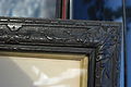 Frame made from oak tree found six foot underground in an avenue, Coulter, in 1859.jpg 3,008 × 2,000; 2.43 MB
-
 Gate on track between Nisbet and Kilbucho - geograph.org.uk - 3522662.jpg 4,608 × 3,456; 6.43 MB
-
 Howe Gill - geograph.org.uk - 925316.jpg 640 × 480; 99 KB
-
 Lodge at Culter House - geograph.org.uk - 812042.jpg 640 × 480; 86 KB
-
 On the track contouring White Hill - geograph.org.uk - 1764768.jpg 640 × 480; 67 KB
-
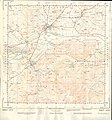 Ordnance Survey Sheet NT 03 Biggar, Published 1955.jpg 7,244 × 7,792; 14.94 MB
-
 Quarry, Windgill Knowe - geograph.org.uk - 925318.jpg 640 × 480; 101 KB
-
 Road between Snaip and Nisbet - geograph.org.uk - 3522687.jpg 4,608 × 3,456; 5.66 MB
-
 Scree slope on White Hill - geograph.org.uk - 3522596.jpg 4,608 × 3,456; 6.06 MB
-
 Signpost, Broughton to Culter path - geograph.org.uk - 1764270.jpg 640 × 480; 84 KB
-
 Skirting round White Hill - geograph.org.uk - 3522643.jpg 4,608 × 3,456; 6.29 MB
-
 Beechwood, East Mains. - geograph.org.uk - 135675.jpg 640 × 480; 142 KB
-
 Coulter - geograph.org.uk - 421691.jpg 640 × 427; 87 KB
-
 Coulter Mill. - geograph.org.uk - 421681.jpg 640 × 427; 87 KB
-
 Coulter Mill. - geograph.org.uk - 421702.jpg 427 × 640; 132 KB
-
 Coulter. - geograph.org.uk - 135667.jpg 640 × 480; 89 KB
-
 Craigend Bridge and rock strata - geograph.org.uk - 630242.jpg 640 × 480; 114 KB
-
 Derelict buildings at Southside Farm - geograph.org.uk - 190674.jpg 640 × 480; 91 KB
-
 Farmland, East Mains. - geograph.org.uk - 135674.jpg 640 × 480; 122 KB
-
 Road near Gosland - geograph.org.uk - 102217.jpg 640 × 480; 120 KB
-
 Stone barn, Thripland. - geograph.org.uk - 135681.jpg 640 × 480; 83 KB
-
 Sunlit track to Mitchell Hill - geograph.org.uk - 102209.jpg 640 × 480; 111 KB
-
 The Summit of Goseland Hill - geograph.org.uk - 145013.jpg 640 × 480; 248 KB


_-_geograph.org.uk_-_630284.jpg)


