Category:Cotherstone
Jump to navigation
Jump to search
English: Cotherstone is a village and civil parish in the Pennine hills, in Teesdale, County Durham, England.
village and civil parish in County Durham, UK  | |||||
| Upload media | |||||
| Instance of | |||||
|---|---|---|---|---|---|
| Location | County Durham, North East England, England | ||||
| Population |
| ||||
 | |||||
Subcategories
This category has the following 7 subcategories, out of 7 total.
B
- Balder Bridge (2 F)
C
- Crawlaw Rigg (5 F)
G
- Goldsborough, County Durham (16 F)
S
- Shacklesborough (8 F)
Media in category "Cotherstone"
The following 200 files are in this category, out of 566 total.
(previous page) (next page)-
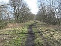
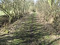
 "Hard unsealed surface" on the Tees Railway Path - geograph.org.uk - 6416926.jpg 1,719 × 1,289; 1.04 MB
-
 A buttress on Goldsborough - geograph.org.uk - 3009891.jpg 800 × 600; 108 KB
-
 A circular walk from Barnard Castle (66) (geograph 7269410).jpg 4,320 × 3,240; 3.13 MB
-
 A happy bull (3) - geograph.org.uk - 3628541.jpg 640 × 480; 78 KB
-
 A meeting of waters - geograph.org.uk - 6496055.jpg 3,880 × 4,620; 5.39 MB
-
 A protected young tree on the Tees Railway Path - geograph.org.uk - 6416950.jpg 1,600 × 1,200; 479 KB
-

-
 Abandoned building - geograph.org.uk - 1257796.jpg 640 × 480; 79 KB
-
 Abutment of former railway bridge, near Towler Hill - geograph.org.uk - 6406173.jpg 1,600 × 1,200; 623 KB
-
 Access for public footpath to Pitcher House and beyond - geograph.org.uk - 3230487.jpg 3,648 × 2,736; 2.83 MB
-
 Access road for Blackton Reservoir - geograph.org.uk - 3230473.jpg 3,648 × 2,736; 2.37 MB
-
 Access road to Booze Wood - geograph.org.uk - 6407055.jpg 1,600 × 1,200; 550 KB
-
 Across Yoke Sike from Middle Mere - geograph.org.uk - 2505263.jpg 640 × 480; 79 KB
-
 Approaching Cuckoo - geograph.org.uk - 1761586.jpg 2,048 × 1,536; 1.79 MB
-
 Approaching the trig point on Currack Rigg - geograph.org.uk - 2779436.jpg 3,072 × 2,304; 1.12 MB
-
 Aqueduct east of Balder Bridge - geograph.org.uk - 6194548.jpg 1,024 × 768; 406 KB
-
 At the edge of the moor - geograph.org.uk - 656069.jpg 640 × 480; 88 KB
-
 Back lane, south-west edge of Cotherstone - geograph.org.uk - 6406280.jpg 1,600 × 1,200; 524 KB
-
 Balder Foot - geograph.org.uk - 6409226.jpg 2,432 × 1,824; 2.45 MB
-
 Balder Viaduct - geograph.org.uk - 3628539.jpg 640 × 480; 73 KB
-
 Balder Viaduct and its shadow - geograph.org.uk - 6416245.jpg 1,600 × 1,200; 631 KB
-
 Balder Viaduct on the Tees Railway Path - geograph.org.uk - 5737453.jpg 4,608 × 3,456; 7.71 MB
-
 Balder Viaduct on the Tees Railway Path - geograph.org.uk - 5737461.jpg 4,608 × 3,456; 7.93 MB
-
 Balder Viaduct, from the south - geograph.org.uk - 6416250.jpg 2,432 × 1,824; 2.08 MB
-
 Balder View Cottages, Cotherstone - geograph.org.uk - 6310848.jpg 1,024 × 768; 233 KB
-
 Balderhead Reservoir Valve Tower - geograph.org.uk - 7028540.jpg 1,600 × 900; 661 KB
-
 Baldersdale field boundaries - geograph.org.uk - 6406881.jpg 1,539 × 1,155; 510 KB
-
 Baldersdale from the Pennine Way - geograph.org.uk - 5161110.jpg 1,024 × 638; 107 KB
-
 Baldersdale view to Low Birk Hatt Farm - geograph.org.uk - 6221293.jpg 4,842 × 3,479; 3.14 MB
-
 Barn at High Corn Park - geograph.org.uk - 1577673.jpg 640 × 500; 142 KB
-
 Barn near Cotherstone - geograph.org.uk - 4052045.jpg 4,068 × 2,348; 3.74 MB
-
 Barn near Osmond Bridge - geograph.org.uk - 3628523.jpg 640 × 480; 67 KB
-
 Barn ^ spire of Cotherstone Church - geograph.org.uk - 6311782.jpg 1,024 × 766; 256 KB
-
 Barns at Scoon Bank - geograph.org.uk - 3010123.jpg 640 × 480; 90 KB
-
 Bense Sike - geograph.org.uk - 1577841.jpg 480 × 640; 121 KB
-
 Between two valleys, west of East Briscoe - geograph.org.uk - 6406911.jpg 1,532 × 1,148; 608 KB
-
 Beware of sheep on Cotherstone Moor - geograph.org.uk - 6409053.jpg 1,499 × 1,125; 522 KB
-
 Bird's nest in stile, East Loups's - geograph.org.uk - 6806102.jpg 4,480 × 6,720; 7.39 MB
-
 Birkett Close, Cotherstone - geograph.org.uk - 6325174.jpg 1,024 × 768; 196 KB
-
 Blackton Reservoir - geograph.org.uk - 4487424.jpg 480 × 640; 121 KB
-
 Blackton Reservoir - geograph.org.uk - 4487436.jpg 480 × 640; 130 KB
-
 Blackton reservoir, from the dam - geograph.org.uk - 6408761.jpg 1,600 × 1,200; 412 KB
-
 Bowes Moor - geograph.org.uk - 1206653.jpg 640 × 480; 85 KB
-
 Bridge over How Beck (or Robins Gill) at Briscoe - geograph.org.uk - 4745801.jpg 2,592 × 1,944; 1.82 MB
-
 Bridge over How Sike - geograph.org.uk - 1567916.jpg 640 × 480; 115 KB
-
 Bridge over the Balder - geograph.org.uk - 3154177.jpg 2,448 × 3,264; 2.43 MB
-
 Bridge over the old Middleton branch railway - geograph.org.uk - 3154228.jpg 2,448 × 2,176; 1.41 MB
-
 Bridge over Willypot Gill - geograph.org.uk - 6408790.jpg 1,600 × 1,200; 522 KB
-

-
 Bridleway crosses Crook Beck - geograph.org.uk - 1577706.jpg 640 × 480; 137 KB
-
 Bridleway crossing Common Sike - geograph.org.uk - 1577610.jpg 640 × 550; 144 KB
-
 Bridleway to Casset How - geograph.org.uk - 5257888.jpg 640 × 480; 254 KB
-
 Bridleway to Towler Hill - geograph.org.uk - 6406079.jpg 1,600 × 1,200; 702 KB
-
 Bridleway under the Stainmore Line, east of Spring Wood - geograph.org.uk - 6406143.jpg 1,600 × 1,200; 676 KB
-
 Bridleway west from Naby - geograph.org.uk - 1577316.jpg 640 × 520; 132 KB
-
 Bridleway west of Towler Hill Farm - geograph.org.uk - 2309065.jpg 640 × 480; 44 KB
-
 Briscoe Lane - geograph.org.uk - 4745792.jpg 2,592 × 1,944; 2.08 MB
-
 British Rail concrete ladder stile south of Cotherstone - geograph.org.uk - 2708038.jpg 3,648 × 2,736; 1.74 MB
-
 Broken rock band on Shacklesborough - geograph.org.uk - 6947358.jpg 1,600 × 1,050; 472 KB
-
 Broken rocks at dam of Balderhead Reservoir - geograph.org.uk - 6946458.jpg 1,600 × 928; 500 KB
-
 Brook House Cafe, Cotherstone - geograph.org.uk - 5258204.jpg 640 × 480; 265 KB
-
 Building at Scoon Bank - geograph.org.uk - 5517149.jpg 640 × 480; 75 KB
-
 Buildings at Water Knott - geograph.org.uk - 6949717.jpg 1,600 × 978; 498 KB
-
 Burners Hill - geograph.org.uk - 3334648.jpg 640 × 480; 72 KB
-
 Buttercups below Balderhead - geograph.org.uk - 3010264.jpg 800 × 600; 128 KB
-

-
 Bywash channel alongside Hury reservoir - geograph.org.uk - 6408779.jpg 1,600 × 1,200; 524 KB
-
 Bywash channel, Hury reservoir - geograph.org.uk - 6408748.jpg 2,432 × 1,824; 3.16 MB
-
 Bywash, Hury reservoir - geograph.org.uk - 6407278.jpg 1,600 × 1,200; 585 KB
-
 Caper Gill - geograph.org.uk - 5507888.jpg 1,500 × 930; 1.03 MB
-
 Caper Gill - geograph.org.uk - 854994.jpg 640 × 480; 220 KB
-
 Caravans at Doe Park - geograph.org.uk - 1593206.jpg 640 × 480; 83 KB
-
 Cattle Grid in minor road in Baldersdale - geograph.org.uk - 3230494.jpg 3,648 × 2,736; 2.46 MB
-
 Catty Crag Quarry - geograph.org.uk - 4487645.jpg 640 × 480; 136 KB
-
 Catty Quarry - geograph.org.uk - 6808396.jpg 1,024 × 583; 193 KB
-
 Chapel Villa, Cotherstone - geograph.org.uk - 6325091.jpg 1,024 × 768; 341 KB
-
 Chest tomb and railings inscribed to Abraham Hilton - geograph.org.uk - 2707149.jpg 3,648 × 2,736; 5.34 MB
-
 Cis Hole - geograph.org.uk - 854963.jpg 640 × 427; 237 KB
-
 Cis Hole - geograph.org.uk - 854967.jpg 427 × 640; 269 KB
-
 Cis Hole - geograph.org.uk - 854973.jpg 640 × 427; 255 KB
-
 Clapper Bridge over Grise Beck - geograph.org.uk - 1257590.jpg 480 × 640; 118 KB
-
 Clove Lodge - geograph.org.uk - 2997738.jpg 1,500 × 724; 1.02 MB
-
 Clove Lodge - geograph.org.uk - 3991726.jpg 640 × 480; 64 KB
-
 Clove Lodge, Baldersdale - geograph.org.uk - 6409031.jpg 1,600 × 1,200; 574 KB
-
 Clove Lodge.jpg 1,280 × 960; 323 KB
-
 Collapsing barn near Cooper House - geograph.org.uk - 6311798.jpg 1,024 × 768; 300 KB
-
 Common Sike has recently burst its banks - geograph.org.uk - 6406076.jpg 1,600 × 1,200; 764 KB
-
 Confluence of the Balder and Tees, Cotherstone - geograph.org.uk - 2040970.jpg 1,280 × 960; 847 KB
-
 Cooper House - geograph.org.uk - 1513421.jpg 640 × 480; 106 KB
-
 Cooper House Farm - geograph.org.uk - 4052047.jpg 3,378 × 1,946; 3.04 MB
-
 Cooper House Farm Cotherstone - geograph.org.uk - 2304001.jpg 640 × 480; 43 KB
-
 Corn Park - geograph.org.uk - 1705088.jpg 640 × 480; 122 KB
-
 Cotherstone ... (3066710070).jpg 1,280 × 960; 259 KB
-
 Cotherstone civil parish boundary marker - geograph.org.uk - 6409247.jpg 2,432 × 1,824; 2.36 MB
-
 Cotherstone East Green - geograph.org.uk - 3154222.jpg 2,251 × 2,384; 1.11 MB
-
 Cotherstone East Green - geograph.org.uk - 6221227.jpg 3,888 × 5,184; 6.17 MB
-
 Cotherstone Friends Meeting House - geograph.org.uk - 6406291.jpg 1,600 × 1,200; 605 KB
-
 Cotherstone from the south - geograph.org.uk - 6325137.jpg 1,024 × 768; 351 KB
-
 Cotherstone Methodist Church - geograph.org.uk - 3511977.jpg 4,608 × 3,456; 2.97 MB
-
 Cotherstone Mill, on the River Tees - geograph.org.uk - 6409244.jpg 1,600 × 1,199; 488 KB
-
 Cotherstone Moor, above Baldersdale - geograph.org.uk - 6409012.jpg 1,600 × 1,200; 610 KB
-
 Cotherstone Post Office - geograph.org.uk - 6325201.jpg 1,024 × 767; 751 KB
-
 Cotherstone Primary School - geograph.org.uk - 6406281.jpg 1,600 × 1,200; 685 KB
-
 Cotherstone Put-in - geograph.org.uk - 1245403.jpg 640 × 480; 99 KB
-
 Cotherstone Quaker Meeting House.JPG 2,848 × 2,136; 1.44 MB
-
 Cotherstone Resident with a 'Seven Year Itch' - geograph.org.uk - 4050378.jpg 4,608 × 3,456; 6.58 MB
-
 Cotherstone station, Tees Valley Railway - geograph.org.uk - 6406058.jpg 1,600 × 1,200; 839 KB
-
 Cotherstone Village - geograph.org.uk - 533759.jpg 640 × 427; 85 KB
-

-
 Cottage by the Tees - geograph.org.uk - 3153977.jpg 2,448 × 3,264; 2.44 MB
-
 Covered reservoir with air shaft - geograph.org.uk - 6407263.jpg 1,600 × 1,200; 590 KB
-
 Crawlaw Beck - geograph.org.uk - 4487412.jpg 480 × 640; 164 KB
-
 Crawlaw Gill - geograph.org.uk - 1257729.jpg 480 × 640; 110 KB
-
 Crawlaw Gill - geograph.org.uk - 1257749.jpg 480 × 640; 129 KB
-
 Crawlaw Gill - geograph.org.uk - 2240898.jpg 3,264 × 2,448; 2.57 MB
-
 Crawlaw Gill - geograph.org.uk - 2779455.jpg 3,072 × 2,304; 1.08 MB
-
 Crawlaw Gill - geograph.org.uk - 4487449.jpg 640 × 480; 132 KB
-
 Crook House - geograph.org.uk - 1756890 (cropped).jpg 1,940 × 1,092; 749 KB
-
 Crook House - geograph.org.uk - 1756890.jpg 2,048 × 1,536; 1.48 MB
-
 Culvert under the Tees Valley Railway - geograph.org.uk - 6406065.jpg 1,600 × 1,200; 803 KB
-
 Cup-marked rock, Sunny Brow - geograph.org.uk - 6806111.jpg 4,480 × 6,720; 7.42 MB
-
 Cup-marked rock, Sunny Brow - geograph.org.uk - 6806127.jpg 6,720 × 4,480; 7.4 MB
-
 Currick on Shacklesborough - geograph.org.uk - 6195373.jpg 1,600 × 831; 470 KB
-
 Damaged Scots pine tree in enclosure - geograph.org.uk - 7109555.jpg 1,600 × 1,043; 578 KB
-
 Demesne Lane changes here - geograph.org.uk - 6406308.jpg 1,600 × 1,200; 781 KB
-
 Demesne Lane crossing Lance Beck - geograph.org.uk - 6406303.jpg 1,600 × 1,200; 784 KB
-
 Derelict barn below Scalehow Rigg - geograph.org.uk - 1241211.jpg 640 × 480; 101 KB
-

-
 Derelict field barn near Cotherstone in Teesdale - geograph.org.uk - 2707034.jpg 3,648 × 2,736; 4.4 MB
-
 Detached house beside River Balder - geograph.org.uk - 4231968.jpg 1,500 × 817; 1.44 MB
-
 Dismantled Railway Pecknall Wood - geograph.org.uk - 10169.jpg 640 × 480; 111 KB
-
 Disused railway bridge north of Lartington Hall - geograph.org.uk - 6324475.jpg 1,024 × 768; 454 KB
-
 Doe Park Mill - geograph.org.uk - 1474442.jpg 528 × 640; 129 KB
-
 Drive to Mere Beck Farm off minor road in Baldersdale - geograph.org.uk - 3230500.jpg 3,027 × 2,189; 1.84 MB
-
 Drive to The Mill near Cotherstone - geograph.org.uk - 2707047.jpg 3,648 × 2,736; 4.56 MB
-
 Drive to West Friar House Farm in Baldersdale - geograph.org.uk - 3230727.jpg 3,648 × 2,736; 2.52 MB
-
 Dropped bridge near Cotherstone - geograph.org.uk - 6416952.jpg 1,600 × 1,200; 853 KB
-
 Dropped bridge near West Park - geograph.org.uk - 6416255.jpg 1,600 × 1,200; 847 KB
-
 Drove road on Loups's Hill - geograph.org.uk - 6806067.jpg 6,720 × 4,230; 7.01 MB
-
 Drove road on Loups's Hill - geograph.org.uk - 6806077.jpg 6,720 × 4,480; 7.29 MB
-
 Drystone Walls Near West Loups - geograph.org.uk - 2034142.jpg 1,499 × 966; 2.36 MB
-
 Dun Moss Sike - geograph.org.uk - 854904.jpg 640 × 480; 239 KB
-
 East Briscoe Ford - geograph.org.uk - 3896621.jpg 3,872 × 2,592; 4.66 MB
-
 East Briscoe in winter - geograph.org.uk - 6406909.jpg 1,600 × 1,200; 427 KB
-
 East Friar House - geograph.org.uk - 3334666.jpg 640 × 480; 93 KB
-
 East Friar House Farm - geograph.org.uk - 3230533.jpg 2,853 × 2,138; 1.04 MB
-
 East Hare Crag - geograph.org.uk - 2779448.jpg 3,072 × 2,304; 1.09 MB
-
 East Loup's Farm - geograph.org.uk - 2779439.jpg 3,072 × 2,304; 1.11 MB
-
 East Loups - geograph.org.uk - 2033713.jpg 1,500 × 882; 2.15 MB
-
 Embedded rocks along Crawlaw Rigg - geograph.org.uk - 6948927.jpg 1,600 × 889; 433 KB
-
 Entrance to Balder Grange - geograph.org.uk - 3230461.jpg 3,648 × 2,736; 4.74 MB
-
 Entrance to Hagworm Hall - geograph.org.uk - 3229111.jpg 3,648 × 2,736; 3.23 MB
-

-
 Entrance to W S Hodgson ^ Co., Cotherstone - geograph.org.uk - 6324978.jpg 1,024 × 767; 237 KB
-
 Eroded gritstone on Goldsborough - geograph.org.uk - 6806084.jpg 4,480 × 6,720; 7.29 MB
-
 Estate road crossing Mawmon Sike - geograph.org.uk - 5505637.jpg 1,499 × 985; 1.16 MB
-
 Estate road on north side of Hinder Beck - geograph.org.uk - 5505341.jpg 1,500 × 805; 916 KB
-
 Estate track on Galloway Rigg - geograph.org.uk - 6643475.jpg 5,472 × 3,078; 4.92 MB
-
 Estate track on Water Knott Hill - geograph.org.uk - 6643460.jpg 5,472 × 3,078; 6.01 MB
-
 Fallen rock^ - geograph.org.uk - 6544628.jpg 2,000 × 1,032; 1.98 MB
-
 Fallen trees in How Beck - geograph.org.uk - 6407213.jpg 1,600 × 1,200; 779 KB
-
 Farm buildings at Booze Wood - geograph.org.uk - 6545748.jpg 2,000 × 1,118; 1.8 MB
-
 Farm buildings at High Corn Park - geograph.org.uk - 6545752.jpg 2,000 × 1,335; 1.78 MB
-
 Farm ruins at East Loups's - geograph.org.uk - 1593801.jpg 640 × 480; 116 KB
-
 Farm track approaching bridge carrying old railway route - geograph.org.uk - 3625095.jpg 1,500 × 1,000; 1.74 MB
-
 Farm track leading to East Corn Park - geograph.org.uk - 6221232.jpg 5,184 × 3,888; 5.98 MB
-

-
 Farmhouse at Briscoe Farm - geograph.org.uk - 3258375.jpg 1,621 × 1,218; 872 KB
-
 Farmhouse at Willoughby Hall Farm - geograph.org.uk - 3230480.jpg 3,648 × 2,736; 3.66 MB
-
 Farmhouse With Attached Barn - geograph.org.uk - 2038170.jpg 1,499 × 842; 1.55 MB
-
 Farmland at Corn Park - geograph.org.uk - 4745803.jpg 2,592 × 1,944; 1.93 MB
-
 Farmland with trees, Scalehow Rigg - geograph.org.uk - 6416932.jpg 1,905 × 1,429; 875 KB
-
 Field barn above the River Balder, Baldersdale - geograph.org.uk - 6406887.jpg 1,643 × 1,231; 663 KB
-
 Field barn near Cotherstone in Teesdale - geograph.org.uk - 2707032.jpg 3,648 × 2,736; 4.66 MB
-
 Field barn near Osmond Bridge in Baldersdale - geograph.org.uk - 6221235.jpg 4,875 × 3,654; 3.94 MB
-
 Field below Towler Hill - geograph.org.uk - 1516411.jpg 640 × 480; 123 KB
-
 Field on the western edge of Cotherstone - geograph.org.uk - 6416936.jpg 1,600 × 1,200; 585 KB
-
 Field with sheep, sheltering - geograph.org.uk - 3577985.jpg 1,500 × 1,000; 1.3 MB
-
 Fields on the western edge of Cotherstone - geograph.org.uk - 6416954.jpg 2,108 × 1,581; 1.26 MB
-
 Fields south of Hury Reservoir - geograph.org.uk - 5517164.jpg 640 × 480; 46 KB
-
 Footbridge across the bywash, Hury reservoir - geograph.org.uk - 6408747.jpg 1,600 × 1,199; 522 KB
-
 Footbridge near River Tees - geograph.org.uk - 5311554.jpg 640 × 480; 139 KB
-

-
 Footbridge over Lance Beck in Teesdale - geograph.org.uk - 2707022.jpg 3,648 × 2,736; 4.31 MB
-
 Footbridge over Lance Beck near the River Tees - geograph.org.uk - 2707040.jpg 3,648 × 2,736; 3.23 MB
-
 Footbridge over River Balder - geograph.org.uk - 5311522.jpg 640 × 480; 131 KB
-
 Footbridge over the River Balder - geograph.org.uk - 2279796.jpg 1,739 × 1,169; 658 KB
-
 Footbridge over the River Balder - geograph.org.uk - 6001820.jpg 1,024 × 768; 425 KB
-
 Footpath across Lathehaw Rigg - geograph.org.uk - 4488590.jpg 480 × 640; 108 KB
-
 Footpath approaching Towlerhill Wood - geograph.org.uk - 3625094.jpg 1,500 × 1,000; 1.42 MB
-

-
 Footpath near Pecknell Cottage - geograph.org.uk - 6324329.jpg 1,024 × 770; 322 KB
-
-
 Footpath signpost near Booze Wood - geograph.org.uk - 6407049.jpg 1,250 × 938; 439 KB
-

-
 Footpath to Balderhead Reservoir - geograph.org.uk - 4745847.jpg 2,592 × 1,944; 1.75 MB
-
-
 Ford - geograph.org.uk - 7080.jpg 640 × 434; 92 KB
-
 Former Chapel, Cotherstone - geograph.org.uk - 4700022.jpg 1,600 × 1,065; 720 KB
-
 Former Shell Garage - Cotherstone - geograph.org.uk - 4050340.jpg 3,032 × 4,608; 5.56 MB


_(geograph_7269410).jpg)
_-_geograph.org.uk_-_3628541.jpg)


_at_Briscoe_-_geograph.org.uk_-_4745801.jpg)


.jpg)


.jpg)


