Category:Costoboci
Jump to navigation
Jump to search
ancient people | |||||
| Upload media | |||||
| Instance of | |||||
|---|---|---|---|---|---|
| |||||
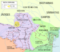
English: The Costoboci ( Latin variants: Costobocae, Coisstoboci or Castabocae;Ancient Greek: Κοστοβῶκοι or Kostobokai or Koistobokoi[4]) were an ancient tribe located, during the Roman imperial era, between the Carpathian Mountains and the river Dniester and around the river Don.
Română: Costobocii (numiți și Koistobokoi, Coisstobocensis) au fost un trib dacic , . Era situat în nordul Daciei, Moldovei și în Basarabia (între Prut și Nistru) până în sudul Galiției (Polonia). Ei au locuit în zona Carpaților nordici și au rămas independenți până la sfârșitul secolului II d.Ch., ca și alte triburi geto-dacice.
Polski: Kostabokowie Castabocae: starożytny lud pochodzenia trackiego, zamieszkiwali obszar pomiędzy górną Cisa a górnym Prutem i Seretem, północną Mołdawię, Bukowinę i Marmarosz, około roku 172 zostali pokonani przez Hasdingów.
Subcategories
This category has the following 2 subcategories, out of 2 total.
Media in category "Costoboci"
The following 29 files are in this category, out of 29 total.
-
Cesare prima Gallia 58 a.C.jpg 1,704 × 1,181; 633 KB
-
CIL 6 1801 Muratori.png 177 × 135; 2 KB
-
Dacia 125.png 390 × 332; 264 KB
-
Dacia around 100 AD - Italian.png 2,280 × 1,404; 1.07 MB
-
Dacia around 60-44 BC during Burebista, including campaigns - Czech.png 2,901 × 1,866; 1.5 MB
-
Dacia around 60-44 BC during Burebista, including campaigns - French.png 2,901 × 1,866; 1.35 MB
-
Dacia around 60-44 BC during Burebista, including campaigns - Italian.png 2,901 × 1,866; 1.48 MB
-
Eleusis.JPG 2,304 × 1,728; 998 KB
-
Marcomannia e Sarmatia 171-175 dC.jpg 1,280 × 886; 279 KB
-
North Western Dacia around 100 AD.png 1,059 × 656; 241 KB
-
Origins 200 AD.png 769 × 665; 297 KB
-
Ptolemy Geographia - North Western Dacia - Anartes and Docidava Highlighted.jpg 1,840 × 1,400; 955 KB
-
Ptolemy Geographia - North Western Dacia.jpg 1,840 × 1,400; 924 KB
-
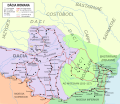
Roman Dacia de.svg 1,500 × 1,300; 844 KB
-
Roman Empire 125 general map-zh.png 2,732 × 2,271; 6.07 MB
-
Roman Empire 125 general map-zh.svg 2,732 × 2,271; 6.55 MB
-
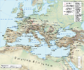
Roman Empire 125 general map.SVG 2,186 × 1,817; 1.77 MB
-
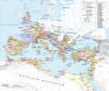
Roman Empire 125 political map-de.svg 2,186 × 1,817; 6.32 MB
-
Roman Empire 125 political map-zh.png 2,049 × 1,703; 2.99 MB
-
Roman Empire 125 political map-zh.svg 2,732 × 2,271; 2.02 MB
-
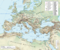
Roman Empire 125 political map.png 2,186 × 1,817; 3.21 MB
-
Roman Empire 125 political map.svg 2,186 × 1,817; 3.25 MB
-
Roman Empire 125.png 2,186 × 1,817; 4.43 MB
-
Roman province of Dacia (106 - 271 AD)-ca.svg 1,500 × 1,300; 395 KB
-
Roman province of Dacia (106 - 271 AD)-es.svg 1,500 × 1,300; 802 KB
-
Roman province of Dacia (106 - 271 AD)-pt.svg 512 × 444; 142 KB
-
Roman province of Dacia (106 - 271 AD).svg 1,500 × 1,300; 392 KB
-
Sarmatia - Maximinus Trax PNG.png 1,295 × 901; 130 KB
-
Sebastian Munster - Tabula europae IX (Dacia).jpg 640 × 499; 86 KB


