Category:Cosdon Hill
Jump to navigation
Jump to search
tor on Dartmoor, in Devon, England, UK | |||||
| Upload media | |||||
| Instance of | |||||
|---|---|---|---|---|---|
| Location | Dartmoor, Devon, South West England, England | ||||
| Elevation above sea level |
| ||||
 | |||||
Subcategories
This category has only the following subcategory.
R
- Remote views of Cosdon Hill (24 F)
Media in category "Cosdon Hill"
The following 53 files are in this category, out of 53 total.
-
 Barley, cows and maize - geograph.org.uk - 186127.jpg 640 × 480; 121 KB
-

-
 Bracken and hawthorn, Cosdon Hill - geograph.org.uk - 3020974.jpg 640 × 480; 115 KB
-
 Bracken and hawthorn, Cosdon Hill - geograph.org.uk - 3020989.jpg 640 × 480; 126 KB
-
 Bracken and hawthorn, Cosdon Hill - geograph.org.uk - 3021024.jpg 640 × 478; 125 KB
-
 Bridleway on Cosdon Hill - geograph.org.uk - 1982899.jpg 640 × 480; 104 KB
-
 Bridleway on Cosdon Hill - geograph.org.uk - 3021199.jpg 640 × 480; 153 KB
-
 Bridleway up Cosdon Hill - geograph.org.uk - 3020961.jpg 640 × 480; 137 KB
-
 Bridleway up Cosdon Hill - geograph.org.uk - 3021045.jpg 480 × 640; 136 KB
-
 Bridleway up Cosdon Hill - geograph.org.uk - 3021075.jpg 640 × 480; 127 KB
-
 Bridleway, Cosdon Hill - geograph.org.uk - 2757602.jpg 2,592 × 1,944; 1.59 MB
-
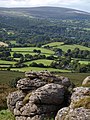
 Cosdon Beacon - geograph.org.uk - 37949.jpg 640 × 425; 86 KB
-
 Cosdon Beacon - geograph.org.uk - 59792.jpg 640 × 480; 44 KB
-
 Cosdon Beacon-1.jpg 2,000 × 1,331; 2.07 MB
-
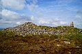
 Cosdon Hill cairn - geograph.org.uk - 1499099.jpg 640 × 427; 70 KB
-
 Cosdon Hill Stone Row - geograph.org.uk - 1499182.jpg 640 × 427; 82 KB
-
 Cow and calf on slopes of Cosdon Hill - geograph.org.uk - 989868.jpg 640 × 455; 107 KB
-
 Dry stone wall, Cosdon Hill - geograph.org.uk - 3021286.jpg 640 × 480; 111 KB
-
 Dry stone wall, Cosdon Hill - geograph.org.uk - 3021370.jpg 640 × 480; 103 KB
-
 Field on slopes of Cosdon Hill - geograph.org.uk - 989852.jpg 640 × 480; 93 KB
-

-
 Fields around Waye Barton - geograph.org.uk - 1479051.jpg 480 × 640; 103 KB
-
 Fields on slopes of Cosdon Hill - geograph.org.uk - 989690.jpg 640 × 480; 83 KB
-
 Fields on the lower slopes of Cosdon Hill - geograph.org.uk - 184557.jpg 640 × 480; 119 KB
-
 Foxes' Holt - geograph.org.uk - 1499091.jpg 640 × 427; 77 KB
-
 Gate and bridleway on Cosdon Hill - geograph.org.uk - 3020772.jpg 640 × 480; 139 KB
-
 Granite wall - geograph.org.uk - 989486.jpg 640 × 480; 121 KB
-
 Granite wall, edge of Cosdon Hill - geograph.org.uk - 989881.jpg 640 × 480; 118 KB
-
 Hound Tor and Cosdon Beacon from Haytor (8661).jpg 4,288 × 2,848; 5.58 MB
-
 Moretonhampstead, Cranbrook Castle - geograph.org.uk - 35961.jpg 597 × 400; 70 KB
-
 On Kennon Hill - geograph.org.uk - 184566.jpg 640 × 480; 106 KB
-
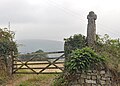 Oxenham Cross.jpg 3,800 × 2,733; 2.07 MB
-
 Sampford Courtenay, near Beacon Cross - geograph.org.uk - 207641.jpg 640 × 427; 137 KB
-
 Sampford Courtenay, near Beer - geograph.org.uk - 207625.jpg 640 × 427; 177 KB
-
 Sampford Courtenay, towards Cosdon Hill - geograph.org.uk - 207623.jpg 640 × 427; 190 KB
-
 Sampford Courtenay, towards Dartmoor - geograph.org.uk - 209829.jpg 640 × 427; 215 KB
-
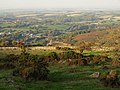
 South Tawton, below Cosdon Hill - geograph.org.uk - 49063.jpg 640 × 436; 130 KB
-
 South Tawton, towards Cosdon Hill - geograph.org.uk - 207529.jpg 640 × 427; 218 KB
-
 South Zeal track at Raybarrow-4.jpg 2,800 × 1,863; 3.3 MB
-
 Stone Row, Cosdon Hill - geograph.org.uk - 2757614.jpg 2,592 × 1,944; 1.64 MB
-
 Stone Row, Cosdon Hill - geograph.org.uk - 3021731.jpg 640 × 433; 84 KB
-
 Stone Rows, Cosdon Hill - geograph.org.uk - 3022038.jpg 480 × 640; 127 KB
-
 Stroll, South Tawton Bridleway 21 - geograph.org.uk - 989876.jpg 640 × 456; 94 KB
-
 Sunlit bushes and trees below Cosdon Hill - geograph.org.uk - 996823.jpg 640 × 427; 106 KB
-
 The Graveyard - geograph.org.uk - 92348.jpg 640 × 480; 123 KB
-
 Thorn - geograph.org.uk - 185797.jpg 640 × 480; 102 KB
-
 Throwleigh Common - geograph.org.uk - 1505935.jpg 640 × 427; 64 KB
-
 Towards Little Hound Tor - geograph.org.uk - 1499113.jpg 640 × 427; 53 KB
-
 View from Hound Tor - geograph.org.uk - 197460.jpg 640 × 437; 70 KB
-
 View NW from Haytor.jpg 3,912 × 2,848; 2.7 MB
-
 Wall corner on Cosdon Hill - geograph.org.uk - 996872.jpg 640 × 480; 103 KB
-
 Wall in woodland - geograph.org.uk - 996702.jpg 640 × 480; 149 KB
-
 Woodland above Rockside - geograph.org.uk - 989350.jpg 640 × 480; 162 KB


.jpg)