Category:Corona Arch Trail
Jump to navigation
Jump to search
hiking trail in Grand County, Utah, United States .jpg) | |||||
| Upload media | |||||
| Instance of | |||||
|---|---|---|---|---|---|
| Named after | |||||
| Location | Bootleger Canyon, Grand County, Utah | ||||
| Operator | |||||
| Heritage designation |
| ||||
| Width |
| ||||
| Length |
| ||||
| Terminus | |||||
| official website | |||||
| |||||
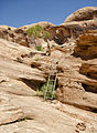
English: Media related to the Corona Arch Trail, a fairly short hiking trail (mostly in Bootlegger Canyon) in Grand County, Utah United States, that connects Utah State Route 279 with the Corona and Pinto arches.
Subcategories
This category has the following 2 subcategories, out of 2 total.
C
- Corona Arch (66 F)
P
- Pinto Arch (60 F)
Media in category "Corona Arch Trail"
The following 9 files are in this category, out of 9 total.
-
 Along the hike to Corona Arch.jpg 1,080 × 2,220; 562 KB
-
 Corona Arch. Moab, Utah.jpg 3,894 × 10,384; 9.21 MB
-
 Great scenery on the trail to Corona Arch (8226264057).jpg 640 × 399; 99 KB
-
 My Public Lands Roadtrip- Corona and Bowtie Arches near Moab, Utah (20103458066).jpg 1,992 × 3,040; 997 KB
-
 On the Trail (7460869116).jpg 661 × 900; 696 KB
-
 Someone is watching you near Corona Arch! (8227336896).jpg 640 × 488; 117 KB
-
 Trail na Corona Arch - Arches N.P. - panoramio.jpg 3,872 × 2,592; 3.22 MB
-
 Výchozí bod k Corona Arch - Goldbar - panoramio.jpg 3,872 × 2,592; 4.03 MB
-
 Wall near the Bowtie Pothole Arch (8226263891).jpg 640 × 384; 85 KB

.jpg)
.jpg)
.jpg)


.jpg)