Category:Corley
Jump to navigation
Jump to search
village and civil parish in the North Warwickshire district of Warwickshire, England  L'église paroissiale de Corley. | |||||
| Upload media | |||||
| Instance of | |||||
|---|---|---|---|---|---|
| Location | North Warwickshire, Warwickshire, West Midlands, England | ||||
| Population |
| ||||
| Area |
| ||||
 | |||||
Subcategories
This category has the following 3 subcategories, out of 3 total.
Media in category "Corley"
The following 136 files are in this category, out of 136 total.
-
 A horizon at Corley Rocks - geograph.org.uk - 4000334.jpg 480 × 640; 88 KB
-
 A Spring Pond on Hollyfast lane - geograph.org.uk - 842557.jpg 480 × 640; 133 KB
-

-
 An ash tree hanging on at Corley Rocks - geograph.org.uk - 4000363.jpg 480 × 640; 124 KB
-
 Any one for coffee^ - geograph.org.uk - 5189153.jpg 1,024 × 768; 163 KB
-
 Bennett's Road North - geograph.org.uk - 5309618.jpg 640 × 480; 72 KB
-
 Bluebells in Daddley's Wood, Wall Hill - geograph.org.uk - 6832350.jpg 2,592 × 1,936; 2.78 MB
-
 Brick built barns, Burrow Hill Farm - geograph.org.uk - 5309616.jpg 640 × 480; 54 KB
-
 Bull ^ Butcher, Common Lane, Corley Moor - geograph.org.uk - 5329752.jpg 1,600 × 900; 308 KB
-

-
 Caged trig point, Corley - geograph.org.uk - 2161586.jpg 640 × 480; 99 KB
-
 Cherubs on gravestone, Corley churchyard - geograph.org.uk - 6832593.jpg 2,592 × 1,936; 2.82 MB
-
 Children's playground, Corley - geograph.org.uk - 5309613.jpg 640 × 480; 66 KB
-
 Church Lane, Corley - geograph.org.uk - 2161578.jpg 480 × 640; 100 KB
-
 Church Lane, Corley - geograph.org.uk - 2162035.jpg 640 × 480; 98 KB
-
 Church Lane, Corley - geograph.org.uk - 2162075.jpg 640 × 435; 99 KB
-
 Church Lane, Corley - geograph.org.uk - 5309614.jpg 640 × 480; 81 KB
-

-
 Close up, Elizabeth II postbox on Tamworth Road, Corley - geograph.org.uk - 5311429.jpg 1,088 × 2,306; 460 KB
-
 Common Lane, Corley Moor - geograph.org.uk - 5309065.jpg 640 × 480; 50 KB
-
 Common Lane, Corley Moor - geograph.org.uk - 5311405.jpg 640 × 480; 91 KB
-
 Common Lane, Corley Moor - geograph.org.uk - 846745.jpg 640 × 480; 105 KB
-
 Corley (looking north) 2s07.JPG 2,592 × 1,944; 2.65 MB
-
 Corley communications corner - geograph.org.uk - 2161471.jpg 640 × 480; 98 KB
-
 Corley Cricket Club - geograph.org.uk - 106227.jpg 640 × 427; 141 KB
-
 Corley Cricket Club on Tamworth Road, Corley (geograph 3793154).jpg 1,200 × 798; 286 KB
-
 Corley m6 bridge (looking north) 2s07.JPG 2,592 × 1,944; 2.75 MB
-

-
 Corley Services car park - geograph.org.uk - 6433366.jpg 1,600 × 1,200; 311 KB
-
 Corley summit - geograph.org.uk - 2161976.jpg 640 × 480; 97 KB
-
 Corley Village Hall - geograph.org.uk - 5309612.jpg 640 × 480; 68 KB
-
 Corley war memorial - geograph.org.uk - 2162817.jpg 640 × 480; 97 KB
-
 Corley, Warwickshire - geograph.org.uk - 5919573.jpg 4,608 × 3,456; 4 MB
-
 Corley3 (looking north).JPG 2,592 × 1,944; 2.69 MB
-

-

-

-
 Entering Corley - geograph.org.uk - 5309607.jpg 640 × 480; 57 KB
-
 Entering Corley Moor - geograph.org.uk - 5963185.jpg 1,600 × 900; 452 KB
-
 Entering Coventry - geograph.org.uk - 5309071.jpg 640 × 480; 96 KB
-
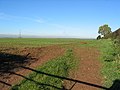
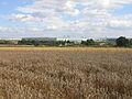
 Farmland near Corley - geograph.org.uk - 2161646.jpg 640 × 480; 100 KB
-

-
 Footpath gateway, Church Lane - geograph.org.uk - 2162003.jpg 640 × 480; 98 KB
-
 Footpath Near Pikers Lane - geograph.org.uk - 98837.jpg 640 × 480; 126 KB
-
 Grazing, Burrow Hill Farm - geograph.org.uk - 5309615.jpg 640 × 480; 64 KB
-

-
 Highfield Lane - geograph.org.uk - 5288399.jpg 4,128 × 2,322; 5 MB
-

-
 House in grounds near to Corley Moor - geograph.org.uk - 4859901.jpg 1,500 × 919; 1.26 MB
-
 Houses on Common Lane, Corley Moor - geograph.org.uk - 5309064.jpg 640 × 480; 70 KB
-
 Houses on Tamworth Road, Corley - geograph.org.uk - 3793160.jpg 1,200 × 798; 282 KB
-

-
 Landscape with bathtubs and blasted tree - geograph.org.uk - 6832337.jpg 1,936 × 2,592; 1.69 MB
-
 Lane to Marsland Farm - geograph.org.uk - 2161629.jpg 640 × 480; 99 KB
-
 Large house in Corley, Warwickshire, England-2Sept2007 (1).jpg 2,592 × 1,944; 2.8 MB
-
 Large house in Corley, Warwickshire, England-2Sept2007.jpg 2,592 × 1,944; 3.01 MB
-

-
 Lillehurst nurseries - geograph.org.uk - 227268.jpg 640 × 480; 56 KB
-

-

-
 Localised faulting, Corley Rocks - geograph.org.uk - 4000375.jpg 640 × 480; 150 KB
-

-
 M6 footbridge ahead - geograph.org.uk - 6216760.jpg 805 × 1,024; 103 KB
-
 M6 Highfield Lane bridge - geograph.org.uk - 4594322.jpg 1,600 × 1,061; 271 KB
-

-
 M6 motorway looking east at Corley services - geograph.org.uk - 6840790.jpg 2,592 × 1,936; 1.73 MB
-
 M6 westbound near Corley - geograph.org.uk - 4596015.jpg 1,600 × 1,061; 236 KB
-
 M6, Corley Ash - geograph.org.uk - 3677701.jpg 640 × 480; 255 KB
-
 M6, Highfield Lane Bridge - geograph.org.uk - 3677706.jpg 640 × 480; 256 KB
-
 Nature reserve - geograph.org.uk - 5908989.jpg 2,000 × 1,333; 2.04 MB
-
 New gantry - M6 northbound - geograph.org.uk - 6216759.jpg 815 × 1,024; 100 KB
-
 North Warwickshire , Shell Petrol Station - geograph.org.uk - 2795295.jpg 4,288 × 2,848; 4.64 MB
-
 North Warwickshire , Shell Petrol Station - geograph.org.uk - 2795297.jpg 4,288 × 2,848; 4.23 MB
-
 North Warwickshire , The M6 Motorway - geograph.org.uk - 2795296.jpg 4,288 × 2,848; 4.41 MB
-
 Northbound M6, Corley - geograph.org.uk - 3665117.jpg 640 × 480; 277 KB
-
 Northwest up Common Lane, Corley Moor - geograph.org.uk - 3477836.jpg 640 × 427; 419 KB
-
 Oak by the lane to Marsland Farm - geograph.org.uk - 2161609.jpg 640 × 480; 99 KB
-
 Old House Lane - geograph.org.uk - 3477850.jpg 640 × 427; 365 KB
-
 Path from Hall Yard Wood to Bennetts Lane North, Keresley - geograph.org.uk - 6822545.jpg 2,592 × 1,936; 2.89 MB
-
 Petrol station shop, Corley Services southbound - geograph.org.uk - 6602093.jpg 1,600 × 1,064; 302 KB
-
 Prehistoric earthwork on Burrow Hill, Corley - geograph.org.uk - 6822577.jpg 2,592 × 1,936; 2.82 MB
-
 Public footpath off Church Lane - geograph.org.uk - 2162015.jpg 480 × 640; 99 KB
-
 Pylons and Farm - geograph.org.uk - 140901.jpg 640 × 480; 102 KB
-
 Radbrook Farm, viewed from over a hedge on Highfield Lane - geograph.org.uk - 6840768.jpg 2,592 × 1,936; 2.13 MB
-
 Road junction, Corley Moor - geograph.org.uk - 846743.jpg 640 × 480; 106 KB
-
 Roadworks M6 northbound - geograph.org.uk - 6216756.jpg 768 × 1,024; 90 KB
-
 Roadworks M6 northbound - geograph.org.uk - 6216758.jpg 768 × 1,024; 74 KB
-
-
 Shaftesbury Avenue, Keresley Newland - geograph.org.uk - 227056.jpg 640 × 480; 49 KB
-
 Shearings interchange, Corley Services - geograph.org.uk - 6433369.jpg 1,600 × 1,107; 182 KB
-

-
 Slip road for Corley M6 Services - geograph.org.uk - 5189144.jpg 1,024 × 768; 171 KB
-

-
 Square Lane - geograph.org.uk - 5311434.jpg 1,600 × 901; 777 KB
-
 Starbucks Drive Thru, Corley Services - geograph.org.uk - 6433363.jpg 1,600 × 1,234; 309 KB
-

-
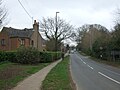
 Tamworth Road (B4098) - geograph.org.uk - 5309609.jpg 640 × 480; 58 KB
-
 Tamworth Road towards Corley - geograph.org.uk - 3793010.jpg 1,200 × 798; 461 KB
-
 Tamworth Road, Corley - geograph.org.uk - 3793155.jpg 1,200 × 798; 342 KB
-

-
 Thatched building, Tamworth Road - geograph.org.uk - 2161449.jpg 640 × 488; 94 KB
-
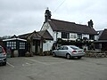
 The Bull and Butcher public house - geograph.org.uk - 846741.jpg 640 × 480; 101 KB
-
 The Bull and Butcher, Corley Moor - geograph.org.uk - 3147280.jpg 1,280 × 960; 331 KB
-
 The Bull ^ Butcher - geograph.org.uk - 5963199.jpg 1,600 × 900; 273 KB
-
 The Bull ^ Butcher, Corley Moor - geograph.org.uk - 5309059.jpg 640 × 480; 55 KB
-

-

-
 The lane to Marslands Farm, Corley - geograph.org.uk - 2054053.jpg 640 × 480; 98 KB
-
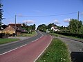
 The road towards Corley - geograph.org.uk - 5963180.jpg 1,600 × 900; 438 KB
-
 The War Memorial, Corley Parish Church - geograph.org.uk - 3793164.jpg 1,200 × 798; 289 KB
-
 The War Memorial, Corley Parish Church - geograph.org.uk - 3793165.jpg 1,200 × 798; 374 KB
-
 The War Memorial, Corley Parish Church - geograph.org.uk - 3793166.jpg 1,200 × 798; 341 KB
-
 Towards Corley from Church Lane - geograph.org.uk - 2161672.jpg 640 × 480; 98 KB
-
 Towards Coventry from Church Lane - geograph.org.uk - 2161662.jpg 640 × 480; 100 KB
-
 Towards Tamworth Road - geograph.org.uk - 2162057.jpg 640 × 480; 98 KB
-
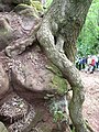
 Tree roots gripping sandstone rock, Corley Rocks - geograph.org.uk - 6832594.jpg 2,592 × 1,936; 2.85 MB
-
 Trees rooted in the rock, Corley Rocks - geograph.org.uk - 4000346.jpg 480 × 640; 138 KB
-
 View from Common Lane, Corley Moor - geograph.org.uk - 2054080.jpg 640 × 480; 81 KB
-

-
-
 Westward on M6 at Corley Services, 1983 - geograph.org.uk - 4204762.jpg 2,345 × 1,362; 4.08 MB
-
 Wood between Breach Brook and M6 motorway - geograph.org.uk - 6822498.jpg 2,592 × 1,936; 2.13 MB
-
 A Tight Squeeze - geograph.org.uk - 842575.jpg 640 × 480; 123 KB
-
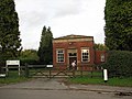 Brownshill Green Water Works - geograph.org.uk - 71504.jpg 640 × 480; 124 KB
-
 Burrow Hill Rocks - geograph.org.uk - 71506.jpg 640 × 480; 196 KB
-

-
-
 Grove Lane, Keresley Newland - geograph.org.uk - 227269.jpg 640 × 480; 45 KB
-
 Keresley Newland Primary School - geograph.org.uk - 227063.jpg 640 × 480; 49 KB
-
 Netball court at Keresley Newland - geograph.org.uk - 227271.jpg 640 × 480; 58 KB
-

-
 November morning - geograph.org.uk - 286440.jpg 640 × 425; 100 KB
-
 Pavilion at Keresley Newland - geograph.org.uk - 227270.jpg 640 × 480; 46 KB
-
 Pikers Lane - geograph.org.uk - 98828.jpg 640 × 480; 157 KB
-

-
 Tamworth Road, Coventry - geograph.org.uk - 106223.jpg 640 × 427; 125 KB


_2s07.JPG)


.jpg)
_2s07.JPG)


.JPG)


.jpg)


_-_geograph.org.uk_-_5309609.jpg)


