Category:Compton Dando
Jump to navigation
Jump to search
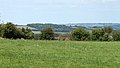
English: Compton Dando is a small village and civil parish on the River Chew in the Chew Valley, Somerset. It is from Keynsham. The parish has a population of 613.
village in the United Kingdom  | |||||
| Upload media | |||||
| Instance of | |||||
|---|---|---|---|---|---|
| Location | Bath and North East Somerset, Somerset, South West England, England | ||||
| Population |
| ||||
| Said to be the same as | Compton Dando (Wikimedia duplicated page, civil parish) | ||||
 | |||||
Subcategories
This category has the following 7 subcategories, out of 7 total.
Media in category "Compton Dando"
The following 200 files are in this category, out of 480 total.
(previous page) (next page)-
 'Chuffy' - geograph.org.uk - 2985796.jpg 2,304 × 1,704; 1.72 MB
-
 'Gloria in Excelsis' - geograph.org.uk - 3614531.jpg 2,304 × 1,704; 1.37 MB
-
 'Resurgam' - geograph.org.uk - 2993780.jpg 1,704 × 2,304; 1.79 MB
-
 2010 , Anyone for Poohsticks^ - geograph.org.uk - 1833955.jpg 640 × 507; 143 KB
-
 2010 , Approach to Tuckingmill - geograph.org.uk - 1833714.jpg 640 × 534; 164 KB
-
 2010 , B3116 heading north near Burnett - geograph.org.uk - 1832378.jpg 1,024 × 561; 117 KB
-

-

-

-

-

-

-

-

-
 2010 , Meadow and view north, Hunstrete - geograph.org.uk - 2034429.jpg 3,598 × 2,529; 2.59 MB
-
 2010 , Meadow and view west of north, Hunstrete - geograph.org.uk - 2034447.jpg 3,148 × 1,779; 2.25 MB
-
 2010 , Minor road to Hunstrete - geograph.org.uk - 2016507.jpg 800 × 567; 136 KB
-
-
 2010 , North east from the B3116 - geograph.org.uk - 1832404.jpg 1,024 × 657; 172 KB
-

-
 2010 , Pasture land near Wick Farm - geograph.org.uk - 2034459.jpg 800 × 533; 106 KB
-
 2010 , Ploughed fields north of Hunstrete - geograph.org.uk - 2034713.jpg 1,024 × 505; 192 KB
-

-
 2010 , Road to Hunstrete - geograph.org.uk - 2034722.jpg 800 × 551; 114 KB
-

-
 2010 , Stile into Common Wood - geograph.org.uk - 2016499.jpg 800 × 580; 244 KB
-
 2010 , The lane to Compton Dando - geograph.org.uk - 1832592.jpg 1,024 × 800; 278 KB
-

-
 2016 George V postbox - geograph.org.uk - 4860276.jpg 1,600 × 1,067; 879 KB
-
 A bridge or a track^ - geograph.org.uk - 6434026.jpg 3,296 × 2,472; 1.84 MB
-
 A byway that welcomes all - geograph.org.uk - 4863155.jpg 2,304 × 1,704; 1.78 MB
-
 A casualty of the rain - geograph.org.uk - 4821756.jpg 2,304 × 1,704; 1.68 MB
-
 A change of route - geograph.org.uk - 5387100.jpg 2,304 × 1,704; 1.62 MB
-
 A circular walk with trees - geograph.org.uk - 4821750.jpg 2,304 × 1,704; 1.7 MB
-
 A clearance - geograph.org.uk - 5385689.jpg 2,304 × 1,704; 1.75 MB
-
 A clearer path - geograph.org.uk - 5385249.jpg 1,704 × 2,304; 2.39 MB
-
 A cleft in the oak - geograph.org.uk - 5546080.jpg 1,704 × 2,304; 1.7 MB
-
 A cone of timber - geograph.org.uk - 3937796.jpg 1,704 × 2,304; 2.66 MB
-
 A country citizen cleft - geograph.org.uk - 5546075.jpg 1,704 × 2,304; 2.2 MB
-
 A crafty crossing - geograph.org.uk - 5648951.jpg 2,304 × 1,704; 1.69 MB
-
 A fallen tower - geograph.org.uk - 6433981.jpg 3,296 × 2,472; 2.01 MB
-
 A fine copper beech at Queen Charlton - geograph.org.uk - 1309259.jpg 640 × 480; 193 KB
-
 A gas pipe in the middle of the countryside - geograph.org.uk - 5649064.jpg 2,304 × 1,704; 1.59 MB
-
 A gentle nod - geograph.org.uk - 6449593.jpg 2,472 × 3,296; 1.62 MB
-
 A gentle water cascade - geograph.org.uk - 5649037.jpg 2,304 × 1,704; 1.57 MB
-
 A green sponge - geograph.org.uk - 5387053.jpg 2,304 × 1,704; 1.74 MB
-
 A guiding oak - geograph.org.uk - 5452517.jpg 2,304 × 1,704; 1.79 MB
-
-
 A leafy Chew - geograph.org.uk - 5387057.jpg 1,704 × 2,304; 2.08 MB
-
 A light to see better - geograph.org.uk - 4863893.jpg 1,704 × 2,304; 2.07 MB
-
 A little known road - geograph.org.uk - 4822827.jpg 2,304 × 1,704; 1.79 MB
-
 A little music in front of the cross - geograph.org.uk - 2985880.jpg 2,304 × 1,704; 1.54 MB
-
 A little pond on Smallbrook Lane - geograph.org.uk - 6449600.jpg 3,296 × 2,472; 1.98 MB
-
 A long car wash - geograph.org.uk - 5649095.jpg 2,304 × 1,704; 1.82 MB
-
 A look into the Chew - geograph.org.uk - 4821789.jpg 2,304 × 1,704; 1.65 MB
-
 A mighty citizen - geograph.org.uk - 4863223.jpg 1,704 × 2,304; 2.05 MB
-
 A moved path - geograph.org.uk - 4822849.jpg 2,304 × 1,704; 1.7 MB
-
 A new line in - geograph.org.uk - 5477999.jpg 1,704 × 2,304; 1.97 MB
-
 A permissive path - geograph.org.uk - 5385744.jpg 2,304 × 1,704; 1.46 MB
-
 A rhyme for reasoning - geograph.org.uk - 5452529.jpg 1,704 × 2,304; 1.74 MB
-
 A ring of life around the stump - geograph.org.uk - 5477415.jpg 2,304 × 1,704; 1.3 MB
-
 A ring of posts for the tree - geograph.org.uk - 6433992.jpg 3,296 × 2,472; 1.84 MB
-
 A shadow on Glebe Wood - geograph.org.uk - 5649099.jpg 2,304 × 1,704; 1.74 MB
-
 A shaggy in the woods - geograph.org.uk - 5563428.jpg 1,704 × 2,304; 1.62 MB
-
 A slight ripple - geograph.org.uk - 5385717.jpg 2,304 × 1,704; 1.56 MB
-
 A small orchard - geograph.org.uk - 5385735.jpg 2,304 × 1,704; 1.67 MB
-
 A spiky tuft - geograph.org.uk - 5649014.jpg 1,704 × 2,304; 1.91 MB
-
 A spring in the garden - geograph.org.uk - 5649094.jpg 1,704 × 2,304; 2.4 MB
-
 A stand of seven - geograph.org.uk - 5648974.jpg 2,304 × 1,704; 1.59 MB
-
 A tall plantation - geograph.org.uk - 5546050.jpg 2,304 × 1,704; 1.62 MB
-
 A touch of the Easter Islands - geograph.org.uk - 5563936.jpg 2,304 × 1,704; 1.66 MB
-
 A tree of sorts - geograph.org.uk - 6449569.jpg 2,472 × 3,296; 1.85 MB
-
 A tree on Tuckingmill Lane - geograph.org.uk - 5649100.jpg 1,704 × 2,304; 2.08 MB
-
 A warning for walkers - geograph.org.uk - 5562484.jpg 1,704 × 2,304; 2.07 MB
-
 A welcoming light - geograph.org.uk - 2985884.jpg 1,704 × 2,304; 1.47 MB
-
 A wet obstacle - geograph.org.uk - 6449557.jpg 3,296 × 2,472; 1.83 MB
-
 A wooden help - geograph.org.uk - 5546095.jpg 1,704 × 2,304; 2.06 MB
-
 A39 with 15 miles to Wells - geograph.org.uk - 4119886.jpg 1,600 × 1,053; 335 KB
-
 Above Woollard - geograph.org.uk - 5452510.jpg 2,304 × 1,704; 1.68 MB
-
 Across Cockers Hill - geograph.org.uk - 5477412.jpg 2,304 × 1,704; 1.51 MB
-
 All a pheasant could want - geograph.org.uk - 5562490.jpg 1,704 × 2,304; 1.61 MB
-
 All are welcome - geograph.org.uk - 3614491.jpg 2,304 × 1,704; 1.34 MB
-
 Allens Brake - geograph.org.uk - 5649004.jpg 2,304 × 1,704; 1.64 MB
-
 Along a rocky track - geograph.org.uk - 6448406.jpg 3,296 × 2,472; 1.98 MB
-
 An authentic enamel - geograph.org.uk - 5649077.jpg 1,704 × 2,304; 1.28 MB
-
 An entrance to Park Copse - geograph.org.uk - 5452544.jpg 1,704 × 2,304; 2.06 MB
-
 An open gate - geograph.org.uk - 5649056.jpg 2,304 × 1,704; 1.62 MB
-
 Approaching Chewton Keynsham from the west - geograph.org.uk - 6448407.jpg 3,296 × 2,472; 1.83 MB
-
 Approaching Compton Dando - geograph.org.uk - 1608593.jpg 640 × 480; 67 KB
-
 Are these yours^ - geograph.org.uk - 4821745.jpg 1,704 × 2,304; 1.67 MB
-
 At Charlton Road and Charlton Field Lane - geograph.org.uk - 6448394.jpg 2,472 × 3,296; 1.83 MB
-
 Avoid all unnecessary travel! (geograph 6449573).jpg 3,296 × 2,472; 1.83 MB
-
 Back on its feet - geograph.org.uk - 5615653.jpg 2,304 × 1,704; 1.76 MB
-
 Bare on Compton Green - geograph.org.uk - 5648969.jpg 2,304 × 1,704; 1.51 MB
-
 Barn near Queen Charlton - geograph.org.uk - 5707378.jpg 4,288 × 2,848; 2.42 MB
-
 Bath ^ North East Somerset , Bristol Scenery - geograph.org.uk - 4155540.jpg 3,993 × 2,652; 6.03 MB
-
 Bathford Brook flows down the Byway to Tucking Mill - geograph.org.uk - 2456500.jpg 2,592 × 1,944; 1.8 MB
-
 Bathford Hill, approaching Compton Dando - geograph.org.uk - 1800164.jpg 640 × 471; 127 KB
-
 Be careful how you tread - geograph.org.uk - 2993789.jpg 1,704 × 2,304; 2.23 MB
-
 Below Warner Farm - geograph.org.uk - 5387135.jpg 2,304 × 1,704; 1.6 MB
-
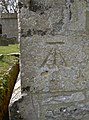 Benchmark at St Mary's - geograph.org.uk - 2376692.jpg 1,704 × 2,304; 2.15 MB
-
 Benchmark on brick and stone - geograph.org.uk - 4821779.jpg 1,704 × 2,304; 1.89 MB
-
 Benchmark on the porch - geograph.org.uk - 2985889.jpg 2,304 × 1,704; 1.64 MB
-
 Beware of the stream - geograph.org.uk - 5546090.jpg 2,304 × 1,704; 1.61 MB
-
 Bluebells and Ramsons - geograph.org.uk - 2378922.jpg 2,304 × 1,704; 1.76 MB
-
 Bluebells in Park Copse - geograph.org.uk - 2378901.jpg 1,704 × 2,304; 2.4 MB
-
 Brass on the green - geograph.org.uk - 2985877.jpg 1,704 × 2,304; 1.78 MB
-
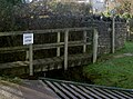
 Bridge at Compton Dando (geograph 1843545).jpg 1,600 × 1,197; 932 KB
-
 Bridge benchmark - geograph.org.uk - 3614367.jpg 1,704 × 2,304; 1.77 MB
-
 Bridge by the works - geograph.org.uk - 5649109.jpg 2,304 × 1,704; 1.56 MB
-
 Bridge over the Bathford Brook - geograph.org.uk - 5385711.jpg 1,704 × 2,304; 2.02 MB
-
 Bridge over the Chew - geograph.org.uk - 2993796.jpg 2,304 × 1,704; 2.06 MB
-
 Bridge over the River Chew - geograph.org.uk - 701031.jpg 640 × 480; 318 KB
-
 Bring the family - geograph.org.uk - 5422866.jpg 2,304 × 1,704; 1.76 MB
-
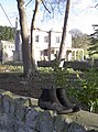
 Bring your wellies^ - geograph.org.uk - 4821689.jpg 1,704 × 2,304; 1.25 MB
-

-
 Brook, bridge and road - geograph.org.uk - 5649083.jpg 2,304 × 1,704; 1.61 MB
-
 Brushwood near Queen Charlton - geograph.org.uk - 5707527.jpg 4,288 × 2,848; 2.49 MB
-
 Building for compost - geograph.org.uk - 6448404.jpg 3,296 × 2,472; 1.94 MB
-
 Bull race - geograph.org.uk - 5477411.jpg 1,704 × 2,304; 2 MB
-
 Burnett village pump - geograph.org.uk - 4863189.jpg 2,304 × 1,704; 1.73 MB
-
 Burnett, towards Keynsham - geograph.org.uk - 4863797.jpg 1,704 × 2,304; 1.65 MB
-
 Bursting at the seams - geograph.org.uk - 5477401.jpg 1,704 × 2,304; 1.58 MB
-
 Bursting open - geograph.org.uk - 3937839.jpg 1,704 × 2,304; 1.04 MB
-
 Byway at Tucking Mill - geograph.org.uk - 4860265.jpg 1,600 × 1,067; 823 KB
-
 Can't move for pheasants - geograph.org.uk - 5563436.jpg 2,304 × 1,704; 1.4 MB
-
 Car show - geograph.org.uk - 3614354.jpg 2,304 × 1,704; 1.63 MB
-
 Changing profile on the way up - geograph.org.uk - 5385703.jpg 1,704 × 2,304; 2.29 MB
-
 Charlton Bottom - geograph.org.uk - 5547942.jpg 2,304 × 1,704; 1.47 MB
-
 Charlton Field Lane meets Charlton Road - geograph.org.uk - 1360156.jpg 640 × 481; 115 KB
-
 Chew valley meadows - geograph.org.uk - 4821700.jpg 2,304 × 1,704; 1.74 MB
-
 Chewton Keynsham millennium stone - geograph.org.uk - 4821703.jpg 2,304 × 1,704; 1.75 MB
-
 Chewton Place - geograph.org.uk - 4822802.jpg 2,304 × 1,704; 1.6 MB
-
 Chewton Place - geograph.org.uk - 5615642.jpg 2,304 × 1,704; 1.72 MB
-
 Chewton Place - geograph.org.uk - 6601876.jpg 1,200 × 809; 1.23 MB
-
 Chewton Road - geograph.org.uk - 4822888.jpg 2,304 × 1,704; 1.58 MB
-
 Chewton Road - geograph.org.uk - 6601869.jpg 1,200 × 803; 1.17 MB
-

-
 Closer to Queen Charlton - geograph.org.uk - 5546656.jpg 2,304 × 1,704; 1.79 MB
-
 Coalpit Lane after heavy rain - geograph.org.uk - 1582850.jpg 640 × 480; 153 KB
-
 Common Wood - geograph.org.uk - 4857403.jpg 3,072 × 2,048; 1.39 MB
-
 Common Wood, Hunstrete near Bath - geograph.org.uk - 2700981.jpg 2,619 × 1,969; 892 KB
-
 Compton Dando - geograph.org.uk - 6598611.jpg 1,200 × 806; 1.25 MB
-
 Compton Dando coronation fountain - geograph.org.uk - 2993853.jpg 1,704 × 2,304; 2.03 MB
-
 Compton Dando sewage treatment works - geograph.org.uk - 5649108.jpg 2,304 × 1,704; 1.61 MB
-
 Compton Dando village centre - geograph.org.uk - 1425727.jpg 640 × 480; 69 KB
-
 Compton Dando village hall - geograph.org.uk - 2993848.jpg 2,304 × 1,704; 1.57 MB
-
 Compton Dando's centrepieces - geograph.org.uk - 6449583.jpg 3,296 × 2,472; 1.92 MB
-
 Compton Green Farm - geograph.org.uk - 5649055.jpg 2,304 × 1,704; 1.52 MB
-
 Could still be a dead end^ - geograph.org.uk - 5649105.jpg 2,304 × 1,704; 1.72 MB
-
 Countryside at Compton Common - geograph.org.uk - 2631205.jpg 640 × 480; 81 KB
-
 Countryside south of Compton Dando - geograph.org.uk - 5899116.jpg 3,264 × 1,832; 935 KB
-
 Countryside southeast of Compton Dando - geograph.org.uk - 5899145.jpg 3,264 × 1,832; 805 KB
-
 Crossroads near Wansdyke House - geograph.org.uk - 5036432.jpg 1,600 × 1,067; 611 KB
-
 Culverhay Bridge (geograph 3614375).jpg 2,304 × 1,704; 1.76 MB
-
 Culverhay corrected - geograph.org.uk - 5452562.jpg 2,304 × 1,704; 1.69 MB
-
 Curly stones - geograph.org.uk - 4863202.jpg 1,704 × 2,304; 1.97 MB
-

-
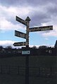 Direction Sign - Signpost in Compton Dando - geograph.org.uk - 6094793.jpg 1,166 × 1,716; 72 KB
-
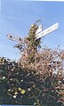
 Direction Sign - Signpost on Culverhay in Compton Dando - geograph.org.uk - 6049937.jpg 1,728 × 1,175; 133 KB
-
-

-

-
 Disconnected^ - geograph.org.uk - 2985874.jpg 1,704 × 2,304; 1.54 MB
-
 Don't go through the gap^ - geograph.org.uk - 5422864.jpg 1,704 × 2,304; 1.75 MB
-
 Dovecot at Tuckingmill Farm - geograph.org.uk - 5649087.jpg 2,304 × 1,704; 1.66 MB
-
 Down the hill to Compton Dando - geograph.org.uk - 2993810.jpg 1,704 × 2,304; 1.81 MB
-
 Down to Common Wood - geograph.org.uk - 5562480.jpg 2,304 × 1,704; 1.72 MB
-
 Driving flat out - geograph.org.uk - 4821723.jpg 1,704 × 2,304; 2.39 MB
-
 Duck race - geograph.org.uk - 3614339.jpg 2,304 × 1,704; 1.77 MB
-
 Early bird or early ladybird - geograph.org.uk - 4864759.jpg 2,304 × 1,704; 1.19 MB
-
 Early flowers in the churchyard - geograph.org.uk - 4863886.jpg 1,704 × 2,304; 2 MB
-
 Earth under wraps - geograph.org.uk - 6448401.jpg 3,296 × 2,472; 1.99 MB
-
 East from Redlynch Lane - geograph.org.uk - 1269318.jpg 640 × 486; 104 KB
-
 East of north from Charlton Field - geograph.org.uk - 1376575.jpg 640 × 427; 127 KB
-
 East of north from Redlynch Lane - geograph.org.uk - 1269291.jpg 640 × 464; 139 KB
-
 Edge of Common Wood - geograph.org.uk - 4857354.jpg 1,920 × 1,440; 953 KB
-
 Entering Common Wood - geograph.org.uk - 4857366.jpg 1,920 × 1,440; 994 KB
-
 Entrance to St Michael's church - geograph.org.uk - 4863879.jpg 1,704 × 2,304; 1.96 MB
-
 Evening relocation - geograph.org.uk - 5451696.jpg 2,304 × 1,704; 1.72 MB
-
 Farmland and wood near Queen Charlton - geograph.org.uk - 5707220.jpg 4,264 × 2,672; 2 MB
-
 Feeding the Chew - geograph.org.uk - 5387089.jpg 2,304 × 1,704; 1.74 MB
-
 Fete in the field - geograph.org.uk - 3614504.jpg 2,304 × 1,704; 1.72 MB
-
 Field by Queen Charlton Lane - geograph.org.uk - 5707531.jpg 4,288 × 2,848; 2.06 MB
-
 Field by Queen Charlton Lane - geograph.org.uk - 5707545.jpg 4,288 × 2,848; 1.96 MB
-
 Flight of fancy - geograph.org.uk - 3614500.jpg 1,704 × 2,304; 1.29 MB
-
 Flood meadows of the Chew - geograph.org.uk - 4821777.jpg 2,304 × 1,704; 1.75 MB
-

-
 Footbridge and gate - geograph.org.uk - 5546053.jpg 2,304 × 1,704; 1.65 MB
-
 Footbridge at the end of Vicarage Lane - geograph.org.uk - 5451693.jpg 2,304 × 1,704; 1.58 MB
-
 Footbridge over Candlestick Brook - geograph.org.uk - 2590332.jpg 3,648 × 2,736; 4.02 MB
-
 Footpath and field edge boundary - geograph.org.uk - 5171603.jpg 3,648 × 2,048; 2.41 MB
-
 Footpath down the valley to Tuckingmill - geograph.org.uk - 5171610.jpg 3,648 × 2,048; 2.2 MB
-
 Footpath near Compton Dando - geograph.org.uk - 1608577.jpg 480 × 640; 94 KB
-
 From Allens Brake to Blackers Mead Brake - geograph.org.uk - 5649010.jpg 2,304 × 1,704; 1.6 MB
-
 From sea to steam - geograph.org.uk - 4863208.jpg 1,704 × 2,304; 1.79 MB
-
 From the pit - geograph.org.uk - 5547941.jpg 2,304 × 1,704; 1.57 MB
-
 Gas pipeline marker - geograph.org.uk - 4863178.jpg 1,704 × 2,304; 1.83 MB
-
 Gate shadow - geograph.org.uk - 4863184.jpg 1,704 × 2,304; 2.2 MB
-
 Gate, field and small woodland. - geograph.org.uk - 1216630.jpg 640 × 480; 85 KB


.jpg)


.jpg)


.jpg)


