Category:Colorado State Highway 14
Jump to navigation
Jump to search
 | number: | (fourteen) |
|---|---|---|
| State highways in Colorado: | 1 · 2 · 3 · 5 · 7 · 8 · 9 · 10 · 11 · 12 · 13 · 14 · 15 · 16 · 17 · 21 · 22 · 23 · 26 · 30 · 33 |
state highway in Colorado, United States   | |||||
| Upload media | |||||
| Instance of | |||||
|---|---|---|---|---|---|
| Location |
| ||||
| Transport network | |||||
| Connects with | |||||
| Owned by | |||||
| Maintained by | |||||
| Length |
| ||||
| Terminus | |||||
| Partially coincident with | |||||
| |||||
English: Media related to Colorado State Highway 14, a 236.92-mile (381.29 km) state highway in Colorado, United States, that connects U.S. Route 40 (southeast of Steamboat Springs) with Interstate 76 Business/U.S. Route 6 in Sterling.
Subcategories
This category has the following 2 subcategories, out of 2 total.
C
- Cameron Pass (Colorado) (10 F)
Media in category "Colorado State Highway 14"
The following 11 files are in this category, out of 11 total.
-
 Colorado 14.svg 601 × 601; 4 KB
-
 Colorado State Highway 14 Map.svg 1,028 × 609; 1.38 MB
-
 ColoradoHighway14Weld.JPG 1,024 × 574; 56 KB
-
 Fire crews in Cache La Poudre Canyon at the High Park Wildfire.jpg 2,462 × 1,847; 1.55 MB
-
 Joe Wright and Barnes Meadow Reservoir along S.R. 14, Colorado (2520231312).jpg 1,536 × 2,048; 290 KB
-
 Nokhu Crags.JPG 3,160 × 2,504; 6.96 MB
-
 Poudre Canyon Tunnel.JPG 4,000 × 5,455; 14.43 MB
-
 Poudre Park, Colorado.JPG 4,720 × 3,107; 12.84 MB
-
 Raymer, Colorado.JPG 3,918 × 2,085; 5.59 MB
-
 Rustic, Colorado.JPG 5,188 × 3,222; 10.86 MB
-
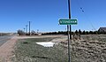 Stoneham, Colorado.JPG 5,563 × 3,222; 11.64 MB


.jpg)


