Category:Coley Park
Jump to navigation
Jump to search
suburb of the town of Reading, UK | |||||
| Upload media | |||||
| Instance of | |||||
|---|---|---|---|---|---|
| Location | Reading, West Berkshire, Berkshire, South East England, England | ||||
 | |||||
Subcategories
This category has the following 12 subcategories, out of 12 total.
B
- Benchmarks in Coley Park (5 F)
C
- Coley Park House (3 F)
- Courage Park, Reading (16 F)
F
S
- Southcote Junction (5 F)
- Swallows Croft, Reading (17 F)
W
Media in category "Coley Park"
The following 69 files are in this category, out of 69 total.
-
'Shaw House', ^1 Shaw Road - geograph.org.uk - 4120762.jpg 1,024 × 683; 151 KB
-
Coley Park bus terminus 2017-04-22 15.18.22.jpg 3,264 × 1,836; 2.6 MB
-
A33 - exiting Reading - geograph.org.uk - 3628744.jpg 640 × 428; 72 KB
-
A33 - River Kennet - geograph.org.uk - 2875005.jpg 640 × 480; 52 KB
-
A33 leaving Reading - geograph.org.uk - 4703070.jpg 800 × 428; 94 KB
-
A4 Berkeley Avenue, Reading - geograph.org.uk - 6483722.jpg 1,024 × 768; 359 KB
-
A4155 - geograph.org.uk - 6701836.jpg 714 × 1,024; 130 KB
-
Bath Road in Reading - geograph.org.uk - 5167766.jpg 1,500 × 1,125; 228 KB
-
Bath Road, Southcote - geograph.org.uk - 4866747.jpg 2,048 × 1,536; 1.53 MB
-
Baydon Drive - geograph.org.uk - 1328551.jpg 640 × 425; 191 KB
-
Blocked Off Bridge - geograph.org.uk - 3979390.jpg 4,000 × 3,000; 4.17 MB
-
Carsdale Close - geograph.org.uk - 1328587.jpg 640 × 426; 209 KB
-
Coley Avenue - geograph.org.uk - 1354074.jpg 640 × 426; 219 KB
-
Coley Park 2014-03-22 16.27.26.jpg 2,322 × 4,128; 4.61 MB
-
Coley Park 2014-03-22 16.27.48.jpg 4,128 × 2,322; 5.5 MB
-
Coley Park Farm - geograph.org.uk - 1354264.jpg 640 × 425; 184 KB
-
Coley Park Farm - geograph.org.uk - 1354288.jpg 427 × 640; 184 KB
-
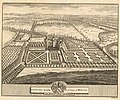
Coley Park, 1700-1709 by L. Knyff.jpg 682 × 569; 197 KB
-
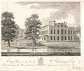
Coley Park, 1790-1799 by William Poole.jpg 698 × 588; 122 KB
-
Coley Park, c. 1823 by W. H. Timms.jpg 750 × 570; 73 KB
-
Entrance to Coley Park Farm - geograph.org.uk - 1354256.jpg 425 × 640; 195 KB
-
Entrance to the Allotments at Southcote - geograph.org.uk - 3371573.jpg 3,648 × 2,736; 1.95 MB
-
Flats 7-12, ^74 Wensley Road - geograph.org.uk - 4110984.jpg 1,024 × 683; 165 KB
-
Flats on Bath Road, Southcote - geograph.org.uk - 4866746.jpg 1,956 × 1,404; 1.15 MB
-
Flats, Coley Park, Reading - geograph.org.uk - 729366.jpg 640 × 480; 145 KB
-
Fobney pumping station - geograph.org.uk - 1314577.jpg 640 × 427; 213 KB
-
Footpath to Coley Park - geograph.org.uk - 847530.jpg 640 × 427; 87 KB
-
Former Coley Branch Line - geograph.org.uk - 225102.jpg 640 × 480; 118 KB
-
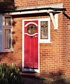
Front Door, Kenilworth Avenue - geograph.org.uk - 3784877.jpg 1,254 × 1,503; 315 KB
-
Furniture Warehouse - Reading - geograph.org.uk - 2340772.jpg 639 × 435; 50 KB
-
Harrow Court - Reading - geograph.org.uk - 1999073.jpg 4,288 × 2,848; 6.19 MB
-
Harrow Court - Reading - geograph.org.uk - 1999119.jpg 4,288 × 2,848; 6.36 MB
-
High Rise 'council' flats - geograph.org.uk - 7571.jpg 640 × 480; 78 KB
-
Holy Brook 2020-03-29 18.04.15.jpg 4,032 × 3,024; 7.33 MB
-
Holy Brook 2020-04-01 15.17.19.jpg 4,032 × 3,024; 5.94 MB
-
Honda show room - Reading - geograph.org.uk - 2340783.jpg 640 × 443; 50 KB
-
Hungerford Drive - geograph.org.uk - 1328540.jpg 640 × 426; 194 KB
-
Keeper's Lodge, Old Lane, Reading - geograph.org.uk - 645299.jpg 640 × 480; 73 KB
-
Kenilworth Avenue - geograph.org.uk - 3784871.jpg 1,024 × 782; 250 KB
-
Letter box and houses on St Saviour's Road - geograph.org.uk - 4111024.jpg 1,024 × 683; 184 KB
-
Pasture south of Coley Park Farm - geograph.org.uk - 1354307.jpg 640 × 427; 191 KB
-
Pillar box with benchmark, St Saviour's Road - geograph.org.uk - 4111003.jpg 683 × 1,024; 239 KB
-
Reading , Bath Road A4155 - geograph.org.uk - 6262141.jpg 4,608 × 3,456; 5.65 MB
-
Reading , Brunswick Street - geograph.org.uk - 6327387.jpg 4,608 × 3,456; 6.96 MB
-
Reading , Downshire Square - geograph.org.uk - 6262143.jpg 4,608 × 3,456; 5.45 MB
-
Reading , Railway Track - geograph.org.uk - 2586296.jpg 3,264 × 2,448; 3.7 MB
-
Reading - Basingstoke railway - geograph.org.uk - 4753112.jpg 640 × 480; 133 KB
-
Reading 2014-04-12 15.18.56.jpg 4,128 × 2,322; 5.91 MB
-
Reading 2014-04-12 15.19.34.jpg 4,128 × 2,322; 6.83 MB
-
Reading to Basingstoke line - geograph.org.uk - 6486955.jpg 1,024 × 768; 430 KB
-
Rembrandt Way - geograph.org.uk - 3979297.jpg 1,600 × 1,211; 386 KB
-
Retail units on Rose Kiln Lane - geograph.org.uk - 2696534.jpg 1,500 × 1,000; 123 KB
-
Sale, let, part exchange ... - geograph.org.uk - 848889.jpg 640 × 427; 108 KB
-
St Saviour's Road, Reading - geograph.org.uk - 729324.jpg 640 × 480; 124 KB
-
St. Saviour's Road - geograph.org.uk - 1354125.jpg 640 × 426; 186 KB
-
Stop, sale now on - geograph.org.uk - 848881.jpg 640 × 423; 78 KB
-
Swallows Croft on 20170128 110422.jpg 3,264 × 1,836; 3.08 MB
-
The Holybrook - geograph.org.uk - 1354273.jpg 640 × 425; 182 KB
-
The Roundhead pub, boarded up - geograph.org.uk - 3996793.jpg 640 × 427; 258 KB
-
Trackside woodland - geograph.org.uk - 5833448.jpg 1,024 × 681; 360 KB
-
Tulips and Daffodils in Coley Park - geograph.org.uk - 4331795.jpg 4,128 × 2,322; 3.34 MB
-
Wensley Road - geograph.org.uk - 3371579.jpg 3,237 × 2,181; 1,023 KB
-
Wensley Road, Southcote - geograph.org.uk - 3980235.jpg 1,600 × 1,211; 442 KB
-
^129 St Saviour's Road - geograph.org.uk - 4111116.jpg 683 × 1,024; 187 KB
-
^46 Coley Avenue - geograph.org.uk - 4110865.jpg 1,024 × 683; 281 KB
-
^60 Southcote Lane - geograph.org.uk - 2639105.jpg 1,024 × 683; 154 KB


