Category:Coleford, Gloucestershire
Jump to navigation
Jump to search
town in the Forest of Dean, Gloucestershire, England, UK | |||||
| Upload media | |||||
| Instance of | |||||
|---|---|---|---|---|---|
| Location | Forest of Dean, Gloucestershire, South West England, England | ||||
| Population |
| ||||
| Different from | |||||
| Said to be the same as | Coleford (Wikimedia duplicated page, civil parish) | ||||
 | |||||
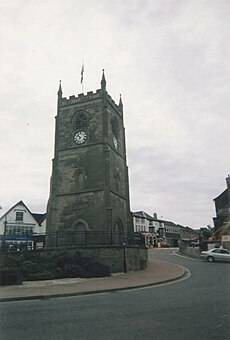
English: Coleford is a small market town in Gloucestershire, England in the west of the Forest of Dean which has a population of 8,351 (2001 census). It is situated approximately four miles to the east of the Welsh border on the English side, and is close to the Wye Valley, a popular walking and canoeing area. The town is the administrative centre of the Forest of Dean district.
Français : Coleford est un petit bourg du Gloucestershire, en Angleterre. C'est le centre administratif du district de Forest of Dean.
Nederlands: Coleford is een plaats in het bestuurlijke gebied Forest of Dean, in het Engelse graafschap Gloucestershire. De plaats telt 8.351 inwoners.
Norsk bokmål: Coleford er en liten markedsby i Gloucestershire, England. Den er administrasjonssenter for distriktet Forest of Dean, og ligger omkring 6,5 km øst for grensen til Wales. Nærheten til Wye Valley betyr at byen er populære blant sykkel-, kano- og fotturister.
Polski: Coleford - miasto w Wielkiej Brytanii, w Anglii w hrabstwie Gloucestershire, położone na zachodnim krańcu Lasu Dziekańskiego, sześć kilometrów od granicy z Walią, niedaleko doliny rzeki Wye. Popularny ośrodek turystyki indywidualnej, punkt wypadowy do Lasu dziekańskiego.
Română: Coleford este un oraş în comitatul Gloucestershire, regiunea South West, Anglia. Oraşul se află în districtul Forest of Dean a cărui reşedinţă este.
Subcategories
This category has the following 11 subcategories, out of 11 total.
C
- Coleford clock tower (15 F)
F
- Forest House, Coleford (1 F)
H
- Hopewell Colliery Museum (14 F)
P
- Perrygrove Railway (23 F)
- Puzzlewood (134 F)
W
- Whitecliff Ironworks (3 F)
Media in category "Coleford, Gloucestershire"
The following 200 files are in this category, out of 706 total.
(previous page) (next page)-
'Dean Auto Centre', Berry Hill, Gloucestershire - geograph.org.uk - 3267666.jpg 1,024 × 588; 142 KB
-
A Coleford Cat - geograph.org.uk - 4354948.jpg 1,600 × 1,245; 598 KB
-
A Forest controversy. - geograph.org.uk - 52952.jpg 640 × 462; 82 KB
-
A pink and white confection - geograph.org.uk - 766940.jpg 640 × 459; 197 KB
-
A view of the clock tower, Coleford - geograph.org.uk - 765947.jpg 640 × 494; 123 KB
-
Albert Road, Coleford - geograph.org.uk - 4203212.jpg 800 × 632; 108 KB
-
Angel Hotel, Coleford, Forest of Dean (4786047).jpg 1,200 × 911; 114 KB
-
Apex Outdoors, Coleford - geograph.org.uk - 4256044.jpg 800 × 482; 99 KB
-
Approaching Berry Hill Pike - geograph.org.uk - 1726168.jpg 640 × 434; 79 KB
-
Approaching Berry Hill Pike - geograph.org.uk - 5089651.jpg 3,707 × 2,685; 3.05 MB
-
B4028 leaving Coleford - geograph.org.uk - 4623289.jpg 640 × 480; 52 KB
-
B4028, Coleford - geograph.org.uk - 4027822.jpg 1,600 × 1,063; 566 KB
-
B4028, Coleford - geograph.org.uk - 4027831.jpg 1,600 × 1,063; 372 KB
-
B4228 at Perrygrove - geograph.org.uk - 4623280.jpg 640 × 480; 51 KB
-
B4228 entering Coleford - geograph.org.uk - 4623285.jpg 640 × 481; 64 KB
-
Balti Hut, Coleford - geograph.org.uk - 3241446.jpg 597 × 640; 89 KB
-
Bank House - January 2013 - panoramio.jpg 4,000 × 3,000; 4.5 MB
-
Barnhill Plantation. - geograph.org.uk - 52941.jpg 640 × 480; 105 KB
-
Barnhill Plantation. - geograph.org.uk - 52942.jpg 640 × 480; 81 KB
-
Barnhill Plantation. - geograph.org.uk - 52947.jpg 640 × 480; 139 KB
-
Beale Garage, Coleford - geograph.org.uk - 2729897.jpg 640 × 482; 66 KB
-
Beale Garage, Coleford - geograph.org.uk - 4423727.jpg 800 × 569; 105 KB
-
Beale Garage, Coleford - geograph.org.uk - 6815736.jpg 1,600 × 900; 444 KB
-
Beechams Factory - geograph.org.uk - 2142583.jpg 640 × 424; 64 KB
-
Beeches Garage, Mile End - geograph.org.uk - 3694204.jpg 1,024 × 680; 166 KB
-
Bell's Hotel and Country Club - geograph.org.uk - 6320642.jpg 4,896 × 3,264; 2.67 MB
-
Bench mark on a defaced milestone near Coleford (geograph 6212795).jpg 1,200 × 1,600; 1.02 MB
-
Bench on a suburban corner in Coleford - geograph.org.uk - 4258416.jpg 800 × 479; 101 KB
-
Berry Hill - New Build - geograph.org.uk - 6670715.jpg 1,600 × 1,200; 399 KB
-
Biker Dean, Coleford - geograph.org.uk - 3257965.jpg 625 × 640; 85 KB
-
Birchill Inclosure - geograph.org.uk - 2034783.jpg 640 × 480; 148 KB
-
Blueboy Carpets, Coleford - geograph.org.uk - 4423999.jpg 800 × 582; 150 KB
-
Bowens Hill Road, Coleford - geograph.org.uk - 4203172.jpg 800 × 593; 190 KB
-
Boxbush Rd, Coleford - geograph.org.uk - 1876588.jpg 3,296 × 2,472; 1.9 MB
-
Boxbush Road houses, Coleford - geograph.org.uk - 4203189.jpg 800 × 607; 147 KB
-
Boxbush Road, Coleford - geograph.org.uk - 3257430.jpg 640 × 554; 79 KB
-
Brewery Centre, Spout Lane, Coleford - geograph.org.uk - 4423711.jpg 800 × 734; 133 KB
-
Broadwell Memorial Hall - geograph.org.uk - 6918250.jpg 1,600 × 1,200; 400 KB
-
Brunston Surgery, Cinder Hill, Coleford - geograph.org.uk - 765918.jpg 640 × 443; 124 KB
-
Building site in Coleford - geograph.org.uk - 4424071.jpg 800 × 586; 129 KB
-
Calico Interiors, Milkwall, Coleford - geograph.org.uk - 5103244.jpg 800 × 547; 87 KB
-
Camping and caravan site - geograph.org.uk - 3122660.jpg 640 × 480; 105 KB
-
Cannop crossroads - geograph.org.uk - 743627.jpg 639 × 479; 183 KB
-
Car Park at Beechenhurst Lodge - geograph.org.uk - 199918.jpg 640 × 480; 149 KB
-
Caragh House, Newland Street, Coleford (geograph 6055480).jpg 1,024 × 768; 173 KB
-
Changes in Coleford - geograph.org.uk - 4202191.jpg 800 × 726; 128 KB
-
Christmas decorations at Coleford, 1 - geograph.org.uk - 3835994.jpg 800 × 508; 160 KB
-
Christmas decorations at Coleford, 2 - geograph.org.uk - 3835996.jpg 800 × 506; 184 KB
-
Citizens Advice Bureau, Coleford - geograph.org.uk - 5102487.jpg 800 × 600; 97 KB
-
Citroën Motorhouse, Coleford - geograph.org.uk - 5102884.jpg 800 × 539; 91 KB
-
Close look at the Whitecliff Furnace - geograph.org.uk - 6228226.jpg 3,024 × 1,701; 1.39 MB
-
Coalway Methodist Pisgah Chapel - geograph.org.uk - 3241222.jpg 640 × 480; 67 KB
-
Coalway Park houses, Coalway - geograph.org.uk - 3241205.jpg 640 × 434; 46 KB
-
Coalway Recreation Ground buildings - geograph.org.uk - 3241152.jpg 640 × 405; 65 KB
-
Coalway school entrance - geograph.org.uk - 3241139.jpg 640 × 397; 72 KB
-
Former Independent Chapel, Coleford - geograph.org.uk - 765886.jpg 640 × 444; 124 KB
-
Coleford (GWR) station, 1950 - geograph.org.uk - 5206511.jpg 2,294 × 1,285; 1.22 MB
-
Coleford - GWR Museum - geograph.org.uk - 6688302.jpg 5,152 × 3,864; 7.21 MB
-
Coleford - GWR Museum - geograph.org.uk - 6688308.jpg 5,152 × 3,864; 7.2 MB
-
Coleford - GWR Museum - geograph.org.uk - 6688312.jpg 5,152 × 2,790; 5.44 MB
-
Coleford - Market Place - geograph.org.uk - 6688349.jpg 5,010 × 3,564; 5.37 MB
-
Coleford - Men of Iron and Steel - geograph.org.uk - 6688333.jpg 4,984 × 3,630; 6.18 MB
-
Coleford - Old White Hart Inn - geograph.org.uk - 6688341.jpg 5,152 × 3,864; 6.76 MB
-
Coleford - The Angel Hotel - geograph.org.uk - 6688344.jpg 5,152 × 3,864; 6.34 MB
-
Coleford Ambulance Station - geograph.org.uk - 3259194.jpg 640 × 439; 55 KB
-
Coleford Baptist church - geograph.org.uk - 3184728.jpg 1,024 × 680; 254 KB
-
Coleford Clock Tower - geograph.org.uk - 3427214.jpg 1,024 × 769; 118 KB
-
Coleford Clock Tower - geograph.org.uk - 6588791.jpg 5,184 × 3,888; 3.91 MB
-
Coleford clock tower from Newland Street - geograph.org.uk - 3427227.jpg 768 × 1,024; 127 KB
-
Coleford Computers - geograph.org.uk - 3257658.jpg 569 × 640; 94 KB
-
Coleford Fire Station - geograph.org.uk - 460812.jpg 640 × 426; 154 KB
-
Coleford Fire Station tower - geograph.org.uk - 3259182.jpg 521 × 640; 64 KB
-
Coleford Fire Station Tower - geograph.org.uk - 3766781.jpg 1,200 × 1,600; 226 KB
-
Coleford Garden Centre greenhouses - geograph.org.uk - 4555249.jpg 800 × 607; 200 KB
-
Coleford glos angel hotel.JPG 3,648 × 2,736; 3.74 MB
-
Coleford glos st johns street.JPG 3,648 × 2,736; 4.26 MB
-
Coleford Junction Signal Box - geograph.org.uk - 6688304.jpg 5,152 × 3,864; 5.72 MB
-
Coleford Leisure, Coleford - geograph.org.uk - 5102700.jpg 800 × 528; 127 KB
-
Coleford Library and The Main Place - geograph.org.uk - 2729971.jpg 640 × 480; 74 KB
-
Coleford Police Station - geograph.org.uk - 3241392.jpg 640 × 412; 57 KB
-
Coleford railway museum - geograph.org.uk - 6318785.jpg 4,896 × 3,264; 6.08 MB
-
Coleford railway museum - geograph.org.uk - 6318792.jpg 4,896 × 3,264; 6.43 MB
-
Coleford Station - geograph.org.uk - 4560079.jpg 4,608 × 3,456; 6.17 MB
-
Coleford station, 1950 - geograph.org.uk - 5206531.jpg 2,359 × 1,323; 1.23 MB
-
Coleford Telephone Exchange - geograph.org.uk - 4203175.jpg 800 × 485; 92 KB
-
Coleford Telephone Exchange, Glos - geograph.org.uk - 5728666.jpg 2,592 × 1,944; 1.35 MB
-
Coleford to Milkwall cycle track - geograph.org.uk - 3240250.jpg 640 × 468; 90 KB
-
Coleford Town - geograph.org.uk - 6966127.jpg 800 × 600; 137 KB
-
Coleford Town Centre - geograph.org.uk - 2154871.jpg 1,024 × 686; 203 KB
-
Coleford Town Centre - geograph.org.uk - 3744518.jpg 640 × 424; 68 KB
-
Coleford town centre car park - geograph.org.uk - 6925257.jpg 1,600 × 900; 364 KB
-
Coleford war memorial - geograph.org.uk - 6228215.jpg 2,268 × 4,032; 2.83 MB
-
Coleford, Forest Hills - geograph.org.uk - 5635603.jpg 1,600 × 1,200; 950 KB
-
Commemorating Darkhill Ironworks - geograph.org.uk - 6297088.jpg 3,000 × 4,000; 2.76 MB
-
Commemorating the Ironworks - geograph.org.uk - 6297075.jpg 2,629 × 3,000; 1.38 MB
-
Commer CA Tractor Unit - geograph.org.uk - 1929187.jpg 640 × 480; 269 KB
-
Common Foxglove, Digitalis purpurea - geograph.org.uk - 4527227.jpg 1,200 × 1,600; 1 MB
-
Concrete post, Sparrow Hill, Coleford - geograph.org.uk - 4257164.jpg 800 × 800; 137 KB
-
Coombs Road, Coleford - geograph.org.uk - 4258411.jpg 800 × 566; 98 KB
-
Cottage at Whitecliff - geograph.org.uk - 3688232.jpg 3,264 × 2,448; 4.76 MB
-
Cottages on Newland Road, Coleford - geograph.org.uk - 5903711.jpg 1,024 × 768; 151 KB
-
Cottages, and bridge for dismantled railway, Coleford - geograph.org.uk - 1876554.jpg 3,296 × 2,472; 1.77 MB
-
Country lane, Scowles - geograph.org.uk - 1019398.jpg 640 × 480; 187 KB
-
Cross on Market Square - geograph.org.uk - 3184718.jpg 680 × 1,024; 145 KB
-
Crossroads at Mile End - geograph.org.uk - 3181513.jpg 1,024 × 680; 138 KB
-
Crossways signpost near Coleford - geograph.org.uk - 4206595.jpg 800 × 562; 151 KB
-
Crown Meadow, Coalway - geograph.org.uk - 3241173.jpg 640 × 480; 81 KB
-
Crucible Close, Coleford - geograph.org.uk - 5102763.jpg 800 × 569; 91 KB
-
Cupola Close - geograph.org.uk - 6736649.jpg 1,600 × 900; 418 KB
-
Cupola Close, Coleford - geograph.org.uk - 5102830.jpg 800 × 575; 97 KB
-
Cycle path and road in Forest of Dean - geograph.org.uk - 2517673.jpg 2,816 × 2,112; 2.35 MB
-
Cycle track from Coleford, nearing Milkwall Station - panoramio.jpg 2,976 × 3,968; 2.24 MB
-
Cyclepath in Milkwall - geograph.org.uk - 2517675.jpg 2,816 × 2,112; 2.25 MB
-
Cyclepath near Coleford - geograph.org.uk - 2517679.jpg 2,816 × 2,112; 2.54 MB
-
Cyclists enjoying a downhill stretch - geograph.org.uk - 760288.jpg 640 × 462; 133 KB
-
Danger, sheep - geograph.org.uk - 743652.jpg 639 × 479; 178 KB
-
Dark Hill Ironworks - geograph.org.uk - 1549504.jpg 640 × 480; 140 KB
-
Darkhill Ironworks - geograph.org.uk - 6320548.jpg 4,896 × 3,264; 4.49 MB
-
Darkhill Ironworks - geograph.org.uk - 6906700.jpg 1,600 × 1,200; 935 KB
-
Darkhill Ironworks - geograph.org.uk - 6906703.jpg 1,600 × 1,200; 932 KB
-
Darkhill Ironworks - geograph.org.uk - 7142889.jpg 1,024 × 683; 301 KB
-
Darkhill Ironworks Ruins - geograph.org.uk - 6297063.jpg 4,000 × 2,579; 2.27 MB
-
Dean Auto Service, Coleford - geograph.org.uk - 4256011.jpg 800 × 586; 122 KB
-
Dean Properties, Coleford - geograph.org.uk - 5102565.jpg 800 × 617; 102 KB
-
Depression near Little Berry Hill - geograph.org.uk - 4259058.jpg 800 × 389; 81 KB
-
Dingle Wood and sign to Stowfield Quarry - geograph.org.uk - 3427209.jpg 1,024 × 683; 150 KB
-
Direction sign, The Gorse, Coleford - geograph.org.uk - 4259032.jpg 800 × 618; 96 KB
-
Distances from Coleford - geograph.org.uk - 4424054.jpg 750 × 638; 217 KB
-
Dog unit vehicle, Coleford - geograph.org.uk - 3258095.jpg 640 × 590; 59 KB
-
Down Boxbush Road, Coleford - geograph.org.uk - 4203179.jpg 800 × 555; 109 KB
-
Downhill to Cannop - geograph.org.uk - 760274.jpg 442 × 640; 143 KB
-
East side of St John Street, Coleford - geograph.org.uk - 4202246.jpg 800 × 668; 124 KB
-
Edenwall Coalway - geograph.org.uk - 3241170.jpg 640 × 574; 86 KB
-
Edenwall Road, Milkwall - geograph.org.uk - 1908339.jpg 640 × 480; 233 KB
-
Edenwall Road, Milkwall - geograph.org.uk - 5564150.jpg 800 × 625; 98 KB
-
Edge End Road, Mile End, Gloucestershire - geograph.org.uk - 3267662.jpg 1,600 × 1,200; 424 KB
-
Edge of Nagshead Plantation - geograph.org.uk - 1769275.jpg 640 × 480; 270 KB
-
Ellwood Road, Milkwall, Coleford - geograph.org.uk - 5103233.jpg 800 × 601; 110 KB
-
End of the 30 zone in Milkwall - geograph.org.uk - 4555108.jpg 800 × 597; 133 KB
-
Entrance to Bells Hotel, Coleford - geograph.org.uk - 3240342.jpg 640 × 435; 59 KB
-
Entrance to Coalway - geograph.org.uk - 4073372.jpg 640 × 480; 124 KB
-
Entrance to Coleford Garden Centre - geograph.org.uk - 4555202.jpg 800 × 528; 115 KB
-
Entrance to Darkhill car park - geograph.org.uk - 5494001.jpg 1,024 × 768; 338 KB
-
Entrance to Puzzle Wood car park - geograph.org.uk - 3427256.jpg 1,024 × 768; 117 KB
-
Entrance to remains of Whitecliff Furnace - geograph.org.uk - 3970065.jpg 1,024 × 577; 253 KB
-
Entrance to The Coombs, Coleford - geograph.org.uk - 4258413.jpg 800 × 632; 125 KB
-
Facade of Coleford Baptist Church - geograph.org.uk - 3257986.jpg 480 × 640; 78 KB
-
Faded postbox, Crossways - geograph.org.uk - 4206736.jpg 832 × 1,392; 266 KB
-
Fairways Avenue, Coleford - geograph.org.uk - 5102896.jpg 800 × 496; 81 KB
-
Fairways van and shop in Coleford - geograph.org.uk - 4204157.jpg 800 × 484; 109 KB
-
Fcbc “Your Choice” car body repairs - geograph.org.uk - 6857968.jpg 1,600 × 963; 1.92 MB
-
Feral sheep at Coleford - geograph.org.uk - 7091756.jpg 1,600 × 900; 882 KB
-
Five Acres High School Logo.jpg 307 × 383; 30 KB
-
Footpath at Coleford - geograph.org.uk - 3691454.jpg 3,264 × 2,448; 5.47 MB
-
Forest Hills Golf Club - geograph.org.uk - 2169145.jpg 1,600 × 1,071; 398 KB
-
Forest Holidays Site, Forest of Dean - geograph.org.uk - 6988962.jpg 4,032 × 3,024; 5.27 MB
-
Forest of Dean District Council Offices - geograph.org.uk - 3691468.jpg 3,264 × 2,448; 4.66 MB


