Category:Coasts of Mecklenburg-Vorpommern
Jump to navigation
Jump to search
Federal states of Germany:
Subcategories
This category has the following 21 subcategories, out of 21 total.
Pages in category "Coasts of Mecklenburg-Vorpommern"
This category contains only the following page.
Media in category "Coasts of Mecklenburg-Vorpommern"
The following 88 files are in this category, out of 88 total.
-
Am Grabow.JPG 819 × 613; 64 KB
-
Am Salzhaff 2.JPG 800 × 600; 138 KB
-
Baltic Sea clouds.jpg 3,072 × 1,180; 1.15 MB
-
Baltic Sea near Brook 1.jpg 3,872 × 2,592; 3.11 MB
-
Baltic Sea Sunset (6005364684).jpg 1,920 × 1,280; 1.3 MB
-
Barendorf Harkenbäk Mündung in Ostsee 2013-07-31 3.JPG 2,816 × 2,112; 1.55 MB
-
Barhöft 1.jpg 2,515 × 1,143; 536 KB
-
Barhöft 2.jpg 800 × 604; 380 KB
-
Barhöft retuschiert.jpg 806 × 275; 200 KB
-
Barhöft.JPG 806 × 609; 82 KB
-
Blue blew Bleu by JMP 2018.12.30- Roadtrip.jpg 3,648 × 2,432; 2.38 MB
-
Blue Sea - Flickr - Peter.Samow.jpg 5,634 × 3,753; 9.82 MB
-
Boergerende Strand.jpg 2,317 × 1,374; 1.19 MB
-
Boinsdorfer werder.jpg 759 × 568; 56 KB
-
Boltenhagen Strand Steilkueste 2009-01-02 031.jpg 2,048 × 1,536; 732 KB
-
Börgerende Warnschild Steilküste 2013-07-22.JPG 2,112 × 2,816; 1.74 MB
-
Börgerende-Rethwisch Küste.jpg 4,000 × 3,000; 5.43 MB
-
Conventer See 4.jpg 800 × 600; 220 KB
-
Die Brücke der Schaprode – 360°-Panorama mit den beiden Kapitänen.jpg 5,376 × 2,688; 2.23 MB
-
Die Brücke des Passagierschiffs Schaprode – 360°-Panorama mit den beiden Kapitänen.jpg 5,376 × 2,688; 2.38 MB
-
Drift till marl flint outcrop Baltic Sea coast, germany.JPG 4,000 × 3,000; 3.39 MB
-
Dünenpflanzen an Ostsee.jpg 3,072 × 2,304; 3.08 MB
-
Fishing boats in tourist resort - 200807.jpg 3,264 × 1,832; 1.43 MB
-
Fishing gear in tourist resort - 200807.jpg 2,048 × 1,536; 844 KB
-
Fishing gear in tourist resort close up - 200807.jpg 2,048 × 1,536; 886 KB
-
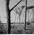
Fotothek df ps 0001841 Bäume.jpg 800 × 812; 336 KB
-
Golf course Golfplatz Wittenbeck Mecklenburg Ostsee Baltic Sea Germany.jpg 1,024 × 685; 109 KB
-
Granica Polsko Niemiecka - panoramio.jpg 2,848 × 2,136; 2.88 MB
-
Göhren, baltské pobřeží.JPG 2,756 × 2,076; 2.49 MB
-
Hiddensee-das-neue-boot.png 2,370 × 3,501; 14.21 MB
-
Hohen Wieschendorf 2011-11-12 010.JPG 2,592 × 1,944; 2.14 MB
-
Hühnengrab bei Rerik.JPG 800 × 600; 195 KB
-
Insel Hiddensee 04.JPG 1,920 × 1,280; 847 KB
-
Insel Rügen - Kreideküste.jpg 1,353 × 2,000; 498 KB
-
JasmundSteilkueste2.jpg 2,000 × 1,500; 1.75 MB
-
Kreidefelsen Rügen vom Boot.jpg 2,304 × 1,068; 813 KB
-
Küstenwald Ostsee MV.jpg 2,816 × 2,112; 2.79 MB
-
Leitfeuer Peenemünde um 1980 Archiv WSA Ostsee CC-BY-SA 4.0.JPG 1,818 × 1,228; 657 KB
-
Nienhagen Baltic Sea.jpg 3,052 × 2,200; 696 KB
-
Nienhagen Steilküste.JPG 800 × 600; 463 KB
-
Nienhäger Holz "Gespensterwald", Nienhagen, Landkreis Rostock 1.jpg 4,000 × 3,000; 1.91 MB
-
Nienhäger Holz "Gespensterwald", Nienhagen, Landkreis Rostock 13.jpg 3,456 × 4,608; 3.51 MB
-
Nienhäger Holz "Gespensterwald", Nienhagen, Landkreis Rostock 2.jpg 4,000 × 3,000; 3.1 MB
-
Nienhäger Holz "Gespensterwald", Nienhagen, Landkreis Rostock 6.jpg 1,944 × 2,592; 1.12 MB
-
Nienhäger Holz "Gespensterwald", Nienhagen, Landkreis Rostock 8.jpg 2,592 × 1,944; 1.16 MB
-
Nothafen Prerow.jpg 2,729 × 600; 1.14 MB
-
NP Vorp. Boddenlandschaft.JPG 800 × 600; 255 KB
-
Outlook from forest over cliffed Baltic Sea coast.JPG 3,000 × 4,043; 2.62 MB
-
Poel, Steilküste südlich von Timmendorf.jpg 2,048 × 1,239; 793 KB
-
Pramort.JPG 800 × 600; 167 KB
-
Prorer Wiek 002.jpg 3,001 × 1,989; 4.29 MB
-
Radweg Steilküsten Niendorf.jpg 3,456 × 2,304; 1.11 MB
-
Relax - Flickr - Peter.Samow.jpg 5,524 × 3,679; 4.5 MB
-
Rerik Halbinsel Wustrow Seebruecke Panorama 2010-05-17 015.jpg 4,912 × 1,080; 901 KB
-
Rerik Panorama.jpg 4,767 × 1,008; 898 KB
-
Rerik Panorama2.jpg 4,376 × 1,064; 958 KB
-
Rerik Steilkueste 2010-05-17 037.jpg 2,592 × 1,944; 3 MB
-
Rerik Steilkueste 2010-05-17 040.jpg 2,592 × 1,944; 2.95 MB
-
Rerik Steilkueste Treppe 2010-05-17 034.jpg 2,592 × 1,944; 2.97 MB
-
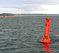
RK 0708 02711 Gellenstrom Tonne 20.jpg 1,800 × 1,614; 141 KB
-
Salzhaff bei Boiensdorf .jpg 6,000 × 4,000; 4.34 MB
-
Seebrücke Boltenhagen.jpg 4,592 × 3,064; 7.99 MB
-
SommerJWP2.jpg 798 × 599; 120 KB
-
Sonne Warnemünde.jpg 1,024 × 679; 210 KB
-
Sonnenaufgang am Meer (10577698014).jpg 1,500 × 1,000; 539 KB
-
SonnenuntergangNonnevitz.jpg 2,048 × 1,536; 1,006 KB
-
Steilküste bei Elmenhorst.JPG 800 × 600; 172 KB
-
Steilküste bei Kalkhorst - panoramio (1).jpg 2,272 × 1,704; 2.55 MB
-
Steilküste bei Timmendorf, Insel Poel (3436640119).jpg 1,024 × 683; 380 KB
-
Steilküste bei Timmendorf, Insel Poel (3437450800).jpg 1,024 × 683; 507 KB
-
Steilküste, oben - panoramio.jpg 4,320 × 3,240; 2.94 MB
-
Stolper-ort.jpg 6,832 × 1,618; 2.13 MB
-
Strand bei Redewisch - geo-en.hlipp.de - 13955.jpg 640 × 480; 62 KB
-
Strand bei Wustrow.jpg 3,020 × 600; 1.22 MB
-
TravemündePilot06.JPG 3,648 × 2,736; 1.33 MB
-
Ufer bei Wohlenberg im März - panoramio.jpg 1,000 × 750; 326 KB
-
Weststrand.jpg 4,134 × 1,911; 5.11 MB
-
Wismar-Wendorf Ostseekueste Hafeneinfahrt 2010-01-26 035.jpg 2,592 × 1,944; 883 KB
-
Wismar-Wendorf Ostseekueste Hafeneinfahrt 2010-01-26 037.jpg 2,592 × 1,944; 889 KB


