Category:Climate maps of Mexico
Jump to navigation
Jump to search
Subcategories
This category has the following 2 subcategories, out of 2 total.
Media in category "Climate maps of Mexico"
The following 28 files are in this category, out of 28 total.
-
Chihuahua desert.jpg 400 × 324; 78 KB
-
Chihuahua, Mexico climate map.jpg 406 × 492; 79 KB
-
Clima de Tabasco.PNG 645 × 330; 13 KB
-
Clima en Michoacán.svg 1,056 × 816; 3.23 MB
-
Clima Köppen de Michoacán.svg 765 × 765; 724 KB
-
COLIMA-CLIMA.png 803 × 519; 58 KB
-
Escarcega Climas.svg 1,466 × 1,034; 182 KB
-
Koppen-Geiger Map Central America future.svg 1,681 × 850; 2.51 MB
-
Koppen-Geiger Map Central America present.svg 1,681 × 850; 2.63 MB
-
Koppen-Geiger Map MEX future.svg 1,769 × 850; 2.72 MB
-
Koppen-Geiger Map MEX present.svg 1,769 × 850; 2.81 MB
-
Koppen-Geiger Map North America future.svg 1,816 × 850; 14.85 MB
-
Koppen-Geiger Map North America present.svg 1,816 × 850; 14.65 MB
-
Mapa de México con la Clasificación Climática de Köppen.png 1,151 × 625; 111 KB
-
Mapa temp.png 2,180 × 1,452; 2.46 MB
-
Mexico Climate - DPLA - 0b479df0a62cea19cd992fbe9a5366c2.jpg 8,064 × 6,616; 5.12 MB
-
Mexico Köppen es.svg 765 × 765; 1.93 MB
-
Mexico Köppen.svg 765 × 765; 2.04 MB
-
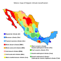
Mexico map of Köppen climate classification.png 1,280 × 1,280; 895 KB
-
Mexico map of Köppen climate classification.svg 1,900 × 1,900; 328 KB
-
Milpa Alta clima.png 776 × 1,004; 175 KB
-
MX-DF-clima.png 816 × 1,056; 98 KB
-
Nevadas y heladas México.png 598 × 421; 15 KB
-
Ostuacan clima.svg 1,198 × 829; 391 KB
-
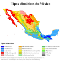
Tipos climáticos do México (Köppen).svg 765 × 765; 2.31 MB
-
Tres Valles climas predominantes.svg 990 × 765; 109 KB
-
USDA Hardiness zone map.jpg 4,014 × 4,002; 5.92 MB
-
USDAplanthardiness.jpg 620 × 603; 165 KB


