Category:Climate maps of Germany
Jump to navigation
Jump to search
Subcategories
This category has the following 3 subcategories, out of 3 total.
G
- Temperaturkarten Deutschland (1435 F)
I
Media in category "Climate maps of Germany"
The following 11 files are in this category, out of 11 total.
-
371 of 'Thüringen. Ein geographisches Handbuch, etc' (11219088124).jpg 1,701 × 1,597; 676 KB
-
D054- N° 432. Le 1er Floréal en Allemagne. - Liv3-Ch16.png 1,442 × 1,632; 406 KB
-
Germany Köppen.svg 765 × 1,179; 889 KB
-
Jahresanimation gif 1991-2021.gif 2,480 × 3,507; 6.44 MB
-
Meyers b18 s0495a.jpg 3,306 × 2,630; 8.83 MB
-
NDVI 062003.png 2,052 × 1,364; 480 KB
-
NDVI 102003.png 2,052 × 1,364; 504 KB
-
Pvgis solar horiz DE.png 1,024 × 1,513; 1.36 MB
-
Schneelastzonenkarte.png 1,640 × 2,086; 153 KB
-
SolarGIS-Solar-map-Germany-de.png 710 × 1,000; 692 KB
-
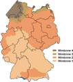
Windzonenkarte.png 1,130 × 1,265; 64 KB


