Category:Climate diagrams of Chile
Jump to navigation
Jump to search
Subcategories
This category has the following 2 subcategories, out of 2 total.
C
Media in category "Climate diagrams of Chile"
The following 19 files are in this category, out of 19 total.
-
Ancud ilmastodiagrammi.png 500 × 720; 9 KB
-
Climograma Antártica.png 450 × 450; 10 KB
-
Climograma Arica.png 450 × 450; 10 KB
-
Climograma Punta Arenas.png 450 × 450; 11 KB
-
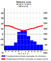
Climograma Temuco.png 477 × 574; 22 KB
-
Climograma Isla de Pascua.png 450 × 450; 9 KB
-
Klimadiagramm-Puerto Montt-Chile-metrisch-deutsch.png 800 × 557; 31 KB
-
Klimadiagramm-San Pedro-Chile-metrisch-deutsch.png 800 × 557; 30 KB
-
Klimadiagramm-Valdivia-Chile-metrisch-deutsch.png 800 × 557; 31 KB
-
NASA 1941 2008 La Serena.gif 650 × 435; 280 KB
-
NASA Tº 1901 2008 Juan Fernández.gif 650 × 435; 280 KB
-
NASA Tº 1951 2008 Antofagasta.gif 650 × 435; 280 KB
-
NASA Tº 1951 2008 Montt.gif 650 × 502; 28 KB
-
NASA Tº Pudahuel 1903-2007.gif 650 × 435; 280 KB
-
NASA Tº 1888-2007 Pta Arenas.gif 650 × 441; 284 KB
-
Climograma Santiago.png 450 × 450; 11 KB
-
Temperaturas-item-036-cuencas-de-chile.png 1,040 × 537; 113 KB
-
Climograma Valdivia.png 450 × 450; 11 KB
-
Valdivia ilmastodiagrammi.png 491 × 720; 4 KB


