Category:Claypole
Jump to navigation
Jump to search
village and civil parish in Lincolnshire, UK  | |||||
| Upload media | |||||
| Instance of | |||||
|---|---|---|---|---|---|
| Location | South Kesteven, Lincolnshire, East Midlands, England | ||||
| Population |
| ||||
 | |||||
English: Claypole is a village in the South Kesteven district of Lincolnshire, England. It is south-east of Newark-on-Trent.
Subcategories
This category has only the following subcategory.
P
Media in category "Claypole"
The following 200 files are in this category, out of 315 total.
(previous page) (next page)-
 "Set Aside" Land - geograph.org.uk - 1838770.jpg 1,600 × 1,200; 457 KB
-
 "Swedish Houses" Barnby Lane, Claypole - geograph.org.uk - 1838789.jpg 1,600 × 1,200; 276 KB
-
 A field of teasles - geograph.org.uk - 6685009.jpg 1,024 × 768; 277 KB
-
 A scrap merchant's dream (2) - geograph.org.uk - 2528336.jpg 1,024 × 768; 273 KB
-
 A scrap merchant's dream - geograph.org.uk - 2528332.jpg 1,024 × 768; 228 KB
-
 A shower in the offing - geograph.org.uk - 6227774.jpg 1,024 × 768; 180 KB
-
 Access denied - geograph.org.uk - 2528326.jpg 1,024 × 768; 292 KB
-

-
 Afternoon nap - geograph.org.uk - 6488405.jpg 1,024 × 768; 318 KB
-
 All Saints church Barnby in the Willows - geograph.org.uk - 1815918.jpg 1,600 × 1,200; 541 KB
-

-
 Animal shelter, silage bales and barns - geograph.org.uk - 6436460.jpg 1,024 × 768; 221 KB
-
 Approaching Barnby Lane - geograph.org.uk - 6436473.jpg 1,024 × 768; 279 KB
-
 Approaching Holm Lane - geograph.org.uk - 6436457.jpg 1,024 × 768; 178 KB
-
 Approaching the Church Bridge - geograph.org.uk - 4752472.jpg 1,024 × 768; 282 KB
-
 Arable land, Witham Valley - geograph.org.uk - 4230997.jpg 640 × 430; 37 KB
-
 Autumn sown cereal - geograph.org.uk - 6321280.jpg 1,024 × 768; 85 KB
-
 Autumn sown crop and Holme Barn Farm - geograph.org.uk - 6684992.jpg 1,024 × 768; 202 KB
-
 Balderton Crossing, Broad Fen Lane - geograph.org.uk - 2827539.jpg 640 × 480; 49 KB
-
 Balderton level crossing - geograph.org.uk - 389572.jpg 640 × 480; 98 KB
-
 Barn on Oster Fen Lane - geograph.org.uk - 2404014.jpg 640 × 293; 27 KB
-
 Barn undergoing conversion - geograph.org.uk - 2527965.jpg 1,024 × 768; 149 KB
-

-
 Barnby Lane - geograph.org.uk - 1838815.jpg 1,600 × 1,200; 427 KB
-
 Barnby Lane - geograph.org.uk - 1839954.jpg 1,600 × 1,200; 700 KB
-
 Barnby Lane - geograph.org.uk - 4067214.jpg 3,776 × 2,520; 4.05 MB
-
 Barnby Lane - geograph.org.uk - 6420378.jpg 1,024 × 768; 195 KB
-
 Barnby Lane becomes a track - geograph.org.uk - 3779100.jpg 3,000 × 2,000; 5.62 MB
-
 Barnby Lane, Claypole - geograph.org.uk - 6447242.jpg 1,024 × 768; 201 KB
-
 Between river and dyke - geograph.org.uk - 5564431.jpg 1,024 × 768; 268 KB
-
 Blackmires Farm - geograph.org.uk - 1944467.jpg 800 × 600; 140 KB
-
 Blackmires Farm - geograph.org.uk - 1944474.jpg 800 × 600; 98 KB
-
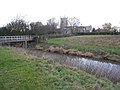
 Bridge over the River Witham - geograph.org.uk - 3084087.jpg 1,024 × 768; 211 KB
-
 Broad Fen Lane - geograph.org.uk - 2124514.jpg 1,024 × 768; 125 KB
-
 Broad Fen Lane - geograph.org.uk - 2731092.jpg 640 × 420; 91 KB
-
 Broad Fen lane - geograph.org.uk - 2827531.jpg 640 × 480; 50 KB
-
 Broad Fen lane - geograph.org.uk - 2974744.jpg 640 × 437; 84 KB
-
 Broad Fen Lane and footbridge - geograph.org.uk - 2124502.jpg 1,024 × 768; 172 KB
-
 Cattle Pen - geograph.org.uk - 1838837.jpg 1,600 × 1,200; 510 KB
-
 Chapel Lane, Claypole - geograph.org.uk - 2827615.jpg 640 × 480; 63 KB
-
 Church Bridge, Barnby in the Willows - geograph.org.uk - 1911704.jpg 1,600 × 1,200; 563 KB
-
 Church of St Peter - geograph.org.uk - 6631759.jpg 902 × 1,024; 96 KB
-
 Churchyard extension, Claypole - geograph.org.uk - 6325254.jpg 1,024 × 768; 225 KB
-
 Claypole - geograph.org.uk - 164767.jpg 640 × 427; 86 KB
-
 Claypole Bridge - geograph.org.uk - 2125507.jpg 1,024 × 768; 220 KB
-
 Claypole Bridge over the River Witham - geograph.org.uk - 4066907.jpg 3,776 × 2,520; 4.28 MB
-
 Claypole Church of England Primary School - geograph.org.uk - 6447166.jpg 1,024 × 768; 178 KB
-
 Claypole Fen in the snow - geograph.org.uk - 2192792.jpg 1,024 × 768; 126 KB
-
 Claypole Fen, Lincolnshire - geograph.org.uk - 389636.jpg 640 × 427; 109 KB
-
 Claypole MMB 01.jpg 4,671 × 2,724; 3.41 MB
-
 Claypole railway level crossing - geograph.org.uk - 2394718.jpg 1,024 × 768; 110 KB
-
 Claypole village across the fields - geograph.org.uk - 2974756.jpg 640 × 416; 72 KB
-
 Claypole Weir, Mill Farm. - geograph.org.uk - 95864.jpg 640 × 480; 153 KB
-
 Claypole, Gateway to Lincolnshire - geograph.org.uk - 2529405.jpg 1,024 × 768; 213 KB
-
 Cone Alone - geograph.org.uk - 2124498.jpg 1,024 × 768; 202 KB
-
 Confluence of two drains near Fen Farm - geograph.org.uk - 6425280.jpg 1,024 × 768; 226 KB
-
 Corner of a field, Claypole Fen - geograph.org.uk - 6684987.jpg 1,024 × 768; 244 KB
-
 Cottages, Barnby Lane - geograph.org.uk - 6447238.jpg 1,024 × 768; 234 KB
-
 Cows grazing by Broad Fen Lane - geograph.org.uk - 2124485.jpg 1,024 × 768; 180 KB
-
 Crop field off Broad Fen Lane - geograph.org.uk - 2827545.jpg 640 × 480; 69 KB
-
 Cross Lane - geograph.org.uk - 1944458.jpg 800 × 600; 111 KB
-
 Cross Lane - geograph.org.uk - 6420359.jpg 1,024 × 768; 204 KB
-
 Cut for silage - geograph.org.uk - 6466051.jpg 1,024 × 768; 264 KB
-
 Cut for silage - geograph.org.uk - 6466053.jpg 1,024 × 757; 174 KB
-
 Cut for silage - geograph.org.uk - 6466054.jpg 1,024 × 768; 274 KB
-
 Dilapidated barn - geograph.org.uk - 1838728.jpg 1,600 × 1,200; 530 KB
-
 Doddington Bridge - geograph.org.uk - 77736.jpg 640 × 480; 172 KB
-
 Drain and footpath to Fenton - geograph.org.uk - 6724550.jpg 1,024 × 768; 213 KB
-
 Drain and plantation, Claypole Fen - geograph.org.uk - 6684988.jpg 1,024 × 768; 196 KB
-
 Drain at the end of Broad Fen Lane - geograph.org.uk - 3779118.jpg 2,256 × 1,504; 2.18 MB
-
 Drain in Claypole Fen - geograph.org.uk - 6428463.jpg 1,024 × 768; 195 KB
-
 East Coast Main line - geograph.org.uk - 2974800.jpg 640 × 403; 73 KB
-
 East Coast Mainline, Claypole. - geograph.org.uk - 95866.jpg 640 × 480; 322 KB
-
 Embankments along the River Witham - geograph.org.uk - 2404015.jpg 640 × 430; 32 KB
-
 Entering Claypole on Doddington Lane - geograph.org.uk - 4066883.jpg 3,776 × 2,520; 3.94 MB
-
 Entering Claypole on Shire Lane - geograph.org.uk - 3304720.jpg 2,256 × 1,504; 1.08 MB
-
 Entrance to Fen Farm - geograph.org.uk - 389664.jpg 640 × 427; 91 KB
-
 Farm track alongside a drain - geograph.org.uk - 6436448.jpg 1,024 × 768; 208 KB
-
 Farm track and drain - geograph.org.uk - 6436449.jpg 1,024 × 768; 239 KB
-
 Farm track, Claypole Fen - geograph.org.uk - 6227767.jpg 1,024 × 768; 122 KB
-
 Farm track, Claypole Fen - geograph.org.uk - 6227769.jpg 1,024 × 768; 163 KB
-
 Farmland - geograph.org.uk - 6631662.jpg 1,024 × 685; 85 KB
-
 Farmland at the end of Broad Fen Lane - geograph.org.uk - 389497.jpg 640 × 427; 97 KB
-
 Farmland near Balderton Crossing - geograph.org.uk - 4230987.jpg 640 × 430; 40 KB
-
 Farmland near Balderton level crossing - geograph.org.uk - 389616.jpg 640 × 480; 123 KB
-
 Farmland near Claypole - geograph.org.uk - 2404003.jpg 640 × 430; 27 KB
-
 Farmland north of Balderton Crossing - geograph.org.uk - 4713196.jpg 1,600 × 696; 124 KB
-
 Farmland off Broad Fen Lane - geograph.org.uk - 2827529.jpg 640 × 480; 64 KB
-
 Farmland off Shire Lane - geograph.org.uk - 2827583.jpg 640 × 480; 65 KB
-
 Farmland off Stubton Road - geograph.org.uk - 2827670.jpg 640 × 480; 48 KB
-
 Farmland, top of Broad Fen Lane - geograph.org.uk - 2827556.jpg 640 × 480; 46 KB
-
 Farmland, top off Broad Fen Lane - geograph.org.uk - 2827567.jpg 640 × 480; 48 KB
-
 Fen Farm, Claypole - geograph.org.uk - 1944497.jpg 800 × 600; 67 KB
-
 Fen Farmhouse, Claypole (geograph 6447228).jpg 1,024 × 768; 252 KB
-
 Field boundary off Broad Fen Lane - geograph.org.uk - 2124511.jpg 1,024 × 768; 182 KB
-
 Field drain top of Broad Fen Lane - geograph.org.uk - 2827563.jpg 640 × 480; 75 KB
-
 Field edge - geograph.org.uk - 2527978.jpg 1,024 × 768; 193 KB
-
 Field edge and drain - geograph.org.uk - 6452678.jpg 1,024 × 768; 169 KB
-

-
 Fishing Pond - geograph.org.uk - 1944479.jpg 800 × 600; 171 KB
-
 Flat farmland, Home Barn Farm - geograph.org.uk - 2404018.jpg 640 × 430; 32 KB
-
 Flat fenland landscape - geograph.org.uk - 2404021.jpg 640 × 244; 13 KB
-
 Flooded drain and flooded field - geograph.org.uk - 6731651.jpg 1,024 × 768; 127 KB
-
 Flooded drain and flooded field - geograph.org.uk - 6731700.jpg 1,024 × 768; 165 KB
-
 Flooded drain and waterlogged field - geograph.org.uk - 6731701.jpg 1,024 × 768; 187 KB
-
 Flooded drain near Barnby - geograph.org.uk - 6321276.jpg 1,024 × 768; 134 KB
-
 Flooded drains near Fenton - geograph.org.uk - 6731704.jpg 1,024 × 768; 179 KB
-
 Flooded field - geograph.org.uk - 6741832.jpg 1,024 × 768; 132 KB
-
 Flooded stubble field - geograph.org.uk - 6731698.jpg 1,024 × 762; 121 KB
-
 Flooded stubble field - geograph.org.uk - 6731711.jpg 1,024 × 738; 95 KB
-
 Fly tip after fire on Stubton Road - geograph.org.uk - 3127930.jpg 1,024 × 768; 143 KB
-
 Footbridge across the River Witham - geograph.org.uk - 6721077.jpg 1,024 × 768; 264 KB
-
 Footbridge and Cross Lane - geograph.org.uk - 6420356.jpg 1,024 × 768; 372 KB
-
 Footbridge near Mill Farm - geograph.org.uk - 2528327.jpg 1,024 × 768; 322 KB
-
 Footbridge on Broad Fen Lane - geograph.org.uk - 2124503.jpg 1,024 × 768; 254 KB
-
 Footbridge over a drain - geograph.org.uk - 6436440.jpg 1,024 × 768; 279 KB
-
 Footbridge over a drain, Broad Fen Lane - geograph.org.uk - 6249064.jpg 1,024 × 768; 148 KB
-
 Footbridge over the Witham (geograph 4066920).jpg 3,776 × 2,520; 4.21 MB
-
 Footpath alongside the railway, Claypole - geograph.org.uk - 6764679.jpg 1,024 × 768; 236 KB
-
 Footpath by the East Coast Main Line - geograph.org.uk - 6447113.jpg 1,024 × 768; 248 KB
-
 Footpath by the river - geograph.org.uk - 6724294.jpg 1,024 × 768; 208 KB
-
 Footpath gate, Holm Lane, Claypole - geograph.org.uk - 6436461.jpg 1,024 × 768; 203 KB
-
 Footpath to Barnby in the Willows - geograph.org.uk - 6465962.jpg 1,024 × 768; 217 KB
-
 Footpath to Barnby in the Willows - geograph.org.uk - 6712882.jpg 1,024 × 768; 322 KB
-
 Footpath to Barnby Lane - geograph.org.uk - 6447178.jpg 1,024 × 768; 209 KB
-
 Footpath to Claypole - geograph.org.uk - 280881.jpg 640 × 427; 86 KB
-
 Footpath to Fenton - geograph.org.uk - 6033774.jpg 1,024 × 768; 198 KB
-
 Footpath to Fenton - geograph.org.uk - 6119774.jpg 1,024 × 768; 189 KB
-
 Footpath to Holm Lane - geograph.org.uk - 6420370.jpg 1,024 × 768; 202 KB
-
 Footpath to Oster Fen Lane - geograph.org.uk - 6447170.jpg 1,024 × 768; 283 KB
-
 Footpath to Oster Fen Lane - geograph.org.uk - 6447172.jpg 1,024 × 768; 358 KB
-
 Footpath to Stubton - geograph.org.uk - 6232573.jpg 1,024 × 768; 138 KB
-
 Former public house in Claypole - geograph.org.uk - 2124521.jpg 1,024 × 768; 111 KB
-
 Former Wesleyan Chapel, Chapel Lane, Claypole - geograph.org.uk - 4066913.jpg 3,776 × 2,520; 4.16 MB
-
 Former Wesleyan Chapel, Claypole - geograph.org.uk - 6764677.jpg 1,024 × 768; 171 KB
-
 Gap in a plantation - geograph.org.uk - 6420426.jpg 1,024 × 768; 181 KB
-
 Gate on a footpath to Holm Lane - geograph.org.uk - 6436454.jpg 1,024 × 768; 322 KB
-

-
 Grass field and Barnby church - geograph.org.uk - 6684991.jpg 1,024 × 768; 167 KB
-
 Grass field and pond, Claypole - geograph.org.uk - 6447108.jpg 1,024 × 768; 185 KB
-

-
 Grass field at Claypole - geograph.org.uk - 6447182.jpg 1,024 × 768; 168 KB
-
 Grass field at Claypole - geograph.org.uk - 6764680.jpg 1,024 × 768; 237 KB
-
 Grass field by the River Witham - geograph.org.uk - 6033796.jpg 1,024 × 768; 208 KB
-
 Grass field off Oster Fen Lane - geograph.org.uk - 6232554.jpg 1,024 × 768; 125 KB
-
 Grass field off Stubton Road - geograph.org.uk - 6561540.jpg 1,024 × 768; 175 KB
-
 Hawthorn in flower by the River Witham - geograph.org.uk - 6465992.jpg 1,024 × 768; 202 KB
-
 Hedge by the ECML - geograph.org.uk - 2403998.jpg 640 × 370; 27 KB
-
 Hedgerow and Trail End Barn - geograph.org.uk - 6685004.jpg 1,024 × 768; 271 KB
-
 Hedgerow off Shire Lane - geograph.org.uk - 2827580.jpg 640 × 480; 66 KB
-
 Here we go again - geograph.org.uk - 6392443.jpg 1,024 × 768; 210 KB
-
 Hidden river - geograph.org.uk - 5564432.jpg 1,024 × 768; 201 KB
-
 Holm Lane - geograph.org.uk - 2528349.jpg 1,024 × 768; 162 KB
-
 Holm Lane - geograph.org.uk - 3781867.jpg 3,000 × 2,157; 6.59 MB
-
 Holm Lane - geograph.org.uk - 4067222.jpg 3,776 × 2,520; 4.1 MB
-
 Holme Barn Farm - geograph.org.uk - 1838777.jpg 1,600 × 1,200; 393 KB
-
 Holme Barn Farm - geograph.org.uk - 2361230.jpg 640 × 430; 30 KB
-
 Holme Barn Farm - geograph.org.uk - 3990429.jpg 1,600 × 1,071; 125 KB
-
 Holme Barn Farm from the railway - geograph.org.uk - 4713203.jpg 1,600 × 711; 114 KB
-
 Hough Lane Crossing - geograph.org.uk - 1944409.jpg 800 × 600; 131 KB
-
 Hough Lane, Claypole - geograph.org.uk - 1944425.jpg 800 × 600; 186 KB
-
 House on the corner of School Lane, Claypole - geograph.org.uk - 6449903.jpg 1,024 × 768; 142 KB
-
 I'm watching you - geograph.org.uk - 6033805.jpg 1,024 × 768; 224 KB
-
 Ice on Broad Fen Lane - geograph.org.uk - 3304585.jpg 2,256 × 1,504; 781 KB
-
 Improvised footbridge - geograph.org.uk - 3671949.jpg 1,024 × 768; 251 KB
-
 In flood again - geograph.org.uk - 6741826.jpg 1,024 × 768; 90 KB
-
 Isthmus at Barnby - geograph.org.uk - 6321273.jpg 1,024 × 768; 175 KB
-
 Just a pile of rubble - geograph.org.uk - 6436468.jpg 1,024 × 768; 178 KB
-
 Late sown barley - geograph.org.uk - 6559860.jpg 1,024 × 768; 202 KB
-
 Level crossing, Stubton Road - geograph.org.uk - 2827663.jpg 640 × 480; 56 KB
-
 Liberty Gate Cottages - geograph.org.uk - 1838802.jpg 1,600 × 1,200; 465 KB
-
 Liberty Gate Crossing, Barnby Lane - geograph.org.uk - 2827621.jpg 640 × 480; 60 KB
-
 Liberty Gate Crossing, Claypole - geograph.org.uk - 4067211.jpg 3,776 × 2,520; 3.89 MB
-
 Local Shop in Claypole - geograph.org.uk - 2124527.jpg 1,024 × 768; 139 KB
-
 Main line towards London - geograph.org.uk - 2827577.jpg 640 × 480; 54 KB
-
 Main line towards London - geograph.org.uk - 2827626.jpg 640 × 480; 65 KB
-
 Main Street, Claypole - geograph.org.uk - 2827660.jpg 640 × 480; 62 KB
-
 Main Street, Claypole - geograph.org.uk - 4066884.jpg 3,776 × 2,520; 3.98 MB
-
 Muddy footpath to Mill Farm - geograph.org.uk - 6325252.jpg 1,024 × 768; 99 KB
-
 New house and old farm buildings - geograph.org.uk - 1838845.jpg 1,600 × 1,200; 360 KB
-
 Odd House Farm - geograph.org.uk - 2361234.jpg 640 × 430; 27 KB
-
 Oilseed rape by River Witham - geograph.org.uk - 6631756.jpg 1,024 × 512; 108 KB
-
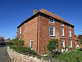
 Old house in Claypole - geograph.org.uk - 2827656.jpg 640 × 480; 87 KB
-
 Ordnance Survey Cut Mark - geograph.org.uk - 4982700.jpg 640 × 538; 137 KB
-
 Ordnance Survey Cut Mark with Bolt - geograph.org.uk - 3889833.jpg 4,000 × 3,000; 4.52 MB
-
 Oster Fen Lane - geograph.org.uk - 1944453.jpg 800 × 600; 108 KB
-
 Oster Fen Lane crossing - geograph.org.uk - 1944445.jpg 800 × 600; 83 KB
-
 Oster Fen Lane Level Crossing - geograph.org.uk - 3306768.jpg 2,256 × 1,504; 914 KB
-
 Overgrown drain in Claypole Fen - geograph.org.uk - 6227758.jpg 1,024 × 768; 198 KB
-
 Partially frozen River Witham - geograph.org.uk - 2192789.jpg 1,024 × 768; 124 KB
-
 Passable with care - geograph.org.uk - 6321277.jpg 1,024 × 768; 165 KB
-
 Passing freight train on the ECML - geograph.org.uk - 2974810.jpg 640 × 408; 61 KB
-
 Plank across a drain - geograph.org.uk - 6420428.jpg 1,024 × 768; 275 KB
-
 Plantations and dyke - geograph.org.uk - 1838741.jpg 1,600 × 1,200; 450 KB
-
 Playground, Claypole Community Park - geograph.org.uk - 6447190.jpg 1,024 × 768; 190 KB
-
 Prepared field near Claypole - geograph.org.uk - 6436471.jpg 1,024 × 768; 241 KB
-
 Railway crossing - geograph.org.uk - 2394715.jpg 1,024 × 768; 137 KB
-
 Railway lines at Balderton Level Crossing - geograph.org.uk - 3781871.jpg 1,929 × 1,326; 1.72 MB
-
 Recent hedge - geograph.org.uk - 6452682.jpg 1,024 × 768; 186 KB
-
 Restricted byway (Barnby Lane) - geograph.org.uk - 6227770.jpg 1,024 × 768; 164 KB


_-_geograph.org.uk_-_2528336.jpg)


.jpg)


.jpg)


_-_geograph.org.uk_-_6227770.jpg)