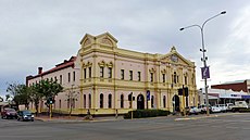
Category:City of Kalgoorlie–Boulder
Jump to navigation
Jump to search
Deutsch: Die City of Kalgoorlie-Boulder ist ein lokales Verwaltungsgebiet (LGA) im australischen Bundesstaat Western Australia. Das Gebiet ist 95.575 km² groß und hat etwa 31.100 Einwohner. (→Kalgoorlie-Boulder City)
English: The City of Kalgoorlie–Boulder is a local government area in the Goldfields–Esperance region of Western Australia, about , and its seat of government is the town of Kalgoorlie; all but 244 of the city's population live in either Kalgoorlie or Boulder. In terms of area, Kalgoorlie–Boulder is the largest city in Australia, and the third-largest city in the world, with a total area of 95,575 km2. (→City of Kalgoorlie–Boulder)
Français : La Cité de Kalgoorlie-Boulder (City of Kalgoorlie-Boulder en anglais) est une zone d'administration locale au sud de l'Australie-Occidentale en Australie à environ à l'est de Perth, la capitale de l'État. (→Cité de Kalgoorlie-Boulder)
Italiano: La Città di Kalgoorlie-Boulder è una delle nove Local Government Areas che si trovano nella regione di Goldfields-Esperance, in Australia Occidentale. Essa si estende su di una superficie di circa 95.575 chilometri quadrati ed ha una popolazione di 28.422 abitanti, la quasi totalità dei quali risiede a Kalgoorlie o a Boulder. (→Città di Kalgoorlie-Boulder)
Nederlands: City of Kalgoorlie-Boulder is een Local Government Area (LGA) in Australië in de staat West-Australië. City of Kalgoorlie-Boulder telt 30.903 inwoners. De hoofdplaats is Kalgoorlie. (→City of Kalgoorlie-Boulder)
Svenska: Kalgoorlie-Boulder är en kommun (City) i regionen Goldfields-Esperance i Western Australia. Kommunen har en yta på 95 575 km², och en folkmängd på 31 107 enligt 2011 års folkräkning. Huvudort är Kalgoorlie. Förutom 266 personer bor hela kommunens befolkning i Kalgoorlie, eller någon av dess förorter, av vilka Boulder är den största. (→Kalgoorlie-Boulder City)
local government area in Western Australia | |||||
| Upload media | |||||
| Instance of | |||||
|---|---|---|---|---|---|
| Location | |||||
| Inception |
| ||||
| Population |
| ||||
| Elevation above sea level |
| ||||
| official website | |||||
 | |||||
Subcategories
This category has the following 13 subcategories, out of 13 total.
Media in category "City of Kalgoorlie–Boulder"
The following 5 files are in this category, out of 5 total.
-
AUS Perth, Vincent, Charles Street 004.jpg 3,024 × 4,032; 2.76 MB
-
CSIRO ScienceImage 1226 Ore Truck at the Silver Swan Nickel Mine.jpg 2,657 × 1,774; 1.74 MB
-
Kalgoorlie-history.svg 583 × 598; 18 KB
-
Welcome to City of Kalgoorlie Boulder sign, WA, 2023.jpg 2,295 × 1,803; 2.15 MB
-
Wiped-out 4WD - panoramio.jpg 2,272 × 1,704; 919 KB


