Category:City and town maps of England by John Speed
Jump to navigation
Jump to search
Media in category "City and town maps of England by John Speed"
The following 25 files are in this category, out of 25 total.
-
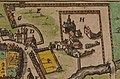 1611 John Speed Reading Abbey.jpg 1,024 × 676; 539 KB
-
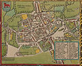
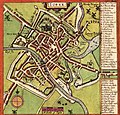 A map of York england.jpg 964 × 927; 438 KB
-
 Bedford - John Speed's map (1611).jpg 491 × 383; 113 KB
-
 Canterbury map, 1610.png 1,165 × 1,186; 3.31 MB
-
 Durham 1610.jpg 400 × 419; 31 KB
-
 Hull. 1611 John Speed in The Theatre of the Empire of Great Britaine.jpg 632 × 591; 136 KB
-
 Ipswich by John Speed, 1610 (1850 facsimile).jpg 2,048 × 1,555; 1.65 MB
-
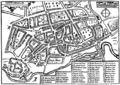 John Speed - Map of Nottingham 1610.gif 650 × 459; 102 KB
-
 John speed 1605 map oxford gropecunt.jpg 827 × 659; 236 KB
-
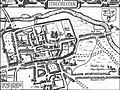 John Speed Colchester 1610.jpg 463 × 348; 54 KB
-
 John Speed map of Lancaster (1610).png 656 × 523; 872 KB
-
 John Speed's map of Oxford, 1605..jpg 2,497 × 2,018; 1.5 MB
-
 FLEURY (1891) p.629 - Map of Lancaster.jpg 2,400 × 1,975; 909 KB
-
 Maidstone-John Speed-1616.gif 328 × 256; 35 KB
-
 Map of Coventry, cropped from Warwickshire - John Speed Map 1610.jpg 1,680 × 1,326; 2.08 MB
-
 Map of Lichfield - John Speed map 1610.jpg 1,662 × 1,244; 628 KB
-
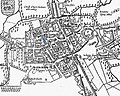
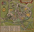 Map of Northampton, 1610, John Speed.jpg 1,774 × 1,656; 1.95 MB
-
 Map of Redding by John Speed, 1611.jpg 3,163 × 2,800; 2.13 MB
-
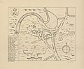
 Map of Southampton Castle.jpg 435 × 630; 70 KB
-
 Map of Stafford - John Speed map 1610.jpg 1,532 × 1,210; 581 KB
-
 Map of Warwick, cropped from Warwickshire - John Speed Map 1610.jpg 1,750 × 1,360; 2.13 MB
-
 Speed baths.jpg 500 × 424; 131 KB
-
 Speeds plan of Ely 1610 from Dorman 1986.jpg 2,598 × 2,371; 716 KB
-
 Worcester 1610 map trimmed.jpg 775 × 596; 247 KB
-
 Worcester, 1610 map.jpg 775 × 726; 293 KB


.jpg)


.jpg)


.png)

_p.629_-_Map_of_Lancaster.jpg)


