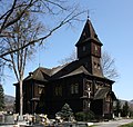
Category:Church of the Exaltation of the Holy Cross (Bystřice)
Jump to navigation
Jump to search
| Object location | | View all coordinates using: OpenStreetMap |
|---|
church in Frýdek-Místek District of Moravian Silesian region | |||||
| Upload media | |||||
| Instance of | |||||
|---|---|---|---|---|---|
| Named after | |||||
| Made from material | |||||
| Location | Bystřice, Frýdek-Místek District, Moravian-Silesian Region, Czechia | ||||
| Architectural style | |||||
| Diocese | |||||
| Heritage designation | |||||
| Religion or worldview | |||||
 | |||||
|
This is a category about a cultural monument of the Czech Republic,
number: 39745/8-645. |
Čeština: Kostel Povýšení sv. Kříže, Bystřice, 1899 r.
Polski: Kościół Podwyższenia Krzyża Świętego, Bystrzyca, 1899 r.
Media in category "Church of the Exaltation of the Holy Cross (Bystřice)"
The following 18 files are in this category, out of 18 total.
-
Bystrzyca-kat-kosciol 2.jpg 800 × 600; 160 KB
-
Bystrzyca-kat-kosciol.jpg 480 × 640; 153 KB
-
Bystřice nad Olší, kostel (2012).JPG 2,877 × 2,724; 2.6 MB
-
Bystřice nad Olší, kostel a jeho okolí (1).JPG 3,159 × 2,300; 684 KB
-
Bystřice nad Olší, kostel a jeho okolí (10).JPG 3,684 × 2,480; 3.18 MB
-
Bystřice nad Olší, kostel a jeho okolí (11).JPG 2,592 × 3,888; 4.67 MB
-
Bystřice nad Olší, kostel a jeho okolí (12).JPG 2,578 × 3,576; 730 KB
-
Bystřice nad Olší, kostel a jeho okolí (3).JPG 3,888 × 2,592; 4.6 MB
-
Bystřice nad Olší, kostel a jeho okolí (4).JPG 2,592 × 3,888; 3.75 MB
-
Bystřice nad Olší, kostel a jeho okolí (5).JPG 2,526 × 3,425; 1.04 MB
-
Bystřice nad Olší, kostel a jeho okolí (6).JPG 2,460 × 2,517; 657 KB
-
Bystřice nad Olší, kostel a jeho okolí (7).JPG 3,888 × 2,592; 2.71 MB
-
Bystřice nad Olší, kostel a jeho okolí (8).JPG 2,559 × 3,613; 984 KB
-
Bystřice nad Olší, kostel a jeho okolí (9).JPG 2,592 × 3,888; 3.41 MB
-
Bystřice nad Olší, kostel a jeho okolí.JPG 2,592 × 3,662; 1.07 MB
-
Bystřice1 397458-645.jpg 3,888 × 2,592; 3.05 MB
-
Bystřice2 397458-645.jpg 2,592 × 3,888; 6.28 MB
-
Kościół katolicki w Bystrzycy.jpg 750 × 1,334; 284 KB


