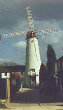
Category:Cholesbury
Jump to navigation
Jump to search
village in United Kingdom | |||||
| Upload media | |||||
| Instance of | |||||
|---|---|---|---|---|---|
| Location | Cholesbury-cum-St Leonards, Buckinghamshire, South East England, England | ||||
| official website | |||||
 | |||||
English: Cholesbury (recorded as Chelwardisbyry in the 13th century) is a village in Buckinghamshire, England, on the border with Hertfordshire. It is situated in the Chiltern Hills, about from Berkhamsted.
Subcategories
This category has the following 3 subcategories, out of 3 total.
C
- Cholesbury Camp (12 F)
- Cholesbury Windmill (6 F)
L
Media in category "Cholesbury"
The following 24 files are in this category, out of 24 total.
-
A droopy tree, Cholesbury Common - geograph.org.uk - 106853.jpg 480 × 640; 101 KB
-
An Old Orchard near Cholesbury Camp - geograph.org.uk - 1200200.jpg 480 × 640; 172 KB
-
Cholesbury - Cottage - geograph.org.uk - 188688.jpg 640 × 480; 119 KB
-
Cholesbury Telephone Exchange - geograph.org.uk - 1085690.jpg 640 × 480; 107 KB
-
Cholesbury Village Hall - geograph.org.uk - 1201157.jpg 640 × 480; 120 KB
-
Cholesbury village hall.jpg 640 × 480; 265 KB
-
GOC Cholesbury to Chartridge 052 Full Moon pub, Cholesbury (44792052302).jpg 4,428 × 3,324; 4.88 MB
-
Old Houses at Cholesbury - geograph.org.uk - 1200210.jpg 640 × 480; 190 KB
-
The droopy tree in Spring - geograph.org.uk - 164369.jpg 482 × 640; 93 KB
-
The Duck Pond, Cholesbury - geograph.org.uk - 106758.jpg 640 × 480; 122 KB
-
Village sign at Cholesbury - geograph.org.uk - 28032.jpg 640 × 479; 47 KB
-
Braziers End Pool - geograph.org.uk - 164448.jpg 480 × 640; 146 KB
-
Bridleway to Leylands Farm - geograph.org.uk - 464243.jpg 640 × 480; 213 KB
-
Curved Wall, Longcroft - geograph.org.uk - 464245.jpg 480 × 640; 224 KB


