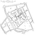
Category:Cholera maps
Jump to navigation
Jump to search
Subcategories
This category has the following 2 subcategories, out of 2 total.
- World maps of cholera (4 F)
E
Media in category "Cholera maps"
The following 40 files are in this category, out of 40 total.
-
A map taken from a report by Dr. John Snow Wellcome L0072917.jpg 4,757 × 4,418; 3.74 MB
-
Actual & supposed routes of Cholera from Hindoostan to Europe Wellcome L0041104.jpg 4,008 × 2,672; 2.54 MB
-
Actual & supposed routes of Cholera from Hindoostan to Europe Wellcome L0074539.jpg 5,802 × 4,145; 6.63 MB
-
Africa cholera2008b.jpg 650 × 692; 68 KB
-
Area around Golden Square during Cholera Epidemic. Wellcome L0005796.jpg 2,900 × 3,804; 2.96 MB
-
Cholera asia 1961.png 800 × 929; 245 KB
-
Cholera in London 1866.gif 459 × 348; 202 KB
-
Cholera Jemen Inzidenzrate.png 1,522 × 882; 137 KB
-
Cholera Map of the Metropolis 1849 Wellcome L0071630.jpg 7,782 × 5,142; 8.19 MB
-
Choleramaplondon1866.png 439 × 64; 3 KB
-
Dr. John Snow Cholera Map.svg 3,045 × 2,840; 344 KB
-
First cholera pandemic - Southeast Asia.PNG 741 × 743; 327 KB
-
First cholera pandemic - Southwest Asia and Eastern Africa.PNG 749 × 745; 425 KB
-
First cholera pandemic-India.PNG 700 × 709; 175 KB
-
German map showing the path of cholera in Poland, 1831. Wellcome L0076254.jpg 6,385 × 5,848; 12.68 MB
-
Haiti Cholera 2010.svg 698 × 526; 291 KB
-
J. Kennedy, The History of the contagious Wellcome M0012982.jpg 3,756 × 2,826; 1.83 MB
-
Map Exhibiting the Progress of the Late Epidemic Cholera... Wellcome L0071628.jpg 6,160 × 4,654; 5.43 MB
-
Map of England showing prevalence of cholera, 1849 Wellcome L0039174.jpg 3,760 × 4,653; 9.8 MB
-
Map of Soho showing deaths from Cholera, 1854. Wellcome L0003055.jpg 3,047 × 3,426; 4.7 MB
-
Map of the Parish of Bethnal Green, Shewing the Cholera Mist Wellcome L0071632.jpg 5,765 × 3,856; 5.32 MB
-
Map showing deaths from Cholera in Broad Street... Wellcome L0063431.jpg 5,064 × 4,856; 4.92 MB
-
Map showing the intimate mixture of the water supply... Wellcome L0063432.jpg 6,004 × 4,896; 8.97 MB
-
Map showing the route of cholera infection through Asia Wellcome L0074533.jpg 5,084 × 3,316; 4.45 MB
-
Marche de l’épidémie cholérique de 1902 à 1910.png 1,582 × 1,358; 969 KB
-
Plan Showing the Ascertained Deaths from Cholera Wellcome L0072142.jpg 5,777 × 7,749; 6.83 MB
-
Plan Showing the Ascertained Deaths from Cholera... Wellcome L0071633.jpg 5,347 × 7,463; 6.41 MB
-
Plan showing the deaths from cholera, London, 1854 Wellcome L0011183.jpg 4,031 × 5,363; 3.26 MB
-
Snow-cholera-map-1.jpg 20,124 × 18,877; 18.38 MB
-
Snow-cholera-map.jpg 889 × 869; 248 KB
-
Title Reports of the medical officer... Wellcome L0071559.jpg 7,595 × 5,428; 9.23 MB
-
План Саратова 1892 года.jpg 1,400 × 1,005; 252 KB


