Category:Chinese maps of Tibet
Jump to navigation
Jump to search
Media in category "Chinese maps of Tibet"
The following 10 files are in this category, out of 10 total.
-
 'Front of Tibet' Map Painted by Wu Run-De (1907).jpg 1,000 × 827; 299 KB
-
 1943 Inside wartime China.jpg 295 × 403; 27 KB
-
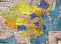 China old map 1936.jpg 1,067 × 761; 417 KB
-
 Japanese Map of Shina in 1938.jpg 2,903 × 2,496; 4.59 MB
-
 Map of Huoqing zhou, in Lijiang Prefecture, Yunnan Provonce Wellcome L0031302.jpg 3,664 × 3,028; 4.23 MB
-

-
 Map of Tibet detail from China old map 1936 (cropped).jpg 504 × 391; 115 KB
-
 Map of Tibet detail from Japanese Map of China in 1938 (cropped).jpg 1,357 × 851; 579 KB
-
 亚新地学社1936年《袖珍中华全图》--04全国政区.jpg 2,151 × 1,540; 622 KB
-
 亚新地学社1936年《袖珍中华全图》--35西藏地方.jpg 2,157 × 1,543; 769 KB
.jpg)


.JPG)
.jpg)
.jpg)

