Category:Chinese-language maps of Africa
Jump to navigation
Jump to search
Temperate regions: North America · South America · Africa · Europe · Asia · – Polar regions: – Other regions:
Media in category "Chinese-language maps of Africa"
The following 23 files are in this category, out of 23 total.
-
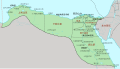
 Africa colonization 1914.PNG 348 × 509; 33 KB
-
 African continent-繁體中文.png 1,595 × 1,470; 659 KB
-
 Al-map.jpg 323 × 347; 18 KB
-
 Angola provinces chinese.png 500 × 566; 25 KB
-
 Azawad map-chinese.jpg 660 × 706; 126 KB
-
 Daerfuer-ditu-zh.png 330 × 355; 66 KB
-
 Dioecesis Aegypti 400 AD-zh.svg 1,313 × 750; 210 KB
-
 Feizhou-guanfang-yuyan-zh.png 360 × 392; 31 KB
-
 Feizhou-yuxi-zh (fanti).svg 600 × 657; 579 KB
-
 Feizhou-yuxi-zh (jianti).svg 600 × 657; 519 KB
-
 Giza pyramid complex (map)-zh.svg 1,204 × 1,177; 286 KB
-
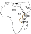 Great-Rift-Valley-Location.png 230 × 253; 5 KB
-
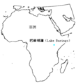 Lake-Baringo.png 300 × 330; 13 KB
-
 Libyan war final zh.svg 1,100 × 1,100; 100 KB
-
 Map of Djibouti in Chinese.png 1,361 × 1,337; 2.97 MB
-
 Map of traditional provinces of Libye-zh.svg 969 × 929; 104 KB
-
 Nigerienne Departments in Roman script and in Chinese scriptzh.png 535 × 425; 31 KB
-
 Nirierhe liuyu-zh.png 900 × 566; 119 KB
-
 Sierra Leone Districts zh en.png 482 × 474; 26 KB
-
 Sudan-ditu-zh.png 330 × 355; 59 KB
-
 Timbuktu.png 350 × 376; 151 KB
-
 塔朱拉灣.png 478 × 666; 135 KB
-
 阿坎族分布地圖.gif 1,237 × 1,276; 127 KB


.svg)
.svg)
-zh.svg)


