Category:Chilton Trinity
Jump to navigation
Jump to search
English: Chilton Trinity is a village and civil parish on the River Parrett, north of Bridgwater in the Sedgemoor district of Somerset, England.
village in the United Kingdom | |||||
| Upload media | |||||
| Instance of | |||||
|---|---|---|---|---|---|
| Location | Sedgemoor, Somerset, South West England, England | ||||
| Population |
| ||||
| Said to be the same as | Chilton Trinity (Wikimedia duplicated page, civil parish) | ||||
 | |||||
Media in category "Chilton Trinity"
The following 155 files are in this category, out of 155 total.
-
30 on Chilton Road, Bridgwater - geograph.org.uk - 5390770.jpg 800 × 669; 152 KB
-
A long view towards Brent Knoll - geograph.org.uk - 2407675.jpg 640 × 430; 97 KB
-
Agricultural buildings - geograph.org.uk - 2407676.jpg 640 × 430; 97 KB
-
Approaching Dairy House Farm - geograph.org.uk - 2406153.jpg 640 × 430; 97 KB
-
Arable crop by the River Parrett - geograph.org.uk - 2407684.jpg 640 × 430; 96 KB
-
Archstone Avenue, Chilton Trinity - geograph.org.uk - 5341602.jpg 800 × 556; 101 KB
-
Banks of the River Parrett - geograph.org.uk - 2407750.jpg 640 × 430; 94 KB
-
Barn at Chilton Farm - geograph.org.uk - 4425291.jpg 1,024 × 768; 173 KB
-
Bend in the Parrett - geograph.org.uk - 2369288.jpg 640 × 462; 49 KB
-
Bridgwater , Footpath - geograph.org.uk - 5797348.jpg 6,000 × 4,000; 5.61 MB
-
Bridgwater , Saltlands Lane - geograph.org.uk - 5797345.jpg 6,000 × 4,000; 6 MB
-
Bridgwater Business Park - geograph.org.uk - 2369221.jpg 640 × 384; 36 KB
-
Buildings at Dunball Wharf - geograph.org.uk - 2407753.jpg 640 × 430; 91 KB
-
Cattle waterer - geograph.org.uk - 2407739.jpg 640 × 430; 94 KB
-
Chilton Moor Lane, Bridgwater - geograph.org.uk - 5391415.jpg 800 × 718; 151 KB
-
Chilton Park name sign, Bridgwater - geograph.org.uk - 5391475.jpg 640 × 555; 109 KB
-
Chilton Park, Bridgwater - geograph.org.uk - 5391500.jpg 800 × 562; 101 KB
-
Chilton Trinity , Brickworks Road - geograph.org.uk - 5796236.jpg 6,000 × 4,000; 7.34 MB
-
Chilton Trinity , Brickworks Road - geograph.org.uk - 5797391.jpg 6,000 × 4,000; 5.88 MB
-
Chilton Trinity , Brickworks Road - geograph.org.uk - 5797393.jpg 6,000 × 4,000; 5.98 MB
-
Chilton Trinity , Play Area - geograph.org.uk - 5796239.jpg 6,000 × 4,000; 6.58 MB
-
Chilton Trinity , Squares Road - geograph.org.uk - 5796240.jpg 6,000 × 4,000; 5.52 MB
-
Chilton Trinity , Squares Road - geograph.org.uk - 5796242.jpg 6,000 × 4,000; 7.28 MB
-
Chilton Trinity Church - geograph.org.uk - 450650.jpg 640 × 480; 88 KB
-
Chilton Trinity Village Hall - geograph.org.uk - 5341141.jpg 800 × 476; 70 KB
-
Chinehorn Rhyne - geograph.org.uk - 2369054.jpg 640 × 474; 83 KB
-
Chinehorn Rhyne - geograph.org.uk - 2369147.jpg 640 × 480; 106 KB
-
Chinehorn Rhyne - geograph.org.uk - 2369154.jpg 640 × 480; 102 KB
-
Chinehorn Rhyne - geograph.org.uk - 2369166.jpg 640 × 471; 92 KB
-
Chinehorn Rhyne - geograph.org.uk - 2370453.jpg 480 × 640; 91 KB
-
Chinehorn Rhyne - geograph.org.uk - 2370511.jpg 480 × 640; 97 KB
-
Church Cottages, Chilton Trinity - geograph.org.uk - 5341565.jpg 800 × 600; 110 KB
-
Cross, Chilton Trinity.jpg 2,631 × 1,354; 541 KB
-
Dairy House Farm - geograph.org.uk - 2370499.jpg 640 × 454; 89 KB
-
Dairy House Farm - geograph.org.uk - 2407667.jpg 640 × 430; 96 KB
-
Dairy House Farm - geograph.org.uk - 2407671.jpg 640 × 430; 94 KB
-
Dairy House Farm - geograph.org.uk - 4425317.jpg 1,024 × 768; 237 KB
-
Dunball Wharf - geograph.org.uk - 2407756.jpg 640 × 430; 96 KB
-
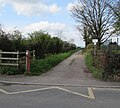
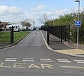
End of cycle route, Chilton Trinity - geograph.org.uk - 5341193.jpg 800 × 800; 190 KB
-
Entrance to Chilton Park, Bridgwater - geograph.org.uk - 5391467.jpg 800 × 600; 135 KB
-
Fence, Starslands Clyce - geograph.org.uk - 2369216.jpg 517 × 640; 110 KB
-
Field gate - geograph.org.uk - 2407722.jpg 640 × 430; 95 KB
-
Fishing ponds - geograph.org.uk - 2407698.jpg 640 × 430; 92 KB
-
Fishing ponds - geograph.org.uk - 2407709.jpg 640 × 430; 92 KB
-
Footbridge, Starslands Clyce - geograph.org.uk - 2369190.jpg 640 × 446; 85 KB
-
Former brickworks, Chilton Trinity - geograph.org.uk - 1769566.jpg 640 × 480; 98 KB
-
Grabham Farm Chilton Trinity - geograph.org.uk - 450662.jpg 640 × 480; 95 KB
-
Grange Farm - geograph.org.uk - 2371008.jpg 640 × 455; 89 KB
-
Groom House Farm - geograph.org.uk - 4425166.jpg 1,024 × 856; 175 KB
-
Holy Trinity church, Chilton Trinity - geograph.org.uk - 5341478.jpg 800 × 676; 140 KB
-
House building development - geograph.org.uk - 4425296.jpg 1,024 × 768; 172 KB
-
Lane west of Chilton Trinity - geograph.org.uk - 2370569.jpg 640 × 473; 105 KB
-
Lane west of Chilton Trinity - geograph.org.uk - 2370646.jpg 640 × 484; 87 KB
-
Lower Lakes housing estate - geograph.org.uk - 4425307.jpg 1,024 × 768; 240 KB
-
Manor Farm - geograph.org.uk - 4425174.jpg 1,024 × 768; 189 KB
-
Meadow Close, Chilton Trinity - geograph.org.uk - 5341126.jpg 800 × 504; 100 KB
-
Mud banks in the River Parrett - geograph.org.uk - 2407679.jpg 640 × 430; 96 KB
-
Mud by the Parrett - geograph.org.uk - 2369310.jpg 640 × 480; 92 KB
-
Mud island in the Parrett - geograph.org.uk - 2369382.jpg 640 × 469; 88 KB
-
Narrow field, Chilton Trinity - geograph.org.uk - 2884631.jpg 640 × 480; 272 KB
-
Nine Streams Reach - geograph.org.uk - 2369354.jpg 640 × 425; 78 KB
-
Pillbox and navigation beacon - geograph.org.uk - 2407726.jpg 640 × 430; 93 KB
-
Pillbox near Dunball Wharf - geograph.org.uk - 2407760.jpg 640 × 430; 94 KB
-
Restricted byway - geograph.org.uk - 2407668.jpg 640 × 430; 96 KB
-
Rhyne and flowering verges - geograph.org.uk - 2407704.jpg 640 × 430; 97 KB
-
Rhyne near Chilton Trinity - geograph.org.uk - 2370583.jpg 640 × 429; 82 KB
-
Rhyne near Starslands Clyce - geograph.org.uk - 2407742.jpg 640 × 430; 94 KB
-
Rhyne, Chilton Trinity - geograph.org.uk - 2370533.jpg 640 × 468; 90 KB
-
River Parrett - geograph.org.uk - 2407720.jpg 640 × 430; 93 KB
-
River Parrett - geograph.org.uk - 2407762.jpg 640 × 430; 95 KB
-
River Parrett near Chilton Trinity - geograph.org.uk - 1606476.jpg 640 × 385; 59 KB
-
Road past Church View, Chilton Trinity - geograph.org.uk - 5341640.jpg 800 × 686; 130 KB
-
Sedgemoor , Bridgwater Business Park - geograph.org.uk - 5796354.jpg 6,000 × 4,000; 7.44 MB
-
Sedgemoor , Chinehorn Drove - geograph.org.uk - 5796367.jpg 6,000 × 4,000; 6.66 MB
-
Sedgemoor , Chinehorn Drove - geograph.org.uk - 5796376.jpg 6,000 × 4,000; 5.76 MB
-
Sedgemoor , Chinehorn Drove - geograph.org.uk - 5796380.jpg 6,000 × 4,000; 5.86 MB
-
Sedgemoor , Chinehorn Drove - geograph.org.uk - 5796391.jpg 6,000 × 4,000; 5.79 MB
-
Sedgemoor , Chinehorn Drove - geograph.org.uk - 5796394.jpg 6,000 × 4,000; 6.7 MB
-
Sedgemoor , Chinehorn Drove - geograph.org.uk - 5796399.jpg 6,000 × 4,000; 6.67 MB
-
Sedgemoor , Country Lane - geograph.org.uk - 5796407.jpg 6,000 × 4,000; 6.91 MB
-
Sedgemoor , Dairy House Farm - geograph.org.uk - 5796408.jpg 6,000 × 4,000; 6.5 MB
-
Sedgemoor , Footpath - geograph.org.uk - 5797352.jpg 6,000 × 4,000; 7.71 MB
-
Sedgemoor , Footpath - geograph.org.uk - 5797354.jpg 6,000 × 4,000; 5.51 MB
-
Sedgemoor , Grassy Field - geograph.org.uk - 5796314.jpg 6,000 × 4,000; 4.89 MB
-
Sedgemoor , Grassy Field - geograph.org.uk - 5796353.jpg 6,000 × 4,000; 7.58 MB
-
Sedgemoor , Grassy Field - geograph.org.uk - 5796357.jpg 6,000 × 4,000; 5.6 MB
-
Sedgemoor , Grassy Field - geograph.org.uk - 5796361.jpg 6,000 × 4,000; 5.67 MB
-
Sedgemoor , Grassy Field - geograph.org.uk - 5796365.jpg 6,000 × 4,000; 7.61 MB
-
Sedgemoor , Grassy Field - geograph.org.uk - 5796366.jpg 6,000 × 4,000; 7.57 MB
-
Sedgemoor , Grassy Field ^ Cattle - geograph.org.uk - 5796383.jpg 6,000 × 4,000; 5.56 MB
-
Sedgemoor , Grassy Field ^ Cattle - geograph.org.uk - 5796386.jpg 6,000 × 4,000; 6.18 MB
-
Sedgemoor , Grassy Field ^ Cattle - geograph.org.uk - 5796387.jpg 6,000 × 4,000; 5.74 MB
-
Sedgemoor , Grassy Field ^ Cattle - geograph.org.uk - 5796401.jpg 6,000 × 4,000; 7.23 MB
-
Sedgemoor , Grassy Field ^ Cattle - geograph.org.uk - 5796402.jpg 6,000 × 4,000; 5.87 MB
-
Sedgemoor , Grassy Field ^ Cattle - geograph.org.uk - 5796404.jpg 6,000 × 4,000; 5.92 MB
-
Sedgemoor , Grassy Field ^ Cattle - geograph.org.uk - 5796405.jpg 6,000 × 4,000; 5.96 MB
-
Sedgemoor , Grassy Field ^ Gate - geograph.org.uk - 5796397.jpg 6,000 × 4,000; 6.85 MB
-
Sedgemoor , Grassy Field ^ Pylon - geograph.org.uk - 5796316.jpg 4,000 × 6,000; 5.09 MB
-
Sedgemoor , Grassy Field ^ Pylon - geograph.org.uk - 5796317.jpg 6,000 × 4,000; 7.76 MB
-
Sedgemoor , Grassy Field ^ Sheep - geograph.org.uk - 5796244.jpg 6,000 × 4,000; 6.68 MB
-
Sedgemoor , Grassy Field ^ Sheep - geograph.org.uk - 5796245.jpg 6,000 × 4,000; 5.63 MB
-
Sedgemoor , Grassy Field ^ Sheep - geograph.org.uk - 5796275.jpg 6,000 × 4,000; 6.52 MB
-
Sedgemoor , Grassy Field ^ Tractor - geograph.org.uk - 5796369.jpg 6,000 × 4,000; 6.96 MB
-
Sedgemoor , Grassy Footpath - geograph.org.uk - 5796319.jpg 6,000 × 4,000; 6.34 MB
-
Sedgemoor , Pims Pill - geograph.org.uk - 5796300.jpg 6,000 × 4,000; 5.81 MB
-
Sedgemoor , Pims Pill - geograph.org.uk - 5796302.jpg 6,000 × 4,000; 7.02 MB
-
Sedgemoor , River Parrett - geograph.org.uk - 5796282.jpg 6,000 × 4,000; 6.37 MB
-
Sedgemoor , River Parrett - geograph.org.uk - 5796283.jpg 6,000 × 4,000; 6.34 MB
-
Sedgemoor , River Parrett - geograph.org.uk - 5796286.jpg 6,000 × 4,000; 5.73 MB
-
Sedgemoor , River Parrett - geograph.org.uk - 5796304.jpg 6,000 × 4,000; 7.66 MB
-
Sedgemoor , River Parrett - geograph.org.uk - 5796306.jpg 6,000 × 4,000; 5.51 MB
-
Sedgemoor , River Parrett - geograph.org.uk - 5796308.jpg 6,000 × 4,000; 4.96 MB
-
Sedgemoor , River Parrett - geograph.org.uk - 5796310.jpg 6,000 × 4,000; 7.3 MB
-
Sedgemoor , River Parrett - geograph.org.uk - 5796312.jpg 6,000 × 4,000; 6.34 MB
-
Sedgemoor , River Parrett - geograph.org.uk - 5796323.jpg 6,000 × 4,000; 5.53 MB
-
Sedgemoor , River Parrett - geograph.org.uk - 5796334.jpg 6,000 × 4,000; 7.03 MB
-
Sedgemoor , River Parrett - geograph.org.uk - 5796336.jpg 6,000 × 4,000; 5.44 MB
-
Sedgemoor , River Parrett - geograph.org.uk - 5796338.jpg 6,000 × 4,000; 5.62 MB
-
Sedgemoor , River Parrett - geograph.org.uk - 5796340.jpg 6,000 × 4,000; 7.14 MB
-
Sedgemoor , River Parrett - geograph.org.uk - 5796343.jpg 6,000 × 4,000; 7.23 MB
-
Sedgemoor , River Parrett - geograph.org.uk - 5796356.jpg 6,000 × 4,000; 6.03 MB
-
Sedgemoor , River Parrett - geograph.org.uk - 5796359.jpg 6,000 × 4,000; 5.94 MB
-
Sedgemoor , River Parrett - geograph.org.uk - 5797357.jpg 6,000 × 4,000; 5.76 MB
-
Sedgemoor , River Parrett - geograph.org.uk - 5797359.jpg 6,000 × 4,000; 5.91 MB
-
Sedgemoor , River Parrett - geograph.org.uk - 5797388.jpg 6,000 × 4,000; 5.5 MB
-
Sedgemoor , River Parrett - geograph.org.uk - 5797389.jpg 6,000 × 4,000; 7.8 MB
-
Sedgemoor , Sheep Grazing - geograph.org.uk - 5796274.jpg 6,000 × 4,000; 6.89 MB
-
Starslands Clyce - geograph.org.uk - 2407745.jpg 640 × 430; 94 KB
-
The Exchange, Express Park - geograph.org.uk - 4294550.jpg 640 × 470; 93 KB
-
The Long Drove, Chilton Trinity - geograph.org.uk - 1001083.jpg 640 × 480; 187 KB
-
Toolstation Bridgwater. - geograph.org.uk - 115558.jpg 640 × 480; 90 KB
-
Trinity Waters commercial fishing lakes - geograph.org.uk - 4425301.jpg 1,024 × 768; 252 KB
-
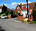
Village phonebox, Chilton Trinity - geograph.org.uk - 5341177.jpg 800 × 684; 167 KB
-
Dairy House Farm - geograph.org.uk - 120971.jpg 640 × 426; 120 KB
-
Field and M5 - geograph.org.uk - 124678.jpg 640 × 426; 119 KB
-
Rhyne and Pylon - geograph.org.uk - 120968.jpg 640 × 426; 134 KB
-
Rickety Bridge. - geograph.org.uk - 120850.jpg 640 × 426; 185 KB
-
Summer buttercups - geograph.org.uk - 447735.jpg 640 × 480; 97 KB


