Category:Chiltern Main Line
Jump to navigation
Jump to search
British railway line | |||||
| Upload media | |||||
| Instance of |
| ||||
|---|---|---|---|---|---|
| Part of |
| ||||
| Named after | |||||
| Location | Greater London, London, England | ||||
| Owned by | |||||
| Operator | |||||
| Has part(s) |
| ||||
| Date of official opening |
| ||||
| Length |
| ||||
| Terminus | |||||
| |||||
Subcategories
This category has the following 51 subcategories, out of 51 total.
A
- Ardley Tunnel (3 F)
- Aynho Junction (11 F)
B
- Beaconsfield railway station (16 F)
- Brill Tunnel (2 F)
C
- Chalfont Viaduct (21 F)
D
- Denham railway station (86 F)
- Dorridge railway station (25 F)
E
G
- Gerrards Cross Tunnel (9 F)
H
L
- Lapworth railway station (14 F)
M
N
O
P
S
- Saunderton railway station (11 F)
T
W
Media in category "Chiltern Main Line"
The following 74 files are in this category, out of 74 total.
-
Approaching High Wycombe station - geograph.org.uk - 1506657.jpg 640 × 480; 103 KB
-
Approaching Wycombe station - geograph.org.uk - 1235842.jpg 640 × 458; 92 KB
-
Ardley station 2001.JPG 1,724 × 1,172; 1.67 MB
-
B&ojr.png 903 × 1,437; 94 KB
-
Bicester South West Chord in 2015.JPG 1,366 × 820; 355 KB
-
Birmingham to Bicester Railway - geograph.org.uk - 345051.jpg 640 × 480; 237 KB
-
Bradenham Road Bridge.jpg 4,000 × 3,000; 5.48 MB
-
Bridge over the M40 at Banbury - geograph.org.uk - 1334845.jpg 640 × 427; 70 KB
-
Buckinghamshire railways, 1880.png 1,053 × 745; 171 KB
-
Chiltern Line Train - geograph.org.uk - 87685.jpg 640 × 480; 151 KB
-
Chiltern Main Line in Myton - geograph.org.uk - 3180004.jpg 640 × 480; 117 KB
-
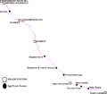
Chiltern Main Line map.png 866 × 761; 114 KB
-
Chiltern Main Line map.svg 866 × 772; 16 KB
-
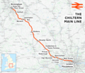
Chiltern Main Line.png 2,098 × 1,822; 4.17 MB
-
Claydon railway crossing - geograph.org.uk - 460962.jpg 640 × 477; 78 KB
-
Disused Tunnel (6185638894).jpg 1,600 × 1,067; 289 KB
-
Gavray Junction in 2015.JPG 1,366 × 820; 417 KB
-
Give Peas a chance! (geograph 2391585).jpg 640 × 398; 57 KB
-
GWR Main Line - geograph.org.uk - 11482.jpg 640 × 480; 101 KB
-
Heading west out of High Wycombe - geograph.org.uk - 1196863.jpg 640 × 480; 102 KB
-
Indecisive Junction - geograph.org.uk - 13485.jpg 640 × 480; 102 KB
-
Lane heading under railway bridge - geograph.org.uk - 1051727.jpg 640 × 480; 101 KB
-
London Underground lines from the Chiltern Main Line - DSCF0489.JPG 4,000 × 3,000; 2.98 MB
-
London Underground train from the Chiltern Main Line - DSCF0491.JPG 4,000 × 3,000; 2.87 MB
-
London underground train from the Chiltern Main Line -DSCF0490.JPG 4,000 × 3,000; 2.92 MB
-
Looking west from West Ruislip station - geograph.org.uk - 5670765.jpg 4,000 × 3,000; 4.45 MB
-
Mainline at Dorton - geograph.org.uk - 1562612.jpg 640 × 480; 81 KB
-
Neasden South Junction Geograph 725944.jpg 640 × 480; 108 KB
-
Railway at Haddenham - geograph.org.uk - 53716.jpg 640 × 480; 110 KB
-
Railway beneath Potkiln Lane Bridge - geograph.org.uk - 852032.jpg 640 × 480; 127 KB
-
Railway bridge, Ardley - geograph.org.uk - 116976.jpg 640 × 480; 128 KB
-
Railway cutting at Gerrards Cross - geograph.org.uk - 910090.jpg 480 × 640; 119 KB
-
Railway line heading towards High Wycombe - geograph.org.uk - 843337.jpg 640 × 480; 109 KB
-
Railway lines (49374345796).jpg 4,032 × 3,024; 2.6 MB
-
Railway lines seen from the North Circular Road at Neasden (geograph 4101475).jpg 4,000 × 3,000; 4.13 MB
-
Railway near Haddenham - geograph.org.uk - 33753.jpg 482 × 640; 123 KB
-
Railway passing under Cape Road Bridge, Warwick.jpg 6,000 × 4,000; 12.52 MB
-
Railway Viaduct - geograph.org.uk - 2005165.jpg 3,072 × 2,304; 1.22 MB
-
Railway viaduct - geograph.org.uk - 464300.jpg 640 × 480; 119 KB
-
Ridgeway Path pedestrian level crossing, Princes Risborough, Buckinghamshire 01.jpg 2,587 × 1,940; 1.95 MB
-
Ridgeway Path pedestrian level crossing, Princes Risborough, Buckinghamshire 02.jpg 2,497 × 1,872; 1.76 MB
-
Rushbeds railway cutting 1.JPG 6,016 × 4,000; 14.61 MB
-
Rushbeds railway cutting 2.JPG 6,016 × 4,000; 13.38 MB
-
Rushbeds railway cutting 3.JPG 5,733 × 3,713; 10.5 MB
-
Snow Hill Lines.svg 512 × 419; 1.03 MB
-
SnowHillLines.png 1,700 × 1,200; 285 KB
-
Underneath the arches - geograph.org.uk - 464306.jpg 640 × 480; 154 KB
-
Viaduct near Souldern - geograph.org.uk - 1092709.jpg 640 × 480; 93 KB
-
Stop Look Listen - geograph.org.uk - 1606783.jpg 640 × 480; 88 KB
-
Syphon Overflow - geograph.org.uk - 143939.jpg 640 × 480; 212 KB
-
Telecom mast by Chiltern Main Line - geograph.org.uk - 5665475.jpg 640 × 426; 79 KB
-
The Chiltern line seen from the North Circular Road at Neasden (geograph 4101470).jpg 4,000 × 3,000; 3.91 MB
-
The line out of Marylebone - geograph.org.uk - 4461124.jpg 1,024 × 731; 978 KB
-
The line to Banbury - geograph.org.uk - 3727072.jpg 1,500 × 999; 294 KB
-
The railway, West Wycombe - geograph.org.uk - 686680.jpg 640 × 480; 162 KB
-
Train Coming^ - geograph.org.uk - 258760.jpg 640 × 480; 119 KB
-
Train for Birmingham - geograph.org.uk - 147302.jpg 640 × 480; 300 KB
-
Trains passing north of Prospect Road - geograph.org.uk - 1576929.jpg 640 × 432; 144 KB
-
View from the North Circular Road (geograph 4101464).jpg 4,000 × 3,000; 4.17 MB


