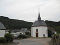
Category:Chapelle Saint-Pierre (Lellingen)
Jump to navigation
Jump to search
| Object location | | View all coordinates using: OpenStreetMap |
|---|
 | |||||
| Upload media | |||||
| Instance of | |||||
|---|---|---|---|---|---|
| Location |
| ||||
 | |||||
Media in category "Chapelle Saint-Pierre (Lellingen)"
The following 7 files are in this category, out of 7 total.
-
 Kapell Lelljen Héichaltor.jpg 3,248 × 2,142; 1.24 MB
-
 Kapelle Lellingen 01.jpg 1,830 × 2,586; 2.99 MB
-
 Kapelle Lellingen 02.jpg 2,465 × 1,910; 2.97 MB
-
 Kapelle Lellingen 03.jpg 1,740 × 2,719; 3.09 MB
-
 Lellgen-KIE 6567 w.jpg 3,354 × 1,935; 169 KB
-
 Lellingen.jpg 1,600 × 1,200; 150 KB
-
 Lelljen Kapell baussen w.jpg 750 × 1,000; 269 KB


