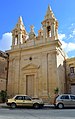
Category:Chapel of St. Mary, Tarxien
Jump to navigation
Jump to search
| Object location | | View all coordinates using: OpenStreetMap |
|---|
 | |||||
| Upload media | |||||
| Instance of | |||||
|---|---|---|---|---|---|
| Named after | |||||
| Location | Tarxien, Port Region (Port), Malta | ||||
 | |||||
Media in category "Chapel of St. Mary, Tarxien"
The following 4 files are in this category, out of 4 total.
-
 Chapel of Santa Marija.png 1,536 × 2,048; 5.2 MB
-
 Chapel of St. Marija Tarxien.jpg 2,632 × 4,174; 1.12 MB
-
 Church of St Mary Tarxien 01.jpg 3,264 × 2,448; 1.54 MB
-
 Church of St Mary Tarxien 02.jpg 2,448 × 3,264; 1.44 MB


