Category:Chaldon
Jump to navigation
Jump to search
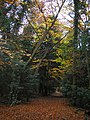
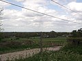
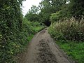
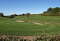
English: Chaldon is a village in Surrey, England on the North Downs to the west of Caterham. It falls within the boundaries of Tandridge district.
village in Tandridge, Surrey, United Kingdom  | |||||
| Upload media | |||||
| Instance of | |||||
|---|---|---|---|---|---|
| Location | Tandridge, Surrey, South East England, England | ||||
| Population |
| ||||
| Area |
| ||||
 | |||||
Subcategories
This category has the following 3 subcategories, out of 3 total.
Media in category "Chaldon"
The following 159 files are in this category, out of 159 total.
-
 18 Roffe's Lane - geograph.org.uk - 5957774.jpg 1,024 × 678; 1.16 MB
-
 20 Roffe's Lane - geograph.org.uk - 5957775.jpg 678 × 1,024; 1 MB
-
 27 - 39 Roffe's Lane - geograph.org.uk - 5942347.jpg 1,024 × 678; 524 KB
-
 27 - 39 Roffe's Lane - geograph.org.uk - 5957247.jpg 678 × 1,024; 955 KB
-
 A country pub in Surrey - geograph.org.uk - 58829.jpg 640 × 480; 106 KB
-
 A foggy morning in Chaldon, Caterham (7301514258).jpg 2,417 × 3,580; 4.45 MB
-
 A green pond (7235775142).jpg 3,872 × 2,592; 7.82 MB
-
 A morning in Chaldon (7211446022).jpg 3,592 × 2,592; 7.09 MB
-
 A morning walk in fog. (7225428140).jpg 3,613 × 2,592; 8.05 MB
-
-
 A walk in Chaldon Caterham (7222805656).jpg 2,454 × 3,509; 5.09 MB
-
 Beside the Track - geograph.org.uk - 5603447.jpg 3,660 × 2,440; 7.74 MB
-
 Birds Chaldon Caterham (7341343900).jpg 3,454 × 1,944; 2.91 MB
-

-
 Bridleway to Coulsdon Common - geograph.org.uk - 5603455.jpg 2,940 × 1,960; 7.57 MB
-
 Building at Willey Park Farm - geograph.org.uk - 794867.jpg 640 × 426; 66 KB
-
 Bus shelter on Rook Lane, Chaldon - geograph.org.uk - 3685873.jpg 1,024 × 768; 294 KB
-
 Chaldon - geograph.org.uk - 5603449.jpg 3,300 × 2,200; 7.73 MB
-
 Chaldon Common Road - geograph.org.uk - 5222426.jpg 2,304 × 1,728; 820 KB
-
 Chaldon Common Road - geograph.org.uk - 5227709.jpg 2,230 × 1,624; 1.58 MB
-
 Chaldon Common Road - geograph.org.uk - 5228115.jpg 2,304 × 1,728; 813 KB
-
 Chaldon Common Road - geograph.org.uk - 5228116.jpg 2,304 × 1,728; 810 KB
-
 Chaldon Common Road - geograph.org.uk - 5941058.jpg 1,024 × 678; 711 KB
-
 Chaldon Common Road at the junction of Roffes Lane - geograph.org.uk - 5227700.jpg 2,304 × 1,728; 1.2 MB
-
 Chaldon Cricket Club pavilion, Six Brothers Field - geograph.org.uk - 3100794.jpg 3,456 × 2,304; 6.76 MB
-
 Chaldon Green - geograph.org.uk - 2661783.jpg 640 × 480; 142 KB
-
 Chaldon Village Sign - geograph.org.uk - 2952254.jpg 4,288 × 3,216; 3.18 MB
-
 Chaldon village sign - geograph.org.uk - 5248272.jpg 662 × 1,000; 1.14 MB
-
 Chaldon, The Church of St Peter and St Paul - geograph.org.uk - 4345770.jpg 3,377 × 2,206; 7.25 MB
-
 Chaldon, Village Hall - geograph.org.uk - 3100805.jpg 3,456 × 2,304; 4 MB
-
 Chaldon, Willey Park Farm.jpg 3,500 × 2,058; 2.89 MB
-
 Church Lane at the junction of Rook Lane - geograph.org.uk - 5222417.jpg 2,304 × 1,728; 2.34 MB
-
 Church Lane, Chaldon, Surrey - geograph.org.uk - 1657776.jpg 3,872 × 2,592; 3.16 MB
-
 Conifers on Chaldon Common Road - geograph.org.uk - 5227978.jpg 2,304 × 1,728; 814 KB
-
 Cut through - geograph.org.uk - 2943952.jpg 1,600 × 1,065; 399 KB
-
 Ditches Lane, Chaldon - geograph.org.uk - 5222398.jpg 2,304 × 1,728; 834 KB
-
 Doctors Lane, Chaldon, Surrey - geograph.org.uk - 1657782.jpg 3,872 × 2,592; 2.12 MB
-
 Downland near Chaldon - geograph.org.uk - 6157698.jpg 6,000 × 4,000; 4.33 MB
-

-
 Driveway into Surrey National Golf Course - geograph.org.uk - 3012211.jpg 4,592 × 3,056; 6.66 MB
-
 Entrance to The Rookery, Chaldon - geograph.org.uk - 5227679.jpg 2,238 × 1,636; 1.33 MB
-
 Farm Track to Tolsworth Manor - geograph.org.uk - 2952269.jpg 4,288 × 3,216; 5.64 MB
-
 Field edge - geograph.org.uk - 5248053.jpg 1,000 × 662; 919 KB
-
 Field edge - geograph.org.uk - 5248056.jpg 662 × 1,000; 1.19 MB
-
 Field edge - geograph.org.uk - 5248062.jpg 1,000 × 662; 808 KB
-
 Field near Hilltop Farm - geograph.org.uk - 2085887.jpg 2,816 × 2,112; 1.78 MB
-
 Field next to Chaldon church (671048461).jpg 3,872 × 2,592; 2.28 MB
-
 Field of Maize by Court Farm - geograph.org.uk - 2085020.jpg 2,816 × 2,112; 1.92 MB
-
 Field of rape - geograph.org.uk - 2943940.jpg 2,967 × 4,266; 3.86 MB
-
 Field on Ockley Hill - geograph.org.uk - 2659640.jpg 640 × 467; 88 KB
-
 Field south of Birchwood Lane - geograph.org.uk - 2253786.jpg 640 × 480; 133 KB
-
 Flytipping, Chaldon - geograph.org.uk - 2661441.jpg 640 × 480; 121 KB
-
 Flytipping, Chaldon - geograph.org.uk - 2661672.jpg 480 × 640; 89 KB
-
 Foggy morning (7204730218).jpg 3,440 × 2,143; 2.94 MB
-
 Footpath junction on Pilgrim's Lane, near Chaldon - geograph.org.uk - 2952193.jpg 4,288 × 3,216; 6.74 MB
-
 Footpath junction on White Hill - geograph.org.uk - 2950291.jpg 4,288 × 3,216; 6.63 MB
-
 Footpath near Upton Farm - geograph.org.uk - 2660215.jpg 480 × 640; 126 KB
-
 Front gardens on Hilltop Lane, Chaldon - geograph.org.uk - 4186892.jpg 2,518 × 1,862; 1.4 MB
-
 Gateway - geograph.org.uk - 3475702.jpg 4,180 × 3,028; 6.13 MB
-
 Glebe House, Chaldon - geograph.org.uk - 1466447.jpg 640 × 480; 350 KB
-
 Green Lane, Caterham - geograph.org.uk - 2253769.jpg 640 × 480; 134 KB
-
 Green, Surrey National Golf Club - geograph.org.uk - 2661235.jpg 640 × 439; 73 KB
-
 Harestone Lane - geograph.org.uk - 5942445.jpg 1,024 × 678; 964 KB
-
 Harvesting Commenced - geograph.org.uk - 5856971.jpg 4,214 × 2,370; 7.56 MB
-
 Harvesting Commenced - geograph.org.uk - 5856978.jpg 4,443 × 2,222; 7.68 MB
-
 Harvesting Commenced - geograph.org.uk - 5856982.jpg 4,317 × 2,428; 7.75 MB
-
 Hilltop Farm - geograph.org.uk - 2433048.jpg 1,600 × 1,066; 539 KB
-
 Hilltop Lane - geograph.org.uk - 2952250.jpg 4,288 × 3,216; 7.12 MB
-
 Hilltop Lane - geograph.org.uk - 6157689.jpg 6,000 × 4,000; 6.25 MB
-
 Hilltop Lane, Chaldon - geograph.org.uk - 3685872.jpg 1,024 × 768; 394 KB
-
 Hilltop Lane, Chaldon - geograph.org.uk - 4187228.jpg 2,512 × 1,854; 1.53 MB
-
 Hilltop Lane, Chaldon, Surrey - geograph.org.uk - 1657426.jpg 3,872 × 2,592; 4.05 MB
-
 Hilltop, Pilgrim's Lane - geograph.org.uk - 2952225.jpg 4,288 × 3,216; 5.37 MB
-
 Hospital burial ground - geograph.org.uk - 2660557.jpg 640 × 460; 102 KB
-
 House by the North Downs Way - geograph.org.uk - 2659747.jpg 640 × 480; 89 KB
-
 House on Church Lane, Chaldon - geograph.org.uk - 5222410.jpg 2,304 × 1,728; 1.66 MB
-
 Houses on Chaldon Common Road - geograph.org.uk - 5228114.jpg 2,304 × 1,728; 819 KB
-
 Junction of Church Lane With Rook Lane, Chaldon, Surrey - geograph.org.uk - 1657713.jpg 2,592 × 3,872; 5.72 MB
-
 Morning fog (7279948560).jpg 3,150 × 2,126; 272 KB
-
 Morning walk, Chaldon Caterham (7306484814).jpg 2,876 × 2,263; 3.66 MB
-
 No Cricket Today - geograph.org.uk - 1657443.jpg 3,872 × 2,592; 6.89 MB
-
 North Downs Way - geograph.org.uk - 5603180.jpg 3,360 × 2,240; 7.77 MB
-
 North Downs Way - geograph.org.uk - 5603204.jpg 3,600 × 2,400; 7.73 MB
-
 North Downs Way at White Hill - geograph.org.uk - 2086343.jpg 2,816 × 2,112; 1.62 MB
-
 North Downs Way at Willey Farm Lane - geograph.org.uk - 2950307.jpg 4,288 × 3,216; 4.48 MB
-
 North Downs Way at Willey Park Farm - geograph.org.uk - 2085906.jpg 2,816 × 2,112; 2.07 MB
-
 North Downs Way near Willey Park Farm - geograph.org.uk - 2950333.jpg 4,288 × 3,216; 7.04 MB
-
 North Downs Way on Oakley Hill - geograph.org.uk - 2952279.jpg 4,288 × 3,216; 4.31 MB
-
 North Downs Way on Pilgrim's Lane - geograph.org.uk - 2950325.jpg 4,288 × 3,216; 5.7 MB
-
 North Downs Way on White Hill - geograph.org.uk - 2660175.jpg 640 × 480; 91 KB
-
 Oak, Stanstead Road, Caterham - geograph.org.uk - 2660273.jpg 480 × 640; 112 KB
-
 Ockley Hill - geograph.org.uk - 6618829.jpg 4,373 × 2,187; 7.81 MB
-
 Park Ham - geograph.org.uk - 2659792.jpg 640 × 458; 106 KB
-
 Pasture by Willey Farm Lane - geograph.org.uk - 2660156.jpg 640 × 435; 85 KB
-
 Path Junction - geograph.org.uk - 5603438.jpg 4,080 × 2,720; 7.8 MB
-
 Path Junction - geograph.org.uk - 5603489.jpg 3,807 × 2,538; 7.75 MB
-
 Path on Alderstead Heath - geograph.org.uk - 804169.jpg 640 × 426; 110 KB
-
 Pilgrim's Lane - geograph.org.uk - 2659717.jpg 480 × 640; 154 KB
-
 Pilgrim's Lane - geograph.org.uk - 2660038.jpg 640 × 480; 158 KB
-
 Pilgrim's Lane near Hilltop Farm - geograph.org.uk - 2952240.jpg 4,288 × 3,216; 5.89 MB
-
 Pilgrims Lane - geograph.org.uk - 2085899.jpg 2,816 × 2,112; 2.37 MB
-
 Pilgrims' Lane at Willey Park Farm - geograph.org.uk - 2660059.jpg 640 × 480; 105 KB
-
 Pond, Surrey National Golf Club - geograph.org.uk - 2660673.jpg 640 × 443; 70 KB
-
 Rape - geograph.org.uk - 3475664.jpg 4,592 × 3,056; 5.48 MB
-
 Rape Field - geograph.org.uk - 2939624.jpg 1,600 × 1,065; 475 KB
-
 Ready For Harvest - geograph.org.uk - 5856954.jpg 3,896 × 2,598; 7.39 MB
-
 Redwoods, The Leazes, Chaldon - geograph.org.uk - 2661340.jpg 492 × 640; 109 KB
-
 Roffes Lane at the junction of Chaldon Road - geograph.org.uk - 5222508.jpg 2,304 × 1,728; 862 KB
-
 Roffes Lane, Chaldon - geograph.org.uk - 5228118.jpg 2,304 × 1,728; 798 KB
-
 Rook Lane Gate - geograph.org.uk - 2433151.jpg 1,933 × 2,900; 3.17 MB
-
 Rook Lane, Chaldon - geograph.org.uk - 4187206.jpg 2,560 × 1,920; 1.97 MB
-
 Rook Lane, Chaldon - geograph.org.uk - 5225530.jpg 2,304 × 1,728; 863 KB
-
 Rook Lane, Chaldon, Surrey - geograph.org.uk - 1657726.jpg 3,872 × 2,592; 2.8 MB
-
 Rook pie - in the sky - geograph.org.uk - 1386118.jpg 640 × 360; 63 KB
-
 Sheds at the end of Birchwood Lane - geograph.org.uk - 2253814.jpg 640 × 480; 168 KB
-
 Sheep by the North Downs Way - geograph.org.uk - 6157701.jpg 6,000 × 4,000; 4.35 MB
-
 Six Brothers Field - geograph.org.uk - 794893.jpg 640 × 426; 98 KB
-
 Six Brothers Field, Chaldon - geograph.org.uk - 48358.jpg 640 × 480; 57 KB
-
 Stanstead Road, Caterham - geograph.org.uk - 2660239.jpg 640 × 470; 89 KB
-
 Surrey National Golf Club - geograph.org.uk - 2660584.jpg 640 × 360; 62 KB
-
 Surrey National Golf Club - geograph.org.uk - 2661037.jpg 640 × 399; 64 KB
-
 Surrey National Golf Club - geograph.org.uk - 2661124.jpg 640 × 480; 91 KB
-
 The Harrow - geograph.org.uk - 5603176.jpg 3,828 × 2,153; 7.75 MB
-
 The Heath, Chaldon - geograph.org.uk - 5222429.jpg 2,304 × 1,728; 822 KB
-
 The Path - geograph.org.uk - 1927929.jpg 1,000 × 1,504; 693 KB
-
 The sun breaks through the mist (7231788450).jpg 3,352 × 2,269; 3.52 MB
-
 Tollsworth Cottages - geograph.org.uk - 794894.jpg 640 × 426; 71 KB
-
 Towards the City of London - geograph.org.uk - 2396683.jpg 640 × 425; 123 KB
-
 Track to the church, Chaldon - geograph.org.uk - 5222389.jpg 2,304 × 1,728; 815 KB
-
 Track, Surrey National Golf Club - geograph.org.uk - 2661098.jpg 640 × 446; 75 KB
-
 Tractor on the North Downs - geograph.org.uk - 6608947.jpg 4,489 × 2,525; 7.04 MB
-
 Tractor on the North Downs - geograph.org.uk - 6618898.jpg 4,614 × 2,595; 7.75 MB
-
 Tractors on the North Downs - geograph.org.uk - 6608915.jpg 5,407 × 3,041; 7.6 MB
-
 Traffic Jam on the North Downs - geograph.org.uk - 6608923.jpg 5,407 × 3,041; 7.79 MB
-
 Trees if fog (7266024212).jpg 2,592 × 3,872; 7.07 MB
-
 Triangulation Point on the North Downs - geograph.org.uk - 6608953.jpg 3,976 × 2,652; 7.58 MB
-
 Trig point by the North Downs Way - geograph.org.uk - 6157675.jpg 6,000 × 4,000; 5.23 MB
-
 Trobridge Hill - geograph.org.uk - 5941118.jpg 1,024 × 678; 941 KB
-
 Upton Farm - geograph.org.uk - 2660228.jpg 640 × 438; 86 KB
-
 View from Hilltop - geograph.org.uk - 2952231.jpg 4,288 × 3,216; 4.85 MB
-
 View From Ockley Hill - geograph.org.uk - 6618889.jpg 4,294 × 2,864; 7.73 MB
-
 View From the North Downs Way - geograph.org.uk - 5603201.jpg 4,080 × 2,295; 7.72 MB
-
 View From the North Downs Way - geograph.org.uk - 5603203.jpg 6,000 × 3,375; 7.51 MB
-
 View near Willey Park Farm - geograph.org.uk - 2660085.jpg 640 × 440; 83 KB
-
 View south off the North Downs Way at Hilltop - geograph.org.uk - 3363364.jpg 1,600 × 1,066; 173 KB
-
 View Towards Chaldon, Surrey - geograph.org.uk - 1387435.jpg 640 × 360; 68 KB
-
 View Towards Furzefield Wood - geograph.org.uk - 1387443.jpg 640 × 360; 64 KB
-
 Wheat field near Chaldon - geograph.org.uk - 6157708.jpg 6,000 × 4,000; 7.47 MB
-
 Wheat field near Tollsworth Manor - geograph.org.uk - 6157645.jpg 6,000 × 4,000; 3.71 MB
-
 Wheat field near Tollsworth Manor - geograph.org.uk - 6157653.jpg 6,000 × 4,000; 3.79 MB
-
 White Hill - geograph.org.uk - 2396656.jpg 640 × 425; 52 KB
-
 Willey Farm Lane - geograph.org.uk - 2660133.jpg 640 × 452; 89 KB
-
 Willey Park Farm - geograph.org.uk - 2407446.jpg 1,600 × 1,065; 401 KB
-
 Willey Park Farm - geograph.org.uk - 2413153.jpg 4,320 × 3,008; 4.9 MB
-
 Winter Landscape at Chaldon, Surrey - geograph.org.uk - 1655920.jpg 3,872 × 2,592; 3.65 MB
-
 A Surrey bridleway - geograph.org.uk - 691448.jpg 640 × 602; 134 KB
-
 Aerial by Pilgrims' Lane - geograph.org.uk - 794618.jpg 640 × 426; 77 KB
-
 Chaldon Village Hall - geograph.org.uk - 48357.jpg 640 × 480; 54 KB
-
 Horsey, Horsey... - geograph.org.uk - 510022.jpg 640 × 510; 142 KB


.jpg)
.jpg)
.jpg)
.jpg)

.jpg)

.jpg)


.jpg)


.jpg)


.jpg)
.jpg)


.jpg)


.jpg)


