Category:Ceres, Fife
Jump to navigation
Jump to search
village in Fife, Scotland, UK  | |||||
| Upload media | |||||
| Instance of | |||||
|---|---|---|---|---|---|
| Location | |||||
| Population |
| ||||
| Elevation above sea level |
| ||||
 | |||||
English: Ceres is a village in Fife, Scotland, located in a small valley approximately 2 miles over the Ceres Moor from Cupar and 7 miles from St Andrews. The former parish of that name included the settlements of Baldinnie, Chance Inn, Craigrothie, Pitscottie and Tarvit Mill.
Subcategories
This category has the following 6 subcategories, out of 6 total.
B
- Bannockburn memorial, Ceres (1 F)
- Bishop's Bridge, Ceres (3 F)
C
- Ceres church, Fife (6 F)
F
- Fife Folk Museum (21 F)
- Fleecefaulds Farm (2 F)
P
- The Provost, Ceres (15 F)
Media in category "Ceres, Fife"
The following 47 files are in this category, out of 47 total.
-
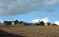
 Abandoned farm - geograph.org.uk - 396813.jpg 640 × 480; 107 KB
-
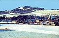
 Above Ceres - geograph.org.uk - 168105.jpg 640 × 426; 249 KB
-
 Approaching Newbigging - geograph.org.uk - 704373.jpg 640 × 434; 105 KB
-
 Brands Hotel, Ceres (geograph 5493448).jpg 2,448 × 3,264; 4.9 MB
-
 Carved panel, Ceres Weighhouse - geograph.org.uk - 930692.jpg 640 × 485; 89 KB
-
 Ceres - geograph.org.uk - 698720.jpg 640 × 425; 76 KB
-
 Ceres Burn - geograph.org.uk - 168106.jpg 426 × 640; 238 KB
-
 Ceres Burn - geograph.org.uk - 396821.jpg 640 × 480; 125 KB
-
 Ceres Burn - geograph.org.uk - 523893.jpg 640 × 424; 98 KB
-
 Ceres Burn - geograph.org.uk - 523895.jpg 424 × 640; 117 KB
-
 Ceres Burn, Kilhill - geograph.org.uk - 1441444.jpg 640 × 480; 167 KB
-
 Ceres from Bridgend - geograph.org.uk - 698712.jpg 640 × 471; 83 KB
-
 Ceres from the air - geograph.org.uk - 1142897.jpg 640 × 480; 80 KB
-
 Ceres green and church - geograph.org.uk - 689434.jpg 480 × 640; 89 KB
-
 Ceres Highland Games 2013.JPG 2,560 × 1,920; 2.19 MB
-
 Ceres in Fife.JPG 2,560 × 1,920; 2.2 MB
-
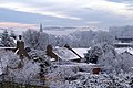
 Ceres in the snow - geograph.org.uk - 700205.jpg 640 × 418; 69 KB
-
 Ceres Inn - geograph.org.uk - 13533.jpg 524 × 393; 32 KB
-
 Ceres Mill - geograph.org.uk - 1441441.jpg 640 × 480; 86 KB
-
 Ceres Post Office - geograph.org.uk - 1441438.jpg 640 × 480; 80 KB
-
 Ceres road - geograph.org.uk - 768016.jpg 640 × 439; 101 KB
-
 Ceres village - geograph.org.uk - 857003.jpg 640 × 480; 62 KB
-
 Ceres village - geograph.org.uk - 860066.jpg 640 × 480; 100 KB
-
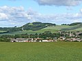
 Ceres village from the West - geograph.org.uk - 89257.jpg 640 × 496; 115 KB
-
 Ceres village under snow - geograph.org.uk - 704296.jpg 640 × 427; 93 KB
-
 Ceres, Fife.jpg 640 × 424; 84 KB
-
 Curling Pond Road street sign, Ceres, Fife.JPG 2,560 × 1,920; 2.18 MB
-
 Entering Ceres - geograph.org.uk - 169915.jpg 640 × 480; 114 KB
-
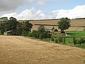
 Greenside Farm - geograph.org.uk - 145278.jpg 640 × 401; 56 KB
-
 Heifers, Baltilly - geograph.org.uk - 1441435.jpg 640 × 480; 93 KB
-
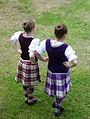 Highland dancers, Ceres Games 2013.jpg 483 × 640; 110 KB
-
 Main Street, Ceres - geograph.org.uk - 860073.jpg 640 × 480; 88 KB
-
 St Johns Lodge, Ceres (geograph 5493466).jpg 3,264 × 2,448; 4.22 MB
-
 Stumps and humps - geograph.org.uk - 1557669.jpg 640 × 480; 118 KB
-
 The Cupar Road - geograph.org.uk - 523896.jpg 507 × 640; 78 KB
-
 The grave of John Lindsay, Earl of Crawford, Ceres, Fife.JPG 3,088 × 2,056; 2.87 MB
-
 The Green at Ceres, Fife.jpg 2,560 × 1,920; 2.18 MB
-
 The vault of John Lindsay (often called Lady Boyd's House) Ceres Churchyard.JPG 3,088 × 2,056; 1.59 MB
-
 Towards Ceres - geograph.org.uk - 767724.jpg 640 × 447; 79 KB
-
 Towards Kilhill - geograph.org.uk - 768015.jpg 640 × 426; 103 KB
-
 Towards Pitscottie - geograph.org.uk - 768018.jpg 640 × 426; 77 KB
-
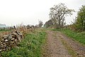
 Track to Freelands - geograph.org.uk - 714742.jpg 640 × 427; 102 KB
-

-
 Wemyss Ware pig (2013).jpg 2,553 × 1,865; 587 KB
-
 Wood and track - geograph.org.uk - 768017.jpg 640 × 426; 117 KB
-
 Woodlands farm - geograph.org.uk - 1557672.jpg 640 × 480; 60 KB
-
 Woodlands Farm - geograph.org.uk - 714731.jpg 640 × 427; 57 KB


.jpg)


.jpg)


_Ceres_Churchyard.JPG)


.jpg)


