Category:Census maps of Cook County, Illinois
Jump to navigation
Jump to search
Media in category "Census maps of Cook County, Illinois"
The following 136 files are in this category, out of 136 total.
-

-

-
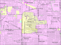
 Alsip IL 2009 reference map.png 575 × 425; 56 KB
-
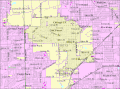
 Arlington Heights IL 2009 reference map.png 575 × 425; 68 KB
-
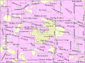
 Barrington Hills IL 2009 reference map.png 575 × 425; 68 KB
-
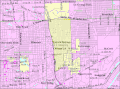
 Barrington IL 2009 reference map.png 575 × 425; 57 KB
-
 Bartlett IL 2009 reference map.png 575 × 425; 57 KB
-
 Bedford Park IL 2009 reference map.png 575 × 425; 50 KB
-
 Bellwood IL 2009 reference map.png 575 × 425; 50 KB
-
 Bensenville IL 2009 reference map.png 575 × 425; 58 KB
-
 Berkeley IL 2009 reference map.png 575 × 425; 50 KB
-
 Berwyn IL 2009 reference map.png 575 × 425; 49 KB
-
 Blue Island IL 2009 reference map.png 575 × 425; 52 KB
-
 Bridgeview IL 2009 reference map.png 575 × 425; 56 KB
-
 Broadview IL 2009 reference map.png 575 × 425; 51 KB
-
 Brookfield IL 2009 reference map.png 575 × 425; 55 KB
-
 Buffalo Grove IL 2009 reference map.png 575 × 425; 67 KB
-
 Burbank IL 2009 reference map.png 575 × 425; 47 KB
-
 Burnham IL 2009 reference map.png 575 × 425; 34 KB
-
 Burr Ridge IL 2009 reference map.png 575 × 425; 69 KB
-
 Calumet City IL 2009 reference map.png 575 × 425; 49 KB
-
 Calumet Park 2009 reference map.png 575 × 425; 50 KB
-
 Chicago Heights IL 2009 reference map.png 575 × 425; 58 KB
-
 Chicago Ridge IL 2009 reference map.png 575 × 425; 51 KB
-
 ChicagoILMap.png 575 × 425; 74 KB
-
 Cicero IL 2009 reference map.png 575 × 425; 43 KB
-
 Country Club Hills 2009 reference map.png 575 × 425; 58 KB
-
 Countryside IL 2009 reference map.png 575 × 425; 60 KB
-
 Crestwood IL 2009 reference map.png 575 × 425; 57 KB
-
 Deer Park IL 2009 reference map.png 575 × 425; 60 KB
-
 Des Plaines IL 2009 reference map.png 575 × 425; 62 KB
-
 Dixmoor IL 2009 reference map.png 575 × 425; 45 KB
-
 Dolton IL 2009 reference map.png 575 × 425; 51 KB
-
 East Dundee IL 2009 reference map.png 575 × 425; 61 KB
-
 East Hazel Crest IL 2009 reference map.png 575 × 425; 40 KB
-
 Elgin IL 2009 reference map.png 575 × 425; 63 KB
-
 Elk Grove Village IL 2009 reference map.png 575 × 425; 64 KB
-
 Elmhurst IL 2009 reference map.png 575 × 425; 58 KB
-
 Elmwood Park IL 2009 reference map.png 575 × 425; 40 KB
-
 Evanston IL 2009 reference map.gif 575 × 425; 39 KB
-
 Evergreen Park IL 2009 reference map.gif 575 × 425; 59 KB
-
 Flossmoor IL 2009 reference map.gif 575 × 425; 65 KB
-
 Ford Heights IL 2009 reference map.gif 575 × 425; 42 KB
-
 Forest Park IL 2009 reference map.gif 575 × 425; 53 KB
-
 Forest View IL 2009 reference map.gif 575 × 425; 45 KB
-
 Frankfort IL 2009 reference map.gif 575 × 425; 58 KB
-
 Franklin Park IL 2009 reference map.gif 575 × 425; 59 KB
-
 Glencoe IL 2009 reference map.gif 575 × 425; 44 KB
-
 Glenview IL 2009 reference map.gif 575 × 425; 64 KB
-
 Glenwood IL 2009 reference map.gif 575 × 425; 62 KB
-
 Golf IL 2009 reference map.gif 575 × 425; 54 KB
-
 Hanover Park IL 2009 reference map.gif 575 × 425; 73 KB
-
 Harvey IL 2009 reference map.gif 575 × 425; 62 KB
-
 Harwood Heights IL 2009 reference map.gif 575 × 425; 47 KB
-
 Hazel Crest IL 2009 reference map.gif 575 × 425; 65 KB
-
 Hickory Hills 2009 reference map.gif 575 × 425; 63 KB
-
 Hillside IL 2009 reference map.gif 575 × 425; 61 KB
-
 Hinsdale IL 2009 reference map.gif 575 × 425; 67 KB
-
 Hodgkins IL 2009 reference map.gif 575 × 425; 70 KB
-
 Hoffman Estates IL 2009 reference map.gif 575 × 425; 72 KB
-
 Hometown IL 2009 reference map.gif 575 × 425; 48 KB
-
 Homewood IL 2009 reference map.gif 575 × 425; 63 KB
-
 Indian Head Park IL 2009 reference map.gif 575 × 425; 60 KB
-
 Inverness IL 2009 reference map.gif 575 × 425; 56 KB
-
 Justice IL 2009 reference map.gif 575 × 425; 58 KB
-
 Kenilworth IL 2009 reference map.gif 575 × 425; 46 KB
-
 La Grange IL 2009 reference map.gif 575 × 425; 57 KB
-
 La Grange Park IL 2009 reference map.gif 575 × 425; 57 KB
-
 Lansing IL 2009 reference map.gif 575 × 425; 61 KB
-
 Lemont IL 2009 reference map.gif 575 × 425; 70 KB
-
 Lincolnwood IL 2009 reference map.gif 575 × 425; 48 KB
-
 Lynwood IL 2009 reference map.gif 575 × 425; 62 KB
-
 Lyons IL 2009 reference map.gif 575 × 425; 57 KB
-
 Markham IL 2009 reference map.gif 575 × 425; 64 KB
-
 Matteson IL 2009 reference map.gif 575 × 425; 58 KB
-
 Maywood IL 2009 reference map.gif 575 × 425; 57 KB
-
 McCook IL 2009 reference map.gif 575 × 425; 40 KB
-
 Melrose Park IL 2009 reference map.gif 575 × 425; 61 KB
-
 Merrionette Park IL 2009 reference map.gif 575 × 425; 41 KB
-
 Midlothian IL 2009 reference map.gif 575 × 425; 68 KB
-
 Morton Grove IL 2009 reference map.gif 575 × 425; 58 KB
-
 Mount Prospect IL 2009 reference map.gif 575 × 425; 68 KB
-
 Niles IL 2009 reference map.gif 575 × 425; 63 KB
-
 Norridge IL 2009 reference map.gif 575 × 425; 49 KB
-
 North Riverside IL 2009 reference map.gif 575 × 425; 56 KB
-
 Northbrook IL 2009 reference map.gif 575 × 425; 62 KB
-
 Northfield IL 2009 reference map.gif 575 × 425; 56 KB
-
 Northlake IL 2009 reference map.gif 575 × 425; 61 KB
-
 Oak Brook IL 2009 reference map.gif 575 × 425; 67 KB
-
 Oak Forest IL 2009 reference map.gif 575 × 425; 67 KB
-
 Oak Lawn IL 2009 reference map.gif 575 × 425; 61 KB
-
 Oak Park IL 2009 reference map.gif 575 × 425; 50 KB
-
 Olympia Fields IL 2009 reference map.gif 575 × 425; 54 KB
-
 Orland Hills IL 2009 reference map.gif 575 × 425; 45 KB
-
 Orland Park IL 2009 reference map.gif 575 × 425; 71 KB
-
 Palatine IL 2009 reference map.gif 575 × 425; 72 KB
-
 Palos Heights IL 2009 reference map.gif 575 × 425; 68 KB
-
 Palos Hills 2009 reference map.gif 575 × 425; 63 KB
-
 Palos Park IL 2009 reference map.gif 575 × 425; 58 KB
-
 Park Forest IL 2009 reference map.gif 575 × 425; 62 KB
-
 Park Ridge IL 2009 reference map.gif 575 × 425; 60 KB
-
 Phoenix IL 2009 reference map.gif 575 × 425; 53 KB
-
 Posen IL 2009 reference map.gif 575 × 425; 59 KB
-
 Prospect Heights Il 2009 reference map.gif 575 × 425; 59 KB
-
 Richton Park IL 2009 reference map.gif 575 × 425; 56 KB
-
 River Forest IL 2009 reference map.gif 575 × 425; 54 KB
-
 River Grove IL 2009 reference map.gif 575 × 425; 51 KB
-
 Riverdale IL 2009 reference map.gif 575 × 425; 58 KB
-
 Riverside IL 2009 reference map.gif 575 × 425; 62 KB
-
 Robbins IL 2009 reference map.gif 575 × 425; 53 KB
-
 Rolling Meadows IL 2009 reference map.gif 575 × 425; 62 KB
-
 Roselle IL 2009 reference map.gif 575 × 425; 68 KB
-
 Rosemont IL 2009 reference map.gif 575 × 425; 56 KB
-
 Sauk Village IL 2009 reference map.gif 575 × 425; 62 KB
-
 Schaumburg IL 2009 reference map.gif 575 × 425; 74 KB
-
 Schiller Park IL 2009 reference map.gif 575 × 425; 42 KB
-
 Skokie IL 2009 reference map.gif 575 × 425; 52 KB
-
 South Barrington IL 2009 reference map.gif 575 × 425; 58 KB
-
 South Chicago Heights IL 2009 reference map.gif 575 × 425; 50 KB
-
 South Holland IL 2009 reference map.gif 575 × 425; 57 KB
-
 Steger IL 2009 reference map.gif 575 × 425; 59 KB
-
 Stickney IL 2009 reference map.gif 575 × 425; 52 KB
-
 Stone Park IL 2009 reference map.gif 575 × 425; 51 KB
-
 Streamwood IL 2009 reference map.gif 575 × 425; 59 KB
-
 Summit IL 2009 reference map.gif 575 × 425; 51 KB
-
 Thornton IL 2009 reference map.gif 575 × 425; 45 KB
-
 Tinley Park IL 2009 reference map.gif 575 × 425; 66 KB
-
 University Park IL 2009 reference map.gif 575 × 425; 52 KB
-
 Westchester IL 2009 reference map.gif 575 × 425; 64 KB
-
 Western Springs IL 2009 reference map.gif 575 × 425; 64 KB
-
 Wheeling IL 2009 reference map.gif 575 × 425; 63 KB
-
 Willow Springs IL 2009 reference map.gif 575 × 425; 68 KB
-
 Wilmette IL 2009 reference map.gif 575 × 425; 47 KB
-
 Winnetka IL 2009 reference map.gif 575 × 425; 42 KB
-
 Woodridge IL 2009 reference map.gif 575 × 425; 70 KB
-
 Worth IL 2009 reference map.gif 575 × 425; 56 KB
.jpg)
.jpg)


