Category:Celtic Sea
Jump to navigation
Jump to search
sea west of the English Channel | |||||
| Upload media | |||||
| Instance of | |||||
|---|---|---|---|---|---|
| Part of | |||||
| Location |
| ||||
| Inflows |
| ||||
| Basin country | |||||
 | |||||
Subcategories
This category has the following 6 subcategories, out of 6 total.
Media in category "Celtic Sea"
The following 44 files are in this category, out of 44 total.
-
Algal bloom 20040615.jpg 2,800 × 2,200; 374 KB
-
MVArdmore.jpg 530 × 363; 42 KB
-
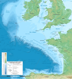
Batimetriezh ar Mor Keltiek ha Pleg-mor Gwaskogn.svg 3,478 × 3,804; 4.92 MB
-
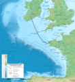
Celtic Interconnector map.png 2,000 × 2,187; 5.25 MB
-
Celtic Sea - panoramio (1).jpg 4,224 × 3,168; 5.15 MB
-
Celtic Sea - panoramio (2).jpg 4,224 × 3,168; 5.65 MB
-
Celtic Sea - panoramio.jpg 4,224 × 3,168; 5.52 MB
-
Celtic Sea and Bay of Biscay bathymetric map-en.svg 3,479 × 3,805; 4.93 MB
-
Celtic Sea and Bay of Biscay bathymetric map-es.svg 3,478 × 3,804; 4.92 MB
-
Celtic Sea and Bay of Biscay bathymetric map-fr.svg 3,478 × 3,804; 4.93 MB
-
Celtic Sea and Bay of Biscay bathymetric map-mk.svg 3,479 × 3,805; 6.16 MB
-
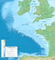
Celtic Sea in its region.svg 500 × 281; 4.83 MB
-
Cobh Rooftops - geograph.org.uk - 596590.jpg 640 × 480; 62 KB
-
Coccoliths in the Celtic Sea-NASA.jpg 1,362 × 1,509; 268 KB
-
Cork Harbour - geograph.org.uk - 1131618.jpg 640 × 427; 48 KB
-
Coucher de soleil en mer celtique - panoramio.jpg 4,000 × 3,000; 1.21 MB
-
Cruise ship terminal - geograph.org.uk - 1384425.jpg 640 × 480; 66 KB
-
Dive survey video by Natural Resources Wales.webm 3 min 30 s, 1,280 × 720; 48.5 MB
-
England and Wales (MODIS 2017-05-28).jpg 3,198 × 2,182; 755 KB
-
Entre la pointe du Raz et l'île de Sein - Mer déchaînée (1).jpg 5,472 × 3,648; 2.75 MB
-
Entre la pointe du Raz et l'île de Sein - Mer déchaînée (2).jpg 5,472 × 3,648; 4.48 MB
-
Entre la pointe du Raz et l'île de Sein - Mer déchaînée (3).jpg 5,472 × 3,648; 2.67 MB
-
Entre la pointe du Raz et l'île de Sein - Phare de la Vieille.jpg 5,472 × 3,648; 2.17 MB
-
Entre la pointe du Raz et l'île de Sein - Phare de Tévennec.jpg 5,472 × 3,648; 2.26 MB
-
First of June 1794 Map.png 431 × 522; 12 KB
-
Independence Seaport Museum 024.JPG 3,264 × 2,448; 3.56 MB
-
Irish Sea-Celtic Sea.jpg 4,032 × 3,024; 4.03 MB
-
ISS018-E-11523 - View of Celtic Sea.jpg 3,072 × 2,040; 440 KB
-
ISS018-E-11524 - View of Celtic Sea.jpg 3,072 × 2,040; 282 KB
-
ISS018-E-11525 - View of Celtic Sea.jpg 3,072 × 2,040; 252 KB
-
ISS018-E-11526 - View of Celtic Sea.jpg 3,072 × 2,040; 283 KB
-
Itsaso Zeltikoko eta Bizkaiko Golkoko mapa batimetrikoa.svg 3,479 × 3,805; 4.93 MB
-
Locatie Keltische Zee.PNG 649 × 475; 21 KB
-
Mappa an Mor Keltek.png 431 × 719; 24 KB
-
Nividic.jpg 1,536 × 2,048; 1.27 MB
-
Phytoplankon bloom in the Celtic Sea (MODIS 2017-06-06).jpg 1,400 × 1,000; 326 KB
-
Phytoplankton Bloom off of England and Wales (MODIS 2022-06-03).jpg 1,869 × 1,448; 686 KB
-
Sky over Celtic Sea - panoramio.jpg 4,224 × 3,168; 6.03 MB
-
The beach at Ringaskiddy - geograph.org.uk - 595345.jpg 640 × 480; 92 KB
-
The Brisons2.jpg 3,072 × 2,304; 2.89 MB
-
The seafront at Cobh - geograph.org.uk - 596578.jpg 640 × 478; 87 KB
-
West Channel beach near Ringaskiddy - geograph.org.uk - 594260.jpg 640 × 480; 102 KB
-
Zawn trevilley lands end cornwall.jpg 1,600 × 2,400; 675 KB
-
Zennor, from Zennor Hill - geograph.org.uk - 633.jpg 640 × 480; 58 KB


