Category:Caucasus Krai
Jump to navigation
Jump to search
| Upload media | |||||
| Instance of | |||||
|---|---|---|---|---|---|
| Location | Russian Empire | ||||
| Inception |
| ||||
| Dissolved, abolished or demolished date |
| ||||
| |||||
Media in category "Caucasus Krai"
The following 20 files are in this category, out of 20 total.
-
1856. Card from set of geographical cards of the Russian Empire 053.jpg 2,731 × 3,976; 2.53 MB
-
1856. Card from set of geographical cards of the Russian Empire 054.jpg 2,731 × 3,976; 3.18 MB
-
Ghalghai Outpost (ГӀалгӀай Коашке).jpg 3,933 × 2,620; 6.29 MB
-
Ingush (Kists) districts by J. Güldenstädt.jpg 1,219 × 907; 382 KB
-
Ingush felt carpet (isting). Aul Furtoug, Ingushetia.jpg 1,430 × 1,170; 1.29 MB
-
Isting.jpg 1,583 × 1,080; 404 KB
-
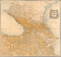
Map of Caucasus Krai 1903.jpg 10,000 × 9,334; 41.85 MB
-
Origin of Itum-Kale (Iton-Qälla) and Ghalghaï teip Mulqoy.jpg 1,664 × 2,480; 884 KB
-
Russia Caucusus 1882.jpg 1,420 × 1,232; 238 KB
-
Transcaucasian Democratic Republic.jpg 1,280 × 720; 218 KB
-
Tsori Towers (Ingushetia).jpg 1,181 × 886; 739 KB
-
Галгай-Юрт (Валерик).jpg 1,429 × 886; 628 KB
-
Ингушский ковер (аул Фуртоуг).jpg 1,270 × 906; 1,013 KB
-
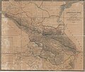
Карта Кавказского края 1842 года.jpg 21,635 × 18,381; 57.63 MB
-
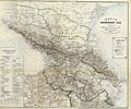
Карта Кавказского края 1868г.jpg 5,900 × 4,898; 19.01 MB
-
Карта Терской Области, 1892 г. (Сунженский отдел).jpg 6,603 × 5,218; 12.54 MB
-
Коки (Ингушетия).jpg 4,939 × 4,048; 19.48 MB
-
Панорама на гору Верблюд.jpg 4,281 × 612; 1.41 MB
-
Фрагмент карты Кавказского края 1842 г. (Галашъ).png 1,083 × 887; 1.97 MB
-
Фрагмент карты Кавказского края 1842 г. (Ингуши).png 1,354 × 1,109; 2.84 MB


