Category:Cattle in Dartmoor
Jump to navigation
Jump to search
Media in category "Cattle in Dartmoor"
The following 70 files are in this category, out of 70 total.
-
 Across Great Combe from the south - geograph.org.uk - 1180087.jpg 640 × 480; 103 KB
-
 Beef cattle on Knowle Down - geograph.org.uk - 716254.jpg 640 × 480; 87 KB
-

-
 Belted Galloways on High-House Waste.jpg 3,812 × 2,684; 6.13 MB
-
 Bluebells and cattle in Hound Tor village (4174).jpg 4,288 × 2,848; 6.27 MB
-
 Bovine Photo Call - geograph.org.uk - 450289.jpg 640 × 353; 89 KB
-
 Bowbeer - geograph.org.uk - 1502679.jpg 640 × 480; 87 KB
-
 Brown's House - Dartmoor - geograph.org.uk - 120707.jpg 640 × 425; 69 KB
-
 Bull in stroll at Horseyeatt - geograph.org.uk - 337871.jpg 640 × 480; 127 KB
-
 Bullock near Wadley Brook - geograph.org.uk - 1468520.jpg 640 × 469; 106 KB
-
 Bullocks near Thorn - geograph.org.uk - 1469421.jpg 640 × 368; 64 KB
-
 Bullocks near Wadley Brook (2) - geograph.org.uk - 1468536.jpg 640 × 501; 135 KB
-
 Bullocks near Wadley Brook - geograph.org.uk - 1468526.jpg 640 × 480; 133 KB
-
 Bullocks, Cranbrook - geograph.org.uk - 1478476.jpg 640 × 454; 86 KB
-
 Calf at Leighon - geograph.org.uk - 861798.jpg 640 × 480; 116 KB
-
 Calf near Horra Burrow - geograph.org.uk - 1015820.jpg 640 × 474; 87 KB
-
 Caroline Farm - geograph.org.uk - 1366961.jpg 640 × 427; 78 KB
-
 Cattle above Babeny - geograph.org.uk - 1409794.jpg 640 × 457; 73 KB
-

-
 Cattle at Middle Rook - geograph.org.uk - 312143.jpg 640 × 480; 115 KB
-
 Cattle at Youlditch Farm - geograph.org.uk - 595959.jpg 640 × 482; 94 KB
-
 Cattle by the Erme - geograph.org.uk - 1356009.jpg 640 × 480; 134 KB
-
 Cattle in Blachford Park - geograph.org.uk - 273301.jpg 640 × 480; 129 KB
-
 Cattle near Bowden Farm - geograph.org.uk - 578659.jpg 640 × 504; 102 KB
-
 Cattle near Brentor - geograph.org.uk - 421250.jpg 640 × 480; 123 KB
-
 Cattle near Wallaford Cross - geograph.org.uk - 1126635.jpg 640 × 378; 87 KB
-
 Cattle, Powder Mills - geograph.org.uk - 1590596.jpg 640 × 497; 101 KB
-
 Cattle, Powder Mills - geograph.org.uk - 1590687.jpg 640 × 469; 97 KB
-
 Cattle, Powder Mills - geograph.org.uk - 1590697.jpg 640 × 443; 85 KB
-
 Concerned cow, Counting House - geograph.org.uk - 1534027.jpg 640 × 460; 104 KB
-
 Cow (30224308995).jpg 2,276 × 1,541; 1.93 MB
-
 Cow (48931001413).jpg 2,071 × 2,383; 1.34 MB
-
 Cow and calf on slopes of Cosdon Hill - geograph.org.uk - 989868.jpg 640 × 455; 107 KB
-
 Cow and view - geograph.org.uk - 996865.jpg 640 × 489; 78 KB
-
 Cow near Wallaford Cross - geograph.org.uk - 1126679.jpg 640 × 480; 68 KB
-
 Cow on Pupers.jpg 3,464 × 2,528; 2.25 MB
-
 Cow on rock - geograph.org.uk - 1015737.jpg 497 × 640; 100 KB
-
 Cow on Scorhill Down.jpg 5,152 × 3,864; 6.11 MB
-
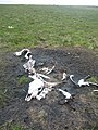 Cow Skeleton - geograph.org.uk - 26234.jpg 477 × 636; 144 KB
-
 Cow, Dunnabridge Pound Farm - geograph.org.uk - 4907500.jpg 2,000 × 1,333; 2.78 MB
-
-
 Curious cows at Cross Park - geograph.org.uk - 426041.jpg 640 × 393; 90 KB
-
 Dairy herd, at Lower Withecombe Farm - geograph.org.uk - 1248610.jpg 640 × 480; 89 KB
-
 Dairy herd, Bridford - geograph.org.uk - 1400587.jpg 640 × 480; 134 KB
-
 Dartmoor 054.JPG 3,264 × 2,448; 2.6 MB
-
 DARTMOOR HAYTO 04.JPG 3,008 × 2,000; 2.92 MB
-
 Devon cattle - geograph.org.uk - 25525.jpg 640 × 480; 74 KB
-
 Devon cattle graze near Skir Cross - geograph.org.uk - 1530950.jpg 640 × 480; 84 KB
-
 Field near Shapley - geograph.org.uk - 1588990.jpg 640 × 480; 100 KB
-
 Greator Rocks - geograph.org.uk - 860911.jpg 640 × 480; 105 KB
-
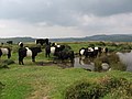
 Highland cattle, Brent Moor - geograph.org.uk - 1088713.jpg 640 × 480; 85 KB
-
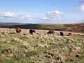
 Highland cattle, Brent Moor - geograph.org.uk - 1088720.jpg 640 × 453; 106 KB
-

-
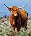
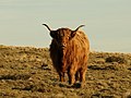 Highland cow, Brent Moor - geograph.org.uk - 1088706.jpg 640 × 478; 75 KB
-
 Howton cattle - Moretonhampstead - geograph.org.uk - 69822.jpg 640 × 425; 76 KB
-
 Lunchtime above Michelcombe - geograph.org.uk - 1179963.jpg 480 × 640; 114 KB
-
 Mardon - geograph.org.uk - 25524.jpg 640 × 480; 94 KB
-
 Milking time at Brook Farm - geograph.org.uk - 906263.jpg 640 × 433; 113 KB
-
 Nattadon cattle - Devon - geograph.org.uk - 69802.jpg 640 × 425; 54 KB
-
 Pastures near Hole - geograph.org.uk - 580517.jpg 640 × 480; 92 KB
-
 Pine, chimney and cattle, Powder Mills - geograph.org.uk - 1590843.jpg 640 × 494; 112 KB
-
 Rambler's predicament - geograph.org.uk - 1356478.jpg 640 × 419; 77 KB
-
 Red Devons, Buckfastleigh - geograph.org.uk - 1097606.jpg 640 × 427; 105 KB
-
 River Swinburne crossing - geograph.org.uk - 617023.jpg 640 × 427; 54 KB
-
 Stiniel cattle - Dartmoor - geograph.org.uk - 69801.jpg 640 × 425; 71 KB
-
 Sunday lunch - geograph.org.uk - 1607109.jpg 640 × 480; 132 KB
-
 Tornado - geograph.org.uk - 191874.jpg 640 × 460; 62 KB
-
 Track to Trowlesworthy Warren House - geograph.org.uk - 1529669.jpg 640 × 400; 90 KB
-
 Two Bridges, cattle - geograph.org.uk - 1987731.jpg 1,024 × 768; 158 KB
-
 Water trough, near the Two Moors Way - geograph.org.uk - 1250882.jpg 640 × 480; 97 KB


.jpg)


_-_geograph.org.uk_-_1468536.jpg)


.jpg)
.jpg)


