Category:Catalan-language SVG maps showing history
Jump to navigation
Jump to search
Media in category "Catalan-language SVG maps showing history"
The following 200 files are in this category, out of 273 total.
(previous page) (next page)-
01 campañasfrancesasenespana.svg 1,052 × 744; 969 KB
-
100 Years War France 1435.svg 948 × 945; 162 KB
-
12 Tribes of Israel Map.svg 2,168 × 3,300; 149 KB
-
1346-1353 spread of the Black Death in Europe map-ca.svg 992 × 866; 1.78 MB
-
14 century BC Eastern ca.svg 1,001 × 557; 92 KB
-
2023 Belgorod Oblast attacks.svg 1,545 × 1,215; 450 KB
-
3-guerra-servil-inicial.svg 4,252 × 3,123; 79 KB
-
450 roman-hunnic-empire-ca.svg 1,758 × 1,118; 2.39 MB
-
500 fall-roman-empire-ca.svg 1,758 × 1,118; 1.91 MB
-
Acadie Nouvelle-Écosse-ca.svg 1,342 × 1,096; 944 KB
-
AD 0455 Greatest extent of the Vandal Kingdom ca.svg 1,897 × 896; 220 KB
-
Africa Roman map.svg 2,500 × 650; 311 KB
-
Aleppo offensive (October 2013).svg 1,207 × 933; 4.95 MB
-
Aleppo Offensives 2015.svg 2,326 × 2,566; 4.24 MB
-
Almohad Expansion-ca.svg 1,827 × 1,235; 1.79 MB
-
Almoravid Empire-ca.svg 403 × 557; 58 KB
-
Anatolia 1097 ca.svg 1,440 × 749; 720 KB
-
Anaximander world map-ca.svg 1,063 × 1,063; 14 KB
-
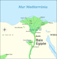
Ancient Egypt map-ca.svg 1,000 × 1,028; 230 KB
-
Ancient Egypt map-en.svg 1,577 × 3,219; 687 KB
-
Ancient kingdoms of Cyprus hu.svg 1,064 × 665; 47 KB
-
AncientGreekDialects (Woodard) en.svg 660 × 555; 950 KB
-
Anglo-Saxon Homelands and Settlements ca.svg 2,000 × 2,000; 2.51 MB
-
Annexation of Southern and Eastern Ukraine.svg 1,546 × 1,038; 1.09 MB
-
Antiga Iugoslàvia - 2006.svg 1,832 × 1,142; 110 KB
-
Antiga Iugoslàvia - durant la guerra.svg 1,832 × 1,142; 141 KB
-
Antigua grecia.svg 285 × 261; 51 KB
-
ARA.Belgrano.sunk.svg 1,066 × 1,357; 531 KB
-
Athenian empire ca.svg 993 × 794; 1.18 MB
-
August 2024 Kursk Oblast incursion.svg 1,318 × 930; 1.22 MB
-
Babylone 1-es.svg 1,821 × 1,294; 12.01 MB
-
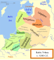
Baltic Tribes c 1200 en(multilang).svg 988 × 1,088; 358 KB
-
Battle cannae destruction.-ca.svg 737 × 515; 37 KB
-
Battle of Ad Decimum - Vandal plan-ca.svg 1,330 × 1,104; 775 KB
-
Battle of hastings1.svg 1,052 × 744; 105 KB
-
Battle of Qamishli.svg 2,770 × 2,254; 4.64 MB
-
Battle of Raqqa (2017).svg 2,115 × 1,644; 4.32 MB
-
Battle of Seminara Ops-es.svg 752 × 789; 128 KB
-
Battle Trebia-ca.svg 999 × 755; 96 KB
-
Bergkarabach.svg 900 × 600; 118 KB
-
Biafra independent state map-en.svg 1,100 × 850; 472 KB
-
Borno in 1810.svg 280 × 270; 164 KB
-
Buddhist Expansion.svg 512 × 473; 749 KB
-
Byzantine beacon system-pt.svg 743 × 452; 265 KB
-
Byzantine Empire Themata-750-fr.svg 743 × 457; 211 KB
-
Byzantine Empire Themata-950-en.svg 747 × 455; 201 KB
-
Byzantine Empire Themes 1025-en.svg 1,840 × 1,178; 485 KB
-
Byzantine Macedonia 1045CE.svg 423 × 335; 457 KB
-
Caesar campaigns gaul-ca.svg 625 × 457; 179 KB
-
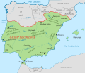
Califato de Córdoba - 1000-ca.svg 686 × 594; 686 KB
-
CalifatoDeCordoba961-V1.svg 1,744 × 1,436; 557 KB
-
CaminoEspañol.svg 449 × 614; 1.25 MB
-
Carte du Mitanni-es.svg 459 × 335; 11.32 MB
-
Cell junction simplified ca.svg 686 × 128; 77 KB
-
China-Historic macro areas.svg 1,438 × 1,047; 3.61 MB
-
Chinese plain 5c. BC-en.svg 568 × 384; 798 KB
-
Cnut lands-es.svg 642 × 511; 182 KB
-
ComunerosCityControl.svg 738 × 542; 521 KB
-
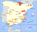
Conflictos en la I República Española.svg 685 × 600; 818 KB
-
Conquistas de Felipe Augusto ca.svg 10,072 × 7,059; 324 KB
-
Conquêtes des Saadiens-ca.svg 1,561 × 1,500; 18 KB
-
Corona de Castilla 1400 ca.svg 738 × 542; 813 KB
-
Cuencas sedimentarias cenozoicas ibéricas.svg 542 × 406; 108 KB
-
Czechoslovakia 1939 ca.SVG 1,069 × 435; 122 KB
-
Dadao map 1939.svg 634 × 387; 2.17 MB
-
Ducat de Neopàtria.svg 638 × 675; 350 KB
-
Ducato di Milano, 1402.svg 558 × 595; 174 KB
-
Dutch and Spanish Taiwan es.svg 627 × 720; 197 KB
-
Dutch Brazil 1630-1654 map.svg 935 × 837; 1.75 MB
-
Early migrations mercator.svg 1,173 × 569; 392 KB
-
Empire akkad.svg 1,475 × 1,149; 2.34 MB
-
Empire almohade-ca.svg 592 × 385; 2.05 MB
-
Empire neo babylonien.svg 1,534 × 1,435; 3.27 MB
-
España bizantina-pt.svg 512 × 274; 142 KB
-
Ethnographic Iberia 200 BCE-ca.svg 987 × 727; 1.59 MB
-
Etruskische beschaving.svg 1,500 × 1,820; 540 KB
-
Evolución condados pirenaicos orientales-ca.svg 1,807 × 901; 1.02 MB
-
Expansión peninsular de la Corona de Aragón-ca.svg 4,250 × 2,825; 861 KB
-
Expulsión judíos-ca.svg 570 × 400; 346 KB
-
Francia el 628.svg 755 × 784; 259 KB
-
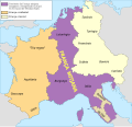
Francia media ca.svg 1,091 × 1,053; 391 KB
-
Francia occidentalis ca.svg 1,091 × 1,053; 193 KB
-
Frankish Empire 481 to 814-ca.svg 1,735 × 1,227; 316 KB
-
Frankish Empire 768 to 814-ca.svg 1,735 × 1,343; 1.17 MB
-
French Indochina 1900-1945-fr.svg 703 × 1,013; 1.75 MB
-
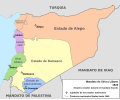
French Mandate for Syria and the Lebanon map ca.svg 983 × 813; 577 KB
-
Genghis Khan empire-switch.svg 512 × 331; 275 KB
-
Germania 70-ca.svg 972 × 780; 1.38 MB
-
Gobernaciones españolas en América del Sur (1534-1539).svg 673 × 909; 3.77 MB
-
GothicInvasions250-251-ca.svg 1,030 × 1,076; 231 KB
-
Greece in 1278-hu.svg 3,509 × 2,000; 518 KB
-
Guerra civil romana (406-411) 1-ca.svg 1,220 × 1,236; 1.01 MB
-
Guerra civil romana (406-411) 2-ca.svg 1,220 × 1,236; 1.1 MB
-
Guerra civil romana (406-411) 3-ca.svg 1,220 × 1,236; 1.09 MB
-
Guerra civil romana (406-411) 4-ca.svg 1,220 × 1,236; 1.1 MB
-
Guerra civil romana (413)-ca.svg 1,220 × 1,236; 1.12 MB
-
Guerra civil romana (423-425)-ca.svg 1,220 × 1,235; 1.86 MB
-
Hadrians Wall map-ca.svg 800 × 995; 217 KB
-
Hammurabi Babilonia CA.svg 717 × 668; 169 KB
-
Herodotus world map-es.svg 788 × 476; 309 KB
-
Hispania 1a division provincial.svg 548 × 455; 55 KB
-
Hispania3c-ca.svg 1,262 × 1,053; 569 KB
-
Hititas 1300 adC.svg 448 × 480; 199 KB
-
Hitt Egypt 1450 bc ca.svg 1,300 × 1,500; 248 KB
-
Holy Roman Empire 1000 map-ca.svg 1,067 × 1,309; 2.73 MB
-
Homeric Greece-ca.svg 1,502 × 1,253; 1.26 MB
-
Hugo Capeto-es.svg 846 × 761; 1.23 MB
-
Iberia 409-429 ca.svg 924 × 762; 359 KB
-
Iberia 455.svg 924 × 762; 299 KB
-
Iberia 560.svg 924 × 762; 315 KB
-
Iberia 586.svg 924 × 762; 306 KB
-
Iberia 700.svg 924 × 762; 314 KB
-
Ibèria el 300 aC.svg 924 × 762; 769 KB
-
Imperio paleobabilónico.svg 400 × 350; 293 KB
-
Invasions of the Roman Empire.svg 512 × 370; 90 KB
-
Invasió israeliana de Síria de 2024.svg 569 × 771; 1.46 MB
-
Iron Age Italy.svg 432 × 525; 283 KB
-
Isabella's invasion route (1326).svg 650 × 400; 469 KB
-
Israel-Lebanon-Syria-border-Conflict-2023 ca.svg 6,665 × 6,682; 9.82 MB
-
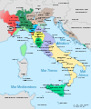
Italia 1494-ca.svg 3,481 × 4,167; 1.5 MB
-
Italia 1494b-ca.svg 688 × 930; 416 KB
-
Italia 1796-ca.svg 3,500 × 4,200; 1.25 MB
-
Italia 1810 ca.svg 1,759 × 2,167; 2.07 MB
-
Italia 1843-ca.svg 3,500 × 4,200; 2.74 MB
-
Italia 1861-ca.svg 3,534 × 4,256; 1.59 MB
-
Italy 1796 AD-ca.svg 767 × 1,093; 99 KB
-
Italy 1864 ca-v2.svg 3,311 × 3,855; 950 KB
-
Italy 1870 ca.svg 924 × 1,065; 775 KB
-
Italy and Illyria 1084 AD-ca.svg 964 × 1,206; 430 KB
-
Jewish east mediterranea-es.svg 724 × 601; 309 KB
-
June 2023 PMC Wagner Mutiny.svg 800 × 1,100; 1.54 MB
-
Kingdom of Israel 1020 map-ca.svg 2,168 × 3,300; 447 KB
-
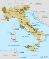
Kingdom of Italy 1870 map-ca.svg 3,360 × 3,950; 1.35 MB
-
Kingdoms of Israel and Judah map 830-ca.svg 768 × 916; 414 KB
-
Korea map 1939.svg 634 × 387; 2.26 MB
-
Kursk south-ca.svg 1,123 × 794; 351 KB
-
Lake Chad map showing receding water area and level 1972-2007.svg 2,440 × 1,373; 155 KB
-
Le royaume Burgonde au Ve siècle.svg 339 × 440; 144 KB
-
Les Micmacs (multilingual).svg 3,387 × 2,113; 455 KB
-
Life of Orpheus Greek Mythology (Extra Details).svg 993 × 793; 3.14 MB
-
Location map Taifa of Valencia-ca.svg 713 × 601; 275 KB
-
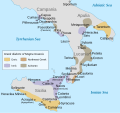
Magna Graecia ancient colonies and dialects-eu.svg 440 × 414; 252 KB
-
MaliWar.svg 1,644 × 1,568; 858 KB
-
Manchukuo map 1939.svg 634 × 387; 2.27 MB
-
Map achaemenid empire ca.svg 1,017 × 727; 741 KB
-
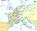
Map administrative divisions of the First French Empire 1812-en.svg 2,052 × 1,728; 4.14 MB
-
Map Aliki peninsula-fr.svg 352 × 555; 197 KB
-
Map Anatolia ancient regions-en.svg 921 × 596; 268 KB
-
Map Anatolia ancient regions-ru.svg 921 × 596; 278 KB
-
Map Anatolia-ca.svg 790 × 638; 300 KB
-
Map ancient Greek colonies in northern Black Sea-fr.svg 1,043 × 696; 1.83 MB
-
Map athenian empire 431 BC-en.svg 993 × 794; 3.32 MB
-
Map Battle of Stalingrad-it.svg 1,700 × 1,810; 137 KB
-
Map Byzantine Empire 1045.svg 1,300 × 900; 428 KB
-
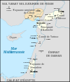
Map Crusader states 1102-fr.svg 591 × 690; 118 KB
-
Map Crusader states 1165-fr.svg 744 × 921; 538 KB
-
Map Crusader states 1190-es.svg 978 × 1,330; 185 KB
-
Map Crusader states 1240-fr2.svg 744 × 921; 529 KB
-
Map Europe 1923-ca.svg 1,037 × 704; 179 KB
-
Map Europe alliances 1914-ca.svg 1,002 × 593; 96 KB
-
Map France 1030-ca.svg 1,053 × 1,199; 4.9 MB
-
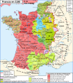
Map France 1180-es.svg 988 × 1,124; 1.97 MB
-
Map France 1477-es.svg 900 × 970; 1.53 MB
-
Map Frank campaigns in Aquitaine 507-509-fr.svg 755 × 784; 505 KB
-
Map Gaul divisions 481-ca.svg 755 × 784; 205 KB
-
Map Hittite rule en.svg 1,890 × 1,194; 440 KB
-
Map Iberian Peninsula 1030-es.svg 827 × 574; 280 KB
-
Map Iberian Peninsula 750-ca.svg 827 × 574; 90 KB
-
Map Israel Judea 926 BC-es.svg 554 × 918; 1.92 MB
-
Map Macedonia 336 BC-ca.svg 992 × 794; 2.89 MB
-
Map Minoan Crete-fr.svg 1,001 × 601; 269 KB
-
Map of Ancient Rome 271 AD ca.svg 2,050 × 1,213; 396 KB
-
Map of cities in ancient boeotia-es.svg 2,700 × 1,998; 134 KB
-
Map of fertile crescent-ca.svg 1,987 × 2,441; 456 KB
-
Map of Italy (1402)-ca.svg 3,264 × 3,837; 322 KB
-
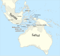
Map of Sunda and Sahul (hy).png 3,053 × 2,838; 722 KB
-
Map of Sunda and Sahul.svg 976 × 907; 847 KB
-
Map of territorial growth 1775-es.svg 506 × 662; 241 KB
-
Map of the Assyrian Empire.svg 2,145 × 1,474; 142 KB
-
Map of the Imperial Circles (1512)-ca.svg 727 × 714; 634 KB
-
Map of the Imperial Circles (1560)-ca.svg 1,165 × 1,140; 2.17 MB
-
Map Peloponnesian War 431 BC-ca.svg 992 × 794; 3.63 MB
-
Mapa Caesaraugusta.svg 550 × 500; 78 KB
-
Mapa de Ifni (1953).svg 2,174 × 1,826; 38 KB
-
Mapa de la Corona d'Aragó.svg 2,317 × 977; 420 KB
-
Mapa de las migraciones humanas.svg 1,116 × 818; 3.29 MB
-
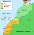
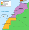
Mapa del Magreb (1956).svg 1,700 × 1,750; 573 KB
-
Mapa del Magreb (1958).svg 1,700 × 1,750; 568 KB
-
Mapa del Magreb (1959).svg 1,700 × 1,750; 553 KB
-
Mapa Grecia Antigua.svg 992 × 794; 3.57 MB
-
Mapa guerra de Hispania (416-418).svg 1,243 × 1,002; 812 KB
-
Mapa guerra suevo-vándala (419-420).svg 1,243 × 1,002; 571 KB
-
Mapa Imperio Occidental (migración año 406).svg 1,220 × 1,236; 1.1 MB
-
Mapa Imperio Occidental año 408-ca.svg 1,220 × 1,235; 983 KB
-
Mapa Imperio Occidental año 410-ca.svg 1,220 × 1,235; 945 KB
-
Mapa Imperio Occidental año 413-ca.svg 1,220 × 1,235; 963 KB
-
Mapa Imperio Occidental año 418-ca.svg 1,220 × 1,235; 971 KB
-
Mapa Imperio Romano 395 (administrativo).svg 2,565 × 1,906; 2.21 MB
-
Mapa polityczna Italii 1719-ca.svg 3,500 × 4,200; 1.27 MB
-
Mapa polityczna Italii 1734-ca.svg 3,500 × 4,200; 1.35 MB


