Category:Castlemartin Ranges
Jump to navigation
Jump to search
| Upload media | |||||
| Location |
| ||||
|---|---|---|---|---|---|
| Inception |
| ||||
 | |||||
Subcategories
This category has the following 2 subcategories, out of 2 total.
F
M
- Merrion Camp (21 F)
Media in category "Castlemartin Ranges"
The following 44 files are in this category, out of 44 total.
-
5 RIFLES Battlegroup deployed to Castlemartin Ranges in Pembrokeshire MOD 45166695.jpg 3,000 × 2,000; 1.08 MB
-
5 RIFLES Battlegroup, Castlemartin Ranges in Pembrokeshire.jpg 1,200 × 801; 196 KB
-
600m Target Range - geograph.org.uk - 3092080.jpg 1,600 × 1,200; 307 KB
-
600m Target Range - geograph.org.uk - 3094252.jpg 1,600 × 1,200; 290 KB
-
Blowhole at Bosherston Mere - geograph.org.uk - 1581454.jpg 640 × 472; 49 KB
-
Castle Martin live firing - geograph.org.uk - 5435181.jpg 1,024 × 768; 209 KB
-
Castle Tank - Military Training Buildings - geograph.org.uk - 5232099.jpg 4,608 × 3,456; 6.19 MB
-
Castlemartin MOD Checkpoint at the Firing Range - geograph.org.uk - 4320674.jpg 1,600 × 1,066; 339 KB
-
Castlemartin Range - geograph.org.uk - 3780786.jpg 640 × 430; 54 KB
-
Castlemartin Range - geograph.org.uk - 3780815.jpg 640 × 430; 54 KB
-
Castlemartin Range - geograph.org.uk - 3787262.jpg 640 × 430; 58 KB
-
Castlemartin Range - geograph.org.uk - 3787275.jpg 640 × 430; 56 KB
-
Challenger 2 Tank Firing a Shell at Night MOD 45157416.jpg 3,000 × 1,688; 1.43 MB
-
Challenger 2 Tank Firing a Shell MOD 45157411.jpg 3,000 × 1,688; 1.46 MB
-
Challenger 2 Tank Firing a Shell MOD 45157415.jpg 3,000 × 1,688; 1.43 MB
-
Challenger 2 Tank Firing a Shell MOD 45157421.jpg 3,000 × 1,687; 1.47 MB
-
Challenger 2 Tank MOD 45157417.jpg 3,000 × 1,688; 1.85 MB
-
Challenger 2 Tank MOD 45157418.jpg 1,997 × 3,000; 1.45 MB
-
Challenger 2 Tank MOD 45157422.jpg 3,000 × 2,000; 1.5 MB
-
Choughs - geograph.org.uk - 462825.jpg 640 × 480; 124 KB
-
Danger Area Access Gate and Guard Hut - geograph.org.uk - 5232105.jpg 4,608 × 3,456; 5.52 MB
-
Elegug Stacks - geograph.org.uk - 208723.jpg 640 × 480; 115 KB
-
Exercise IRON STORM 22 APOWMID-OFFICIAL-20220618-037-0456.jpg 3,600 × 2,401; 1.9 MB
-
Flimston Slab - geograph.org.uk - 1999215.jpg 800 × 600; 212 KB
-
Heavy Tank Target at Castlemartin, Pembrokeshire, Wall MOD 45157414.jpg 3,000 × 1,688; 1.47 MB
-
Military checkpoint - geograph.org.uk - 1544985.jpg 640 × 480; 47 KB
-
Military Radar Installation - geograph.org.uk - 1544992.jpg 640 × 480; 38 KB
-
RAF Regiment Soldiers Firing Javelin Anti Tank Guided Missile MOD 45153855.jpg 2,700 × 1,800; 1.16 MB
-
Soldiers of the Royal Tank Regiment MOD 45155344.jpg 3,000 × 1,996; 1.75 MB
-
Soldiers on Training Exercise in Wales MOD 45153574.jpg 2,000 × 1,333; 163 KB
-
Tank control tower - geograph.org.uk - 466432.jpg 640 × 480; 90 KB
-
Tank crossing point on military road - geograph.org.uk - 1569747.jpg 640 × 480; 54 KB
-
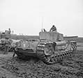
The British Army in the United Kingdom 1939-45 H25509.jpg 2,400 × 2,288; 1.11 MB
-
The British Army in the United Kingdom 1939-45 H25510.jpg 2,400 × 2,249; 1.17 MB
-
The Royal Anglian Regiment at the Castlemartin Ranges MOD 45167995.jpg 3,600 × 2,396; 2.09 MB
-
The Royal Anglian Regiment at the Castlemartin Ranges MOD 45167996.jpg 2,343 × 3,521; 2.79 MB
-
The Royal Anglian Regiment at the Castlemartin Ranges MOD 45167997.jpg 2,555 × 3,558; 3.04 MB
-
The Royal Anglian Regiment at the Castlemartin Ranges MOD 45168002.jpg 1,901 × 2,851; 2.06 MB
-
Western Walls - geograph.org.uk - 30830.jpg 299 × 441; 48 KB
-
Gate onto military land - geograph.org.uk - 524023.jpg 640 × 480; 80 KB
-
Hanging Tar - geograph.org.uk - 502410.jpg 640 × 482; 52 KB
-
Military post - geograph.org.uk - 462845.jpg 640 × 480; 120 KB


