Category:Cartography of Africa
Jump to navigation
Jump to search
Temperate regions: North America · South America · Africa · Europe · Asia · Oceania – Polar regions: – Other regions:
overview of the cartography of Africa | |||||
| Upload media | |||||
| Instance of |
| ||||
|---|---|---|---|---|---|
| Main subject | |||||
| |||||
Subcategories
This category has the following 4 subcategories, out of 4 total.
E
H
S
Media in category "Cartography of Africa"
The following 12 files are in this category, out of 12 total.
-
BML Le Lointain partie 1 26 421941 itinéraires Barth Livingstone.jpg 3,149 × 3,077; 6.44 MB
-
BML Le Lointain partie 1 27 SJ G 101 12 p 123.jpg 3,059 × 4,049; 11.01 MB
-
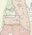
Extract of Thomson’s map (1817) with borders of Tigray.jpg 520 × 563; 128 KB
-
Location of the border between Tigray and Amhara.jpg 1,348 × 535; 85 KB
-
Nyssen and Demissie JoM supplemental map.pdf 3,508 × 2,475; 5.9 MB
-
Nyssen and Demissie JoM supplemental map.tif 7,019 × 4,950; 99.41 MB
-
Western Tigray Manesson-Mallet 1683.jpg 602 × 420; 84 KB


