Category:Cartography in the BNP
Jump to navigation
Jump to search
English: Cartography in the National Library of Portugal
Português: Cartografia na Biblioteca Nacional de Portugal
Subcategories
This category has only the following subcategory.
Media in category "Cartography in the BNP"
The following 112 files are in this category, out of 112 total.
-
1-Cuadrículas.png 720 × 321; 563 KB
-
1-Morfología de líneas.png 720 × 414; 679 KB
-
1-ruta TeIDe.png 720 × 1,135; 1.65 MB
-
10-ruta TeIDe.png 720 × 2,017; 2.83 MB
-
11-ruta TeIDe.png 936 × 1,475; 2.76 MB
-
1574-10-03; Haghe, Leyden, Delft (Siege of Leiden).jpg 1,852 × 1,379; 557 KB
-
1653 atlas by Johannes Janssonius - Nuevo atlas, o teatro de todo el mundo - Volume 1 of 4.pdf 1,310 × 2,035, 240 pages; 288.39 MB
-
1653 atlas by Johannes Janssonius - Nuevo atlas, o teatro de todo el mundo - Volume 2 of 4.pdf 1,352 × 2,039, 200 pages; 252.77 MB
-
1653 atlas by Johannes Janssonius - Nuevo atlas, o teatro de todo el mundo - Volume 4 of 4.pdf 1,350 × 1,950, 233 pages; 308.16 MB
-
1679 Aethiopische Zee v Keulen BNP.jpg 4,666 × 3,708; 3.16 MB
-
1680 - Le grand nouvel atlas de la mer ou monde aquatique by Johannes von Keulen.pdf 1,350 × 2,039, 52 pages; 13.53 MB
-
1705 circa, Nieuwe Platte Grond van 's Gravenhage.jpg 3,965 × 3,363; 2.79 MB
-
1717 maps - Atlas de vários mapas, planos e ordens de batalha.pdf 1,191 × 1,960, 204 pages; 60.47 MB
-
1788 map - Teatro marittimo della guerra presente ossia l'arcipelago.jpg 4,095 × 3,083; 3.18 MB
-
1829 atlas - General atlas of the world, containing upwards of seventy maps.pdf 2,050 × 2,750, 156 pages; 247.06 MB
-
1886 map - Atlas des ports étrangers.pdf 1,514 × 1,962, 53 pages; 79.74 MB
-
2 Mediterráneo.png 720 × 357; 643 KB
-
2-Escalas.png 720 × 291; 356 KB
-
2-ruta TeIDe.png 720 × 1,135; 1.66 MB
-
3-Cota base.png 720 × 357; 404 KB
-
3-Línea Este-Oeste.png 720 × 81; 136 KB
-
3-ruta TeIDe.png 720 × 1,135; 1.66 MB
-
4-Cotas 1..png 720 × 414; 685 KB
-
4-ruta TeIDe.png 720 × 1,135; 1.65 MB
-
5-Cotas 2.png 720 × 414; 692 KB
-
5-ruta TeIDe.png 720 × 1,135; 1.65 MB
-
6-Cotas 3..png 720 × 414; 697 KB
-
6-ruta TeIDe.png 720 × 1,135; 1.65 MB
-
7-Cotas 4.JPG 720 × 414; 405 KB
-
9-ruta TeIDe.png 720 × 941; 872 KB
-
Alto Douro Forrester.jpg 5,787 × 2,978; 3.93 MB
-
Aveline, Antoine (1691-1743) - Milan.jpg 895 × 608; 492 KB
-
Bahía Algeciras.jpg 1,565 × 2,330; 1.03 MB
-
Brazil provincial railroads.jpg 2,038 × 3,046; 928 KB
-
Ca. 1854 Portuguese map of the Balkans.jpg 2,534 × 3,500; 1.44 MB
-
Carta topografica das Linhas do Porto.jpg 2,572 × 1,804; 3.9 MB
-
Cartouche in a Madrid map by Lopez.jpg 706 × 906; 279 KB
-
Cartouche in an Ottoman map by Jaillot.jpg 491 × 368; 61 KB
-
Cc-1230-r 0001 1 t24-C-R0150.jpg 4,944 × 3,372; 2.14 MB
-
Cc-1317-a 0001 1 p24-C-R0072-1-.jpg 1,827 × 1,548; 820 KB
-
Cc-1697-a 0001 1 t24-C-R0150.jpg 3,940 × 3,337; 5.25 MB
-
Cc-379-v 0001 1 t24-C-R0150.jpg 3,229 × 2,357; 3.83 MB
-
Cc-400-v 1 t24-C-R0150.jpg 3,028 × 2,364; 1.7 MB
-
Cc-665-a t24-C-R0150.jpg 4,067 × 2,880; 5.87 MB
-
Cc-803-v 0001 1 p24-C-R0150.jpg 3,202 × 2,191; 1.87 MB
-
Cc-812-v 0001 1 p24-C-R0150.jpg 3,232 × 2,103; 1.93 MB
-
Cc-950-v 0001 t24-C-R0150.jpg 6,126 × 4,230; 4.32 MB
-
Cerco Campo Maior 1712.jpg 1,211 × 842; 234 KB
-
Colobo.jpg 426 × 480; 83 KB
-
Cosmographiae uniuersalis (Munster) 612.jpg 2,465 × 1,912; 1.09 MB
-
Cresques y Llull.png 450 × 290; 159 KB
-
D-356-v 00001 t24-C-R0150 (mapa de alfaiates).jpg 2,566 × 2,038; 1,023 KB
-
Del 0 fer.png 720 × 1,207; 635 KB
-
Delisle - L'Asie (Ausschnitt Jesso Japan Compagnie).jpg 1,020 × 836; 685 KB
-
Delisle - L'Asie (Ausschnitt Jesso Japan).jpg 572 × 646; 363 KB
-
Delisle - L'Asie.jpg 3,672 × 2,872; 9.08 MB
-
Delisle Asie3.png 874 × 890; 1.91 MB
-
Delisle Asie3b.png 874 × 890; 204 KB
-
Diu Plini.png 720 × 135; 191 KB
-
Douro river map Forrester.jpg 6,913 × 1,687; 3.05 MB
-
Fer - Plan de Pondichery retouched.jpg 2,400 × 1,639; 3.44 MB
-
Fer - Plan de Pondichery.jpg 1,180 × 806; 342 KB
-
Fuertes de la linea3.jpg 1,158 × 572; 185 KB
-
Ghent, belgium, Husson P., B&W.jpg 3,753 × 3,212; 3.22 MB
-
Gibraltar e istmo en 1786.jpg 440 × 920; 115 KB
-
HoangSaVN-DongNamA1687.jpg 3,150 × 1,800; 1.92 MB
-
Iana.png 450 × 618; 544 KB
-
Journeys of Silva Porto - map.jpg 2,554 × 1,876; 893 KB
-
Le Canal Royal de Languedoc .jpg 2,602 × 1,764; 1.03 MB
-
Le royaume d'Arragon.jpg 1,308 × 1,496; 2.81 MB
-
Maastricht 1700 Visscher.jpg 1,550 × 1,890; 2.83 MB
-
Manuel de Mesquita Perestrelo00.jpg 816 × 1,108; 160 KB
-
Mapa Cor-de-Rosa.jpg 800 × 636; 172 KB
-
Mapa de la provincia de Estremadura, Tomás López (1766).jpg 2,292 × 1,212; 635 KB
-
Mapa de Timor (1731).jpg 4,160 × 2,928; 1.08 MB
-
Mapa Depurtugal, e Castella.jpg 2,594 × 3,504; 3.76 MB
-
Mapa Diocese Macau 1894.jpg 1,910 × 1,474; 518 KB
-
Mapa do Porto Arthur.jpg 1,529 × 1,653; 450 KB
-
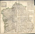
Mapa geográfico del Reyno de Galicia 1784.jpg 2,504 × 2,440; 1.61 MB
-
Mapa Linha Beira Alta - Diario Illustrado 3307 1882.jpg 2,429 × 1,943; 2.65 MB
-
Mapa Topografico das Ilhas e Provincias de Goa.jpg 1,333 × 971; 446 KB
-
Mer Orientale 1700.jpg 626 × 608; 379 KB
-
Monte pascoal mapa.jpg 486 × 800; 87 KB
-
Oeyras do Piauhí.PNG 1,604 × 1,375; 4.52 MB
-
Ottomanmashriq1600.jpg 1,024 × 748; 213 KB
-
Plano geral da cidade de Lisboa em 1812.jpg 1,263 × 899; 754 KB
-
Planta da cidade do Porto 1865 Perry Vidal.jpg 1,696 × 1,251; 1.12 MB
-
Planta da cidade do Porto 1903 Cortes.jpg 1,642 × 1,016; 372 KB
-
Planta da Praça de Peniche.jpg 3,812 × 2,935; 2 MB
-
Planta da Praça de Setúbal.jpg 4,863 × 2,506; 2.42 MB
-
Planta da vila de Mapuçá em 1888.jpg 2,824 × 1,893; 803 KB
-
Planta do Porto e arredores ca1830 (2).jpg 3,864 × 3,024; 1.98 MB
-
Planta do Porto e arredores ca1830.jpg 944 × 702; 270 KB
-
Planta geografica da barra da cidade do Porto 1789.jpg 1,083 × 757; 528 KB
-
Planta geográfica da barra da cidade do Porto 1789 (2).jpg 4,630 × 3,272; 3.07 MB
-
Projectos para pontes ferroviarias sobre Douro - Diario Illustrado 263 1873.jpg 1,378 × 1,928; 1.33 MB
-
Rečyca. Рэчыца (C. Eygerd, 1663).jpg 2,065 × 1,396; 1.7 MB
-
Robert - Amérique ou Indes Occidentales.jpg 1,941 × 1,539; 1,002 KB
-
Robert - Asia Minor cropped Cyprus.JPG 533 × 255; 36 KB
-
Robert - Asia Minor cropped Georgia.JPG 295 × 450; 30 KB
-
Robert - Asia Minor.jpg 1,761 × 1,389; 868 KB
-
Sclavonia Croatia Bosnia Dalmatia in 1653 atlas by Johannes Janssonius.jpg 3,997 × 3,264; 2.36 MB
-
Situação geográfica de Olivença (1766).jpg 1,752 × 1,178; 1.46 MB
-
Tablas IV y V.png 923 × 1,181; 2.39 MB
-
Tomás López de Vargas Machuca (1773) Mapa de la provincia de Madrid.jpg 3,623 × 3,200; 3.92 MB
-
Topographic map of Linhas do Porto.jpg 4,638 × 3,281; 2.86 MB
-
Trapobana.png 450 × 252; 254 KB
-
Utilización de la brújula.png 720 × 349; 471 KB
-
Witsen - Tartaria.jpg 3,675 × 3,080; 4.18 MB


