Category:Carlatton
Jump to navigation
Jump to search
English: Carlatton is a civil parish in the City of Carlisle in Cumbria, England. At the 2001 census it had a population of 29.
civil parish in Cumbria, United Kingdom  | |||||
| Upload media | |||||
| Instance of | |||||
|---|---|---|---|---|---|
| Part of |
| ||||
| Location | Carlisle, Cumbria, North West England, England | ||||
| Population |
| ||||
 | |||||
Media in category "Carlatton"
The following 15 files are in this category, out of 15 total.
-
 Black Dub - geograph.org.uk - 1284798.jpg 640 × 427; 62 KB
-
 Carlatton Mill - geograph.org.uk - 1961991.jpg 640 × 480; 67 KB
-

-
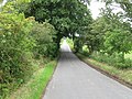 Country Lane towards B6413 - geograph.org.uk - 1962003.jpg 640 × 480; 127 KB
-
 Country Lane towards Hall's Tenement - geograph.org.uk - 1961978.jpg 640 × 480; 123 KB
-
 Farmland near Saughtreegate - geograph.org.uk - 5778553.jpg 2,592 × 1,944; 1.43 MB
-
 Farmland, Carlatton - geograph.org.uk - 4335446.jpg 640 × 480; 135 KB
-
 Field with cattle near Carlatton Demesne - geograph.org.uk - 4235308.jpg 640 × 480; 114 KB
-
 Field with cattle near Carlatton Demesne - geograph.org.uk - 4235313.jpg 640 × 480; 124 KB
-
 Fields near Black Dub farm - geograph.org.uk - 4235319.jpg 640 × 480; 133 KB
-
 Ruins of Carlatton Mill - geograph.org.uk - 4235206.jpg 640 × 480; 229 KB
-
 Saughtreegate - geograph.org.uk - 1284795.jpg 640 × 328; 85 KB
-
 Sheep at Carrock Fell farm - geograph.org.uk - 4235322.jpg 640 × 480; 150 KB
-
 The road to Castle Carrock - geograph.org.uk - 5778536.jpg 2,592 × 1,944; 1.5 MB
-
 The road to Castle Carrock - geograph.org.uk - 6159225.jpg 2,592 × 1,944; 1.55 MB


