Category:Capon Bridge, West Virginia
Jump to navigation
Jump to search
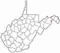
English: Capon Bridge is a town located in eastern Hampshire County, West Virginia along the Northwestern Turnpike (U.S. Route 50), approximately twenty miles west of Winchester, Virginia. As of the 2000 census, the town population was 2,178, 200 of which live within the town limits. Originally known as Glencoe, Capon Bridge was incorporated in 1902 by the Hampshire County Circuit Court. It is named because of the construction of the bridge over the Cacapon River at that place, the name of the river being derived from the Shawnee, "Cape-cape-de-hon", meaning "river of medicine water."
| Object location | | View all coordinates using: OpenStreetMap |
|---|
human settlement in Hampshire County, West Virginia, United States of America | |||||
| Upload media | |||||
| Instance of | |||||
|---|---|---|---|---|---|
| Location | Hampshire County, West Virginia | ||||
| Inception |
| ||||
| Population |
| ||||
| Area |
| ||||
| Elevation above sea level |
| ||||
 | |||||
Subcategories
This category has the following 13 subcategories, out of 13 total.
C
Media in category "Capon Bridge, West Virginia"
The following 4 files are in this category, out of 4 total.
-
Fort Edwards Historical Marker Capon Bridge WV 2014 10 05 01.jpg 2,448 × 3,264; 3.67 MB
-
Fort Edwards Historical Marker Capon Bridge WV 2014 10 05 02.JPG 3,264 × 2,448; 3.42 MB
-
WVMap-doton-CaponBridge.PNG 300 × 262; 11 KB


